El Paso Loop
White Sands National Park- Cloudcroft- Alamogordo- Three Rivers Petroglyphs- Valley Of Fires- Lincoln- Roswell- Carlsbad Caverns- Guadalupe Mountains- El Paso
This is a nice 3 days and 2 nights loop starting in El Paso, Texas, going into southern New Mexico then back into Texas again. We took this trip as a combination of motorbike and car. We wanted to ride motorbike, but we knew that traversing Texas would include some long stretches of road, so we split our trip between two modes of transport. The first part, which we call The El Paso Loop is part of The Texas Traverse featured on its own page.
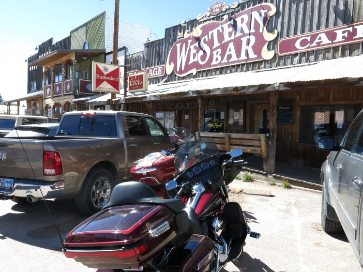
We flew into Houston, since we got a good price for the tickets there, this was in Easter, so mid-April. We bought a one-way ticket to El Paso from Houston, after doing a bit of research of what could be cool to drive on the motorbike, and what place could be a good point for a loop, and a good place to start our roadtrip. Also, there was an Eaglerider in El Paso (no location anymore) where we could rent Harley, so El Paso it was. We rented at Barnett Harley Davidson El Paso and it seems like they still have a rental service.


We arrived late afternoon, so we headed straight to our motel situated close to the airport. We were warned about heading downtown El Paso in the evening, so we had a great meal at a local Mexican restaurant next to our motel, and that was it for the first day.
Day 1: El Paso to Alamogordo

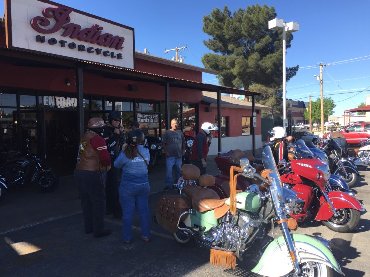
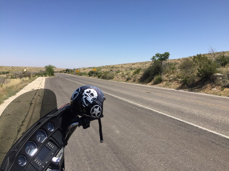
Eaglerider/Barnett Harley was just down the road, and we got a brand-new Ultra to ride. It was another quick pick up, and while waiting for our bike, we got talking with some Indian bikers, who of course started to dis our Harley. All in good humour of course, they said they were going to Cloudcroft, and asked if we wanted to ride with them, but we thanked them politely and said that we had our own route. And we lived to regret our decline of that offer. This is why: if you look at google maps and google earth, the quickest way from El Paso to White Sands National Park looks like Route 213 instead of going Interstate 10 North out of El Paso to Las Cruces and then around the mountains. So we headed to Route 213 and drove in great desert landscape for a long while, a little bemused by all the signs telling us to look out for tanks crossing and military personnel along the road. We passed Fort Bliss Training Centre and Dona Ana Range Complex, all part of the military, and very active in training with live ammunitions and missiles.

This being part again of the White Sands Missile Range and Base. So, no wonder there were a lot of army looking personnel roaming the land with tanks and stuff. At the end of the road, just a few kilometres before it looks like you can join Hwy 70, you get to the military base itself. And the road runs through it. When we showed up at the gates, with nothing but our Norwegian passports, the guard at the gate was less than impressed, and told us that going through the base demanded a military ID or such, not a meagre Norwegian passport. We tried to point out that we could see the Hwy 70, and just needed a quick drive through, but no luck. We had to drive all the way back to El Paso, and up the I 10 and then Hwy 70, and then end up looking down on the base we had just spent a 4-hour detour around.


White Sands Missile Range was established in 1945 as a proving ground for the first atomic bombs, the first one named Trinity detonated on the northern boundaries of the range on July 16th, 1945. The whole range is huge and was used to test German V2 rockets captured after the war, as well as the Nike rockets and the Patriot missiles. The range also has airstrips, the Northrup strip was used as a landing strip for the space shuttle Columbia in 1982 after a mission to space. The whole area around the town of Alamogordo is steeped in clandestine military missions, testing of rockets and missiles, nuclear bombs testing and of course burying of the worst computer game ever made by Atari. They have a cool space museum in town: New Mexico Museum of Space History.
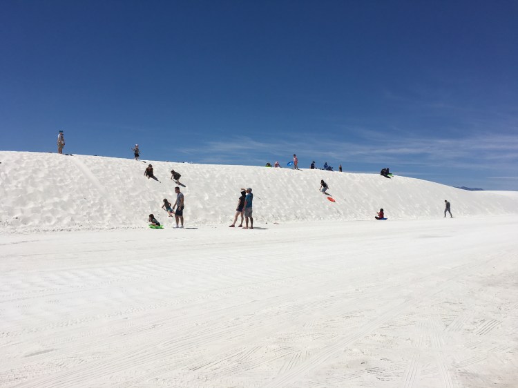
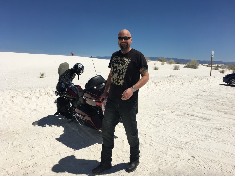
So, in short words, go via Interstate 10, stop at Las Cruces old town square for a refreshment, take Hwy 70 to Alamogordo, and Bob’s your uncle. Along the Hwy 70 about 15 miles before Alamogordo you find the truly otherworldly White Sands National Park.

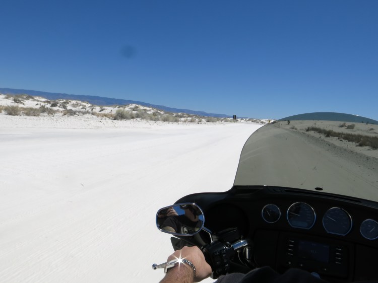
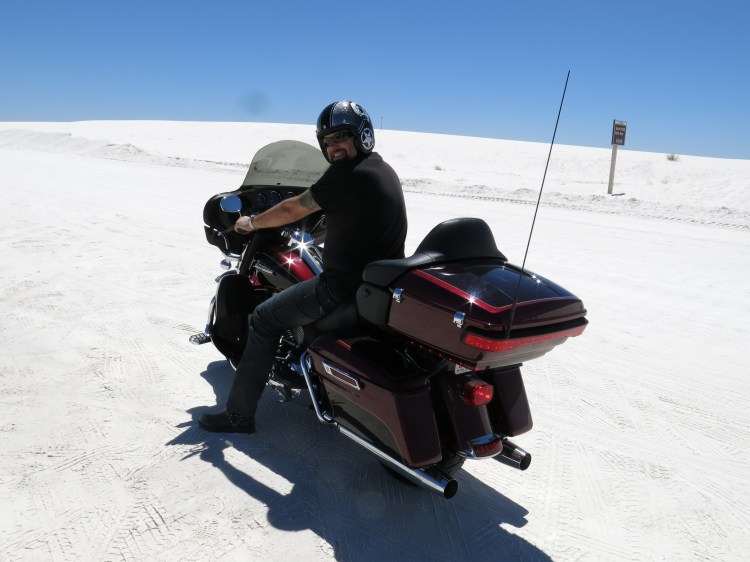
Driving into the park on a motorbike is no problem, at least until the sand starts. You will have hard surface for the first mile or so, but after that it becomes sand, and this sand is very fine, so this makes it hard to ride on. We stopped after a short while on the sand, the chance of doing a tumble was too high, so we left the bike and took a walk on the dunes. The highest dunes are about 18 metres, and plenty of people had small sleds they used to toboggan down the dunes. The whiteness of the sand is fantastic, you could say it’s white like snow, bit being from a snowy country, we can say that this actually looks whiter than snow. It’s so white that sunglasses are a must, the light reflected from the dunes is blinding. The heat, and the strange illusion that this might be snow, makes the whole place seem like another planet. We walked around, but the heat was too much in our riding gear, so we had to retreat to the respite of wind under our wings on the motorbike. We wish we had more time, and visiting by car, so that we could have seen more, but what we saw was amazing.


From White Sands we drove to Alomogordo where we had booked a hotel for the night, we chose Holiday Inn Express because of the good location along the road.
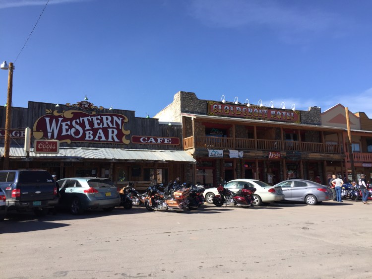
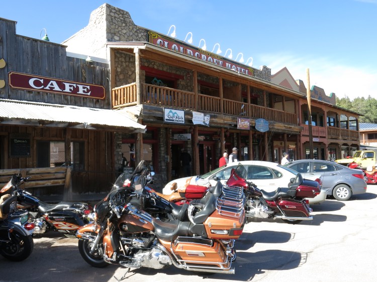
Since we arrived early in the afternoon, we just dropped our excess baggage at the hotel and took a ride on a very cool road starting just north of town into the mountains, and up to the town of Cloudcroft. At 2644 metres above sea level (one of the highest towns in the US), it has a bit of that cowboy frontier town vibe. A great start for hiking and mountain biking, and it’s known for nice summer temperatures, compared to the desert basin below in the valley. The town itself was the product of need for timber, the establishment of a railroad and the insight that this place might attract tourists. We of course met our Indian friends from the morning here, and they invited us to join them for lunch, and laughed merrily at our little detour. They also recommended us to take the drive to the Sunspot National Solar Observatory, along the New Mexico Scenic Byway 6563, and the drive was cool and twisty under huge conifers. The observatory itself was deserted, we were the only people there, but the views from the top down to the desert were spectacular. The observatory was cool but closed to the public when we visited.


Day 2: Alamogordo to Roswell

North of Alamogordo on Hwy 54 there are lots of straight roads and desert landscape, and we love it. These roads are nothing like the ones we have in Europe, so a long straight road to the horizon is something unusual for us. On the way you will drive past the Trinity Site, the place where the first nuclear bomb was detonated. It’s open one Saturday a year, we missed that opening by one week. Ørjan was a bit upset, Tanja not so much…
Also, on the way is the Three Rivers Petroglyph site, something we just stumbled upon, reading about it on a flyer at a gas station.


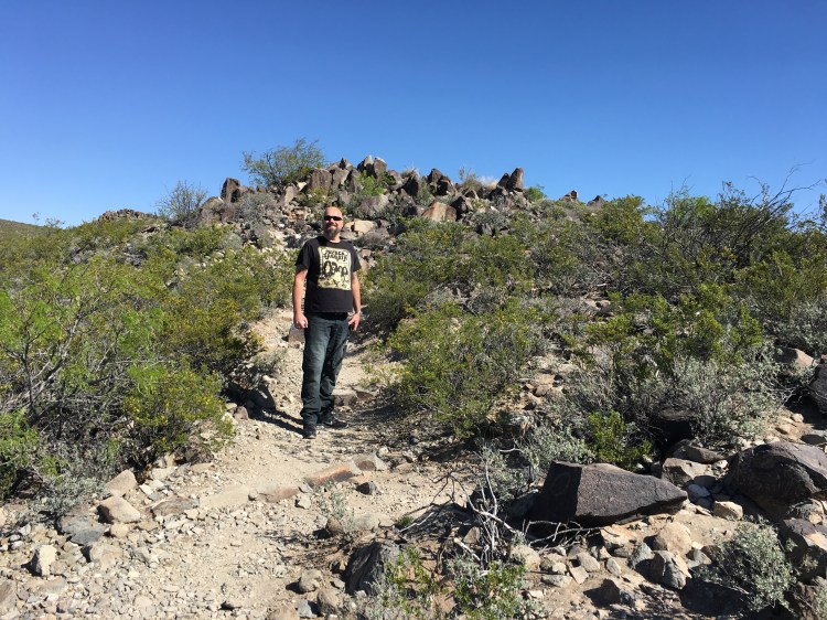
The site contains more than 21 000 glyphs (carved pictures) of birds, humans, animals, fish, insects and plants, as well as many geometric and abstract designs. It dates back to between about 900 and 1400 AD, and were created by Jornada Mogollon people who used stone tools to remove the dark patina on the exterior of the rocks. We had a great hour wander around the site, and it was very cool to see all the small carvings on the rocks everywhere you looked. Again, we were more or less alone at this site, making it even more exclusive and special.
If you use google earth and zoom out on the area, you will see the bright white area that is White Sands, but further north you will see a pitch-black area, which is the Valley Of Fires. When you get to Carrizozo take a left and drive west on the road to San Antonio (US 380), a mile down the road you will get to a site where there are some great walks.
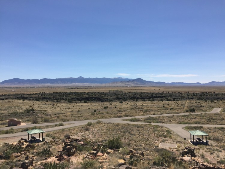
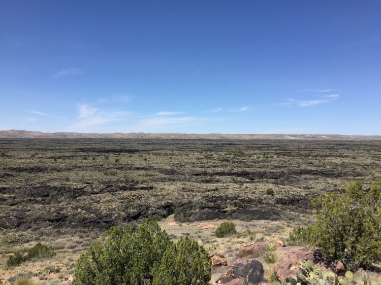

The lava flow of Valley Of Fires is just 5000 years old, from the eruption of Little Black Peak, so it’s one of the youngest lava flows in the US. The charred black landscape is a very cool counterpoint to the whiteness of White Sands.
Backtrack to Carrizozo, fill up on gas and food here, there are some decent places to eat, we stopped at the restaurant on the south eastern corner of the crossroads and had some delish burritos and lemonade. Continuing west toward Capitan (US 380) you could stop by Fort Stanton for some wild west history, but we chose to drive on to the historic town of Lincoln.
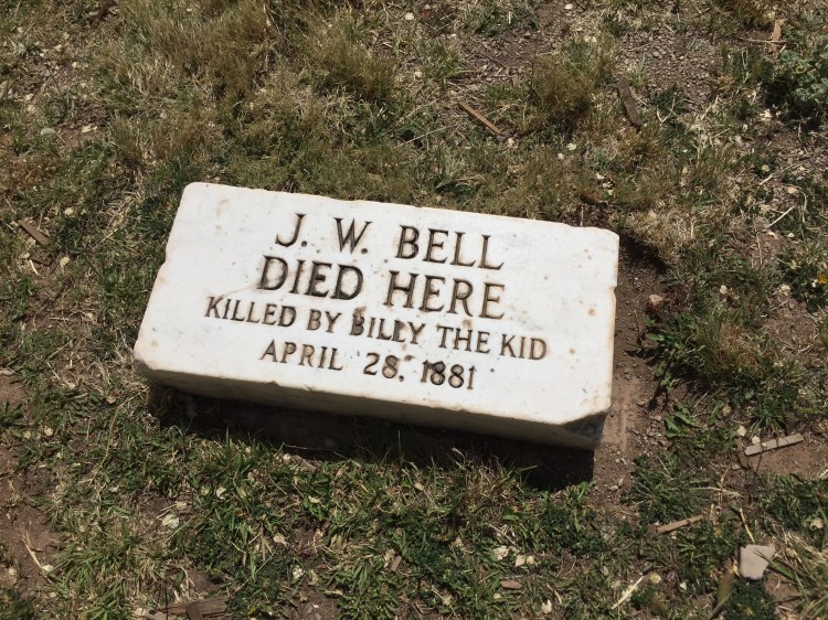
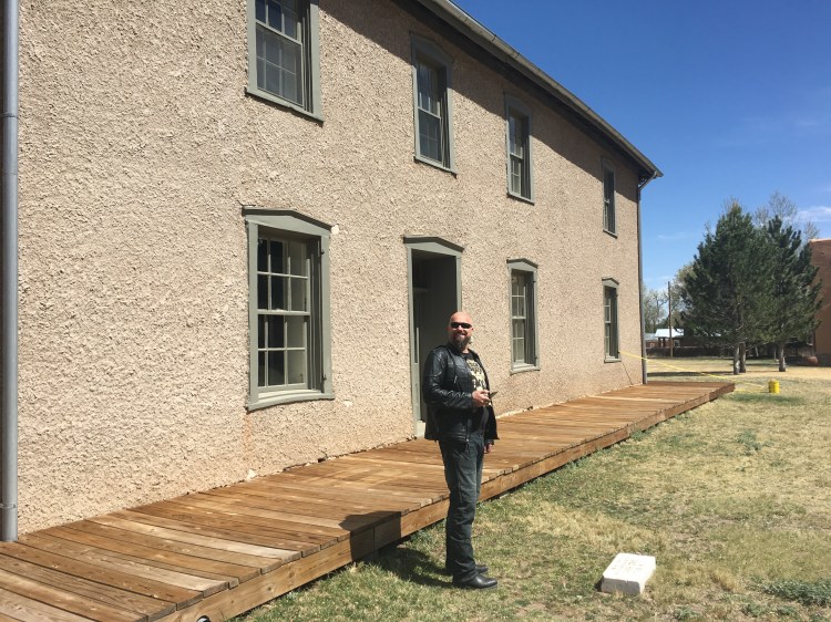
The town of Lincoln is considered by many to be the most authentic old west town remaining. Center of the bloody Lincoln Country War this little town is steeped in history and old west names like Billy the Kid, Kit Carson, Pat Garrett and John Chisum. Ørjan was more than a bit excited riding into town on his chrome steed, being a kid growing up on the stories, the cartoons and the movies heroing Billy the Kid and other famous and infamous inhabitants of the old west. Visiting the courthouse where Billy the Kid made a famous escape, being in the same room where Billy was shackled, was just amazeballs! Shooting his way to freedom, only a few months later he was shot dead by the very man that had followed him to that room, Pat Garrett. The piece of street outside the courthouse and down to the store owned by Billy’s friend John Tunstall, was dubbed the bloodiest street in the world at one point. Some of this story is depicted in the movie Yong Guns and visiting the Tunstall store, and having coffee in a house that might/might not have served coffee to Pat Garrett was a highlight of this trip. If you are an old wild west buff, Lincoln is the place to visit, if I should choose one location.
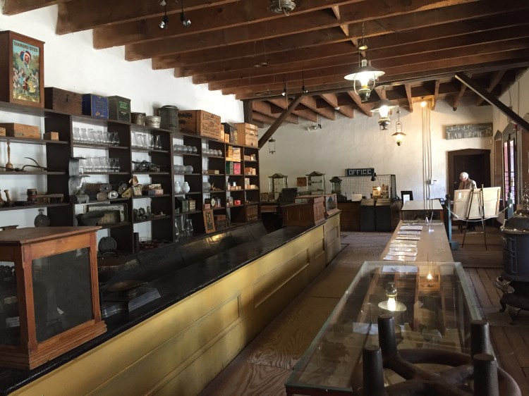
The Tunstall store 
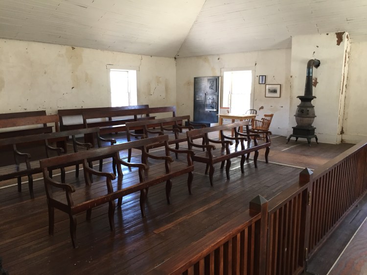
The room where Billy The Kid sat captured 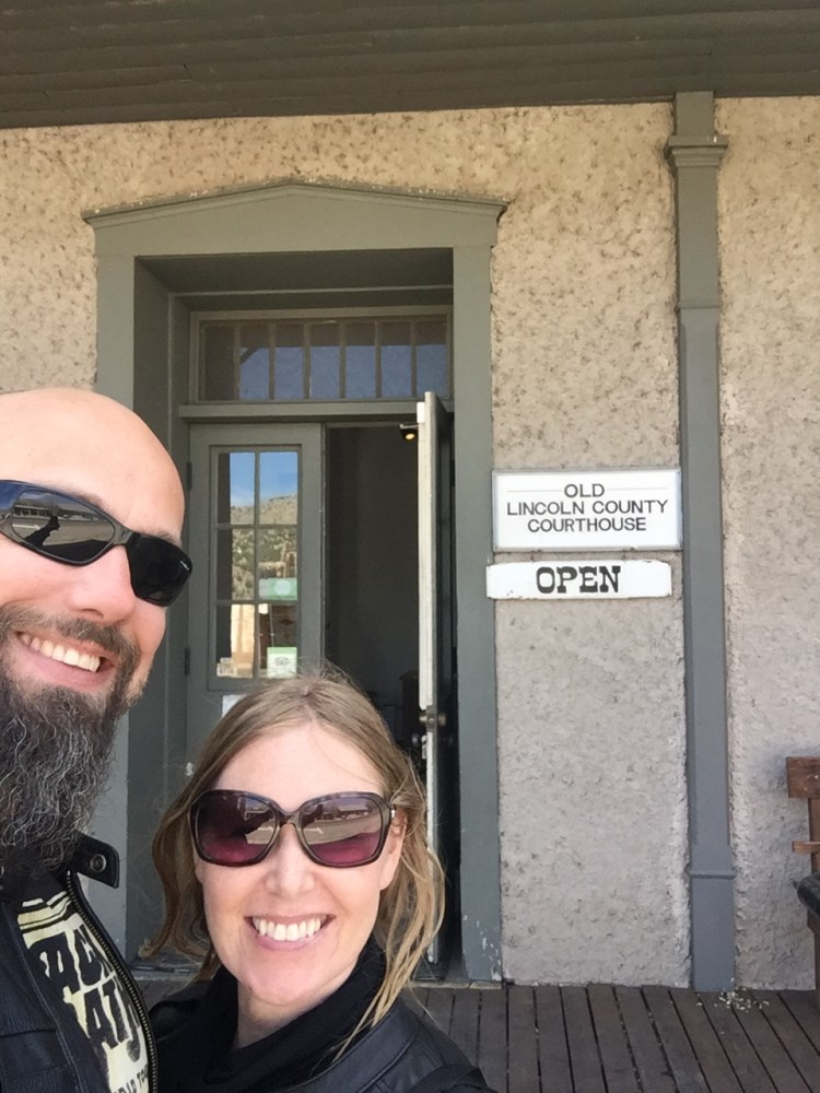
Ørjan by the stone in the ground, Billy The Kid killed J.W. Bell from the window above with a shotgun
Continuing east, the road is spectacular, following the river and valleys, green and lush until you meet Hwy 70 and the landscape flattens out before you get to Roswell. The town being known for being possibly the only site where an UFO crashed , it carries its fame on every sign and every store. In the elevator at our hotel there was a picture of an alien, we stayed at the Alien Suite, and our hotel key had an alien on it. If ET could phone home, he would do it from Roswell. If you want to visit the actual site, you have to go out of town, we did not go. Since we had spent more time than we thought we would on the road that day, we only had an alien burger with interplanetary fries and plasma lemonade and headed for bed.


Brainfreeze! 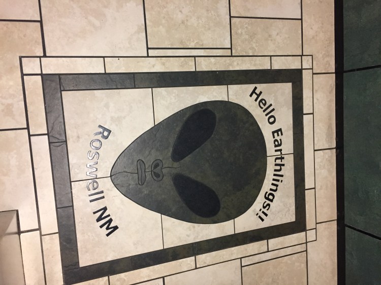
Day 3: Roswell to El Paso

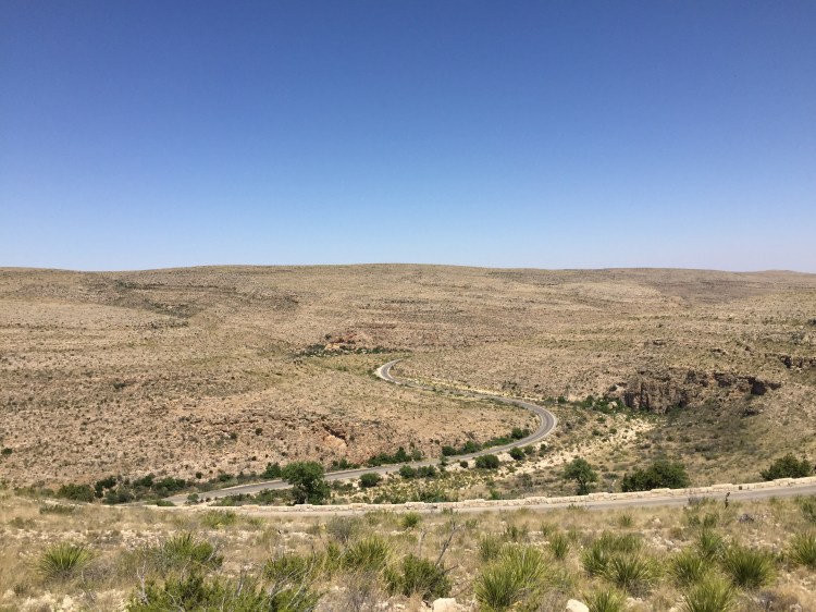

Riding south on Hwy 285 towards Carlsbad, we had no other stops planned than the Carlsbad Caverns that day. The road here was nothing special until we turned onto Hwy 180 (62) west towards El Paso again. At Whites City (more like an RV park) you go up in the mountains and will after a while get to the entrance of the Carlsbad Caverns. The road here is a great one, winding its way through valleys and gorges up to the plateau where the entrance is.


Check the people in the background here… 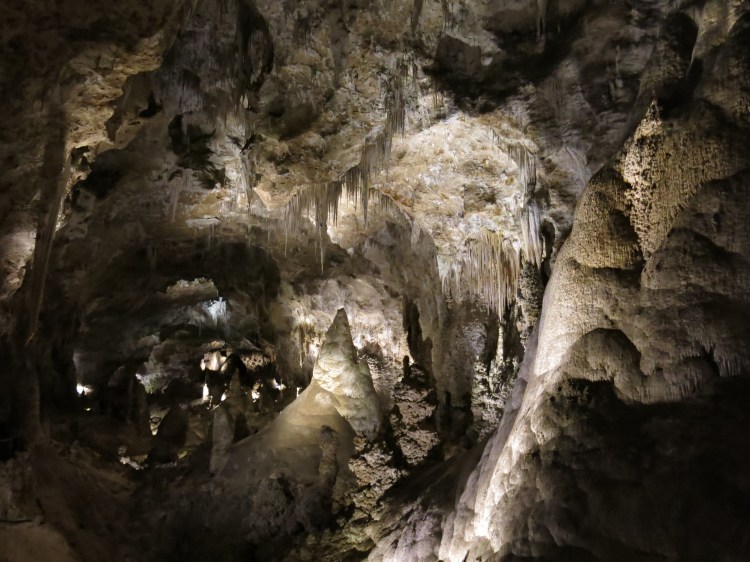
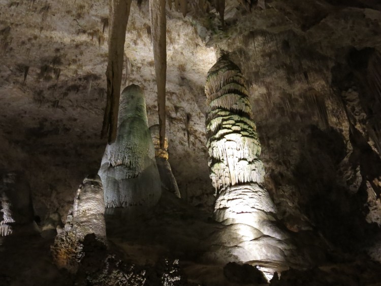
You have no feeling that below your feet are 119 caves, and to get to them you need to take an elevator bringing you 750 feet (229m) below the surface. There is a one-mile trail in the cave system open to the public, and the biggest cave (the Big Room) is almost 4,000 feet (1,220 m) long, 625 feet (191 m) wide, and 255 feet (78 m) high at its highest point, making it the fifth largest chamber in North America. It was hard to take any pictures down there, but the vastness of the cave, the darkness and feeling of being deep under ground was overwhelming. We have never been to such a big cave, and the rock formations, the stalagmites and stalactites were all imposing and extraordinary. Compared to the surface it’s cool down there, so bring some warm clothes.

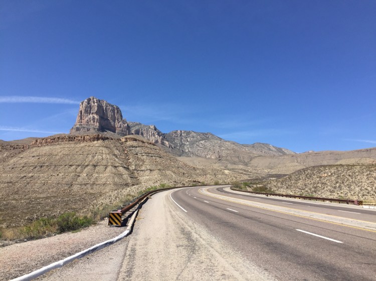


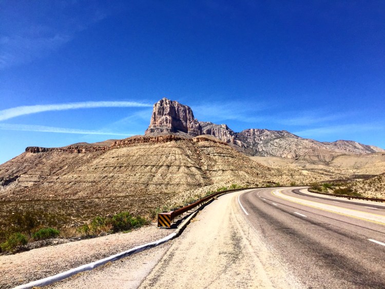
Continuing west towards El Paso you ride with the wonderful Guadalupe Mountains on your right, making for spectacular driving and scenery. You then drop down onto salt flats; it makes for fantastic photos with the salt flats in the foreground and the mountains in the background. The ride back into civilisation is pretty much straight forward desert driving, not much traffic until you get within the city limits of El Paso. We delivered the bikes at Eaglerider that afternoon, and checked into another motel, packing our riding gear into one bag, and getting the flip flops out of the other bag. The next day we took a taxi back to the airport and rented an SUV at Avis to continue our adventure of the Texas Traverse, featured in another page.


