Norway
Welcome To Norway!
- Hyper Loop (Oslo-Geiranger-Trollstigen-Molde-Atlantic Road-Oslo)
- Pulpit Rock (Preikestolen)
- Svalbard
- Brokke-Suleskard-Lysebotn
- North Sea Road RV44
Welcome to our homeland. Land of giants, trolls, vikings, the midnight sun, Munch, Grieg and more Olympic ski winners than any other country in the world. It is said that Norwegians are born with skis on their legs, and that is not far from the truth. Norway is perhaps best known for fjords (yes its a Norwegian word), being one of the best places to live on earth (we are continously scoring high on happiest nation on earth surveys), being home of modern skiing (Morgedal) and generally being annoyingly good at wintersports. Throw in spectacular nature, good looking locals, lots of epic roads, nice towns, archipelagos, mountains and a sun that never sets, you have a place that you might never have to leave. We are not nearly good enough at exploring our own backyard, we will still try to bring inspiration to all who wants to come here, and all locals who need local tips from all over the place, but mainly from our own south Norway, also called Sørlandet.
But starting this off, we go on an epic road trip to the mountains and fjords of western Norway.
Norwegian Hyper Loop
Oslo/Gardermoen-Beitostølen-Jotunheimen-Lom-Dalsnibba-Geiranger-Trollstigen-Molde-Atlanterhavsveien-Kristiansund-Sunndalsøra-Dovrefjell-Rondane-Lillehammer-Oslo

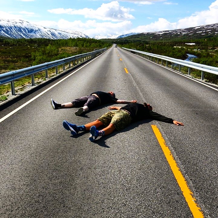
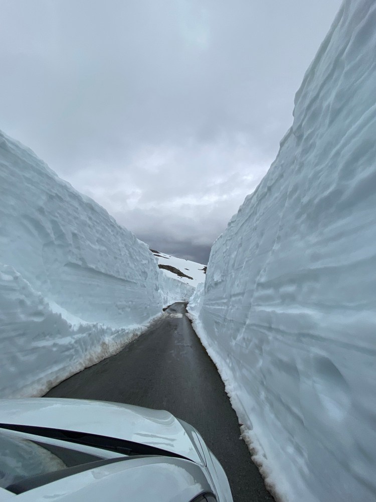
This is the Norwegian Hyper Loop. We thought we should find out if we could go to some of the most iconic Norwegian places in less than 48 hours, only 1-night road trip across the mountains from Oslo to Molde and back. A 1300 kilometres done by departing Oslo at 8 am, arriving in Molde 9 pm, leaving Molde at 7 am and arriving in Oslo 10 pm. If you have just 2 days and 1 night to experience Norway, this is the itinerary for you. Best time to do this road trip is May and June, spring in Norway is the most magical time, with lush greenery in the valleys and fjords, combined with lots of snow on the mountains. This itinerary is compressing mountains, fjords and spectacular roads and scenery all the way.
Oslo-Molde
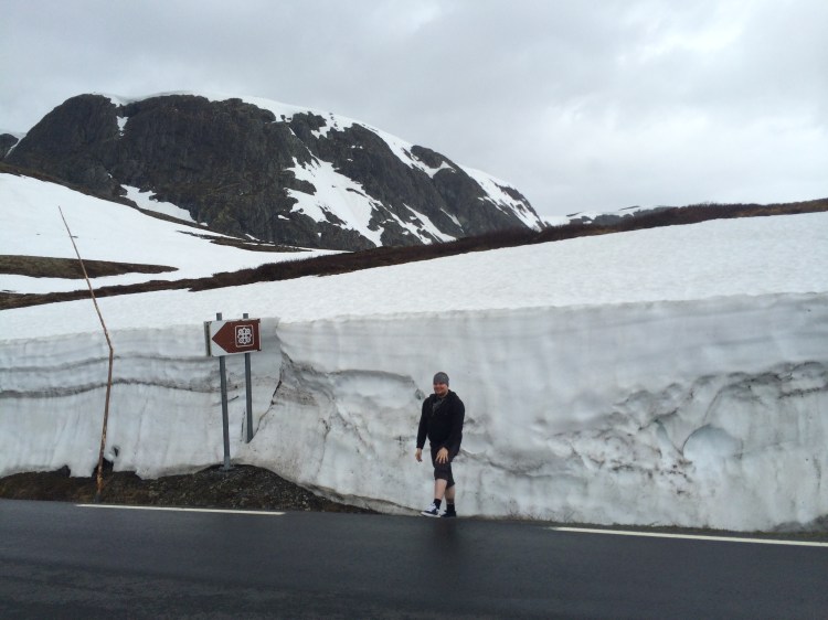
If you start from Oslo or if you arrive by flight and start from Gardermoen Oslo Airport, it’s basically the same thing, E16 to Hønefoss is the first thing you need to do. From Oslo you approach from south and from Gardermoen you come in from the east. From Hønefoss you continue up the valley, and there is a lot of valley and a lot of spruce trees on this first leg, like many of the other valleys of Norway. But there are beautiful inland lakes and rivers to follow, and you will get glimpses of the mountains in the distance now and then. Keep on trucking on E16 until Fagernes, then you continue on FV51 to Beitostølen over Valdresflya. From Beitostølen and over the mountain this road is winter closed, please check Nasjonale Turistveger website to see if the road you are driving is opened yet. The opening of roads that are winter closed can happen anytime from April to late June depending on the winter’s snowfall. Valdresflya was used by Top Gear to test their combine plow thing. This road hugs the Jotunheimen national park, and it has spectacular hikes in the spring and summertime.


After crossing the first mountain, and surely stopped for photos of snowdrifts and views, you once again meet a valley and do a right on E15 west towards Lom. It is well worth a stop, probably for lunch at Lom bakery with its spectacular location on a raging waterfall, and to visit the Lom Stave Church.


From Lom you continue on E15 west until you get to one of the most spectacular crossroads where the E15 continues towards Stryn and Ålesund and FV63 goes northwest towards Geiranger.
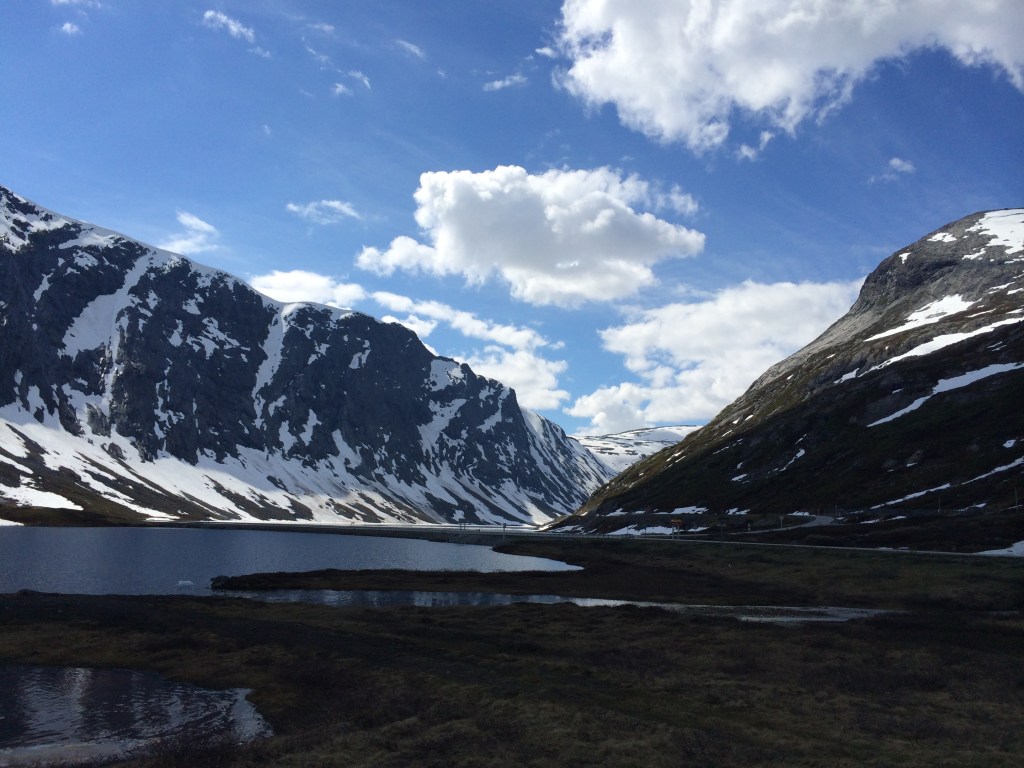
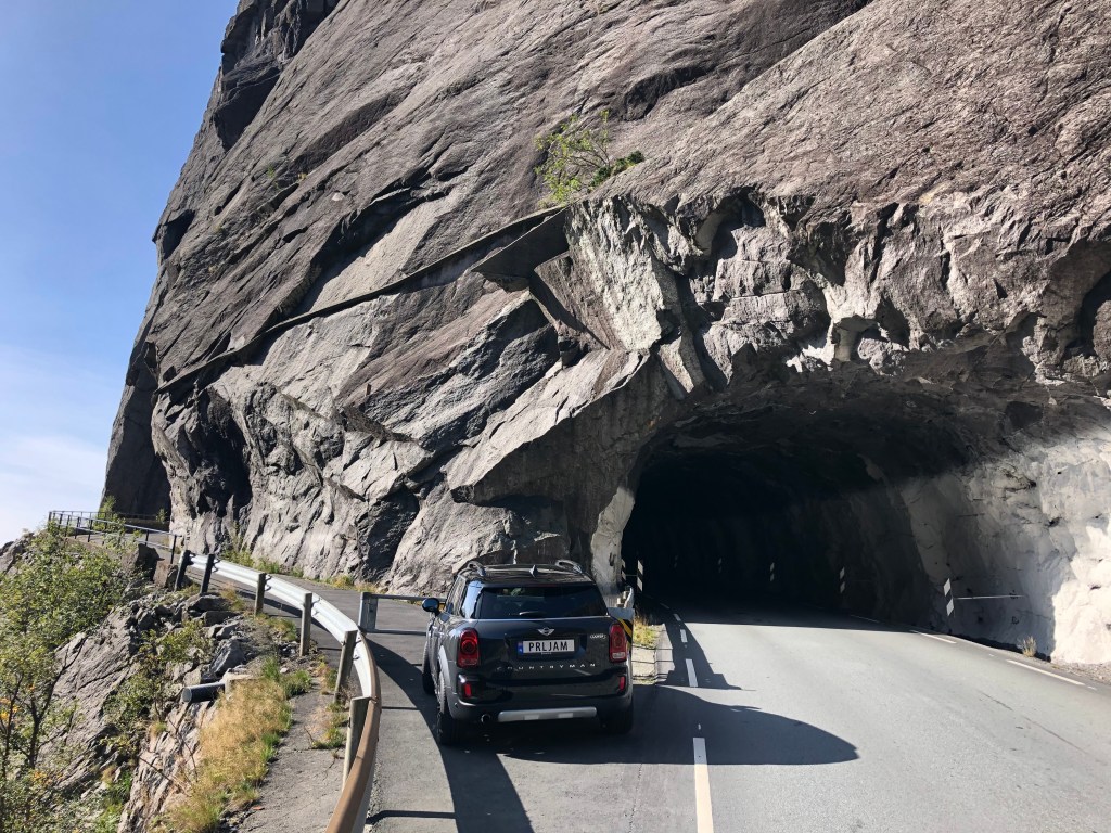
This is also a winter closed road, so check if its open before you go. This is one epic stretch of road, nestling in a valley with high snow-covered mountains on each side. Like all Norwegian roads, its narrow and you need to look out for campervans in both directions. Halfway to Geiranger you must take the road up to the Dalsnibba viewpoint. On a clear day it is breath taking to gaze into the Geiranger fjord below. it costs NOK 170 for a car, but this is a small price to pay for a view like that. On the way down to Geiranger there are some awesome stops you can make for photos, among those are the Flydalsjuvet.


Geiranger itself is a quaint little hamlet, but if there is a cruise ship there, it will be overfilled with people, and best to just drive past it. Later years the lobbying for limiting or stopping the cruise ships have been an issue, not only the amount of people, but also the amount of pollutants those huge ships brings into the fjord. On a busy day you can see the haze from the smoke that the ships emit.
If you can get the planning right, and if you can get a place on the ferry, one of the most mind bending ferry rides of the world is from Geiranger to Hellesylt or Valldal (this is the direction of our road trip). Continue up the fjord ridge on FV63, with a stop at the Ørnesvingen (eagles’ corner) view point and then push on over yet another mountain to Eidsdal.

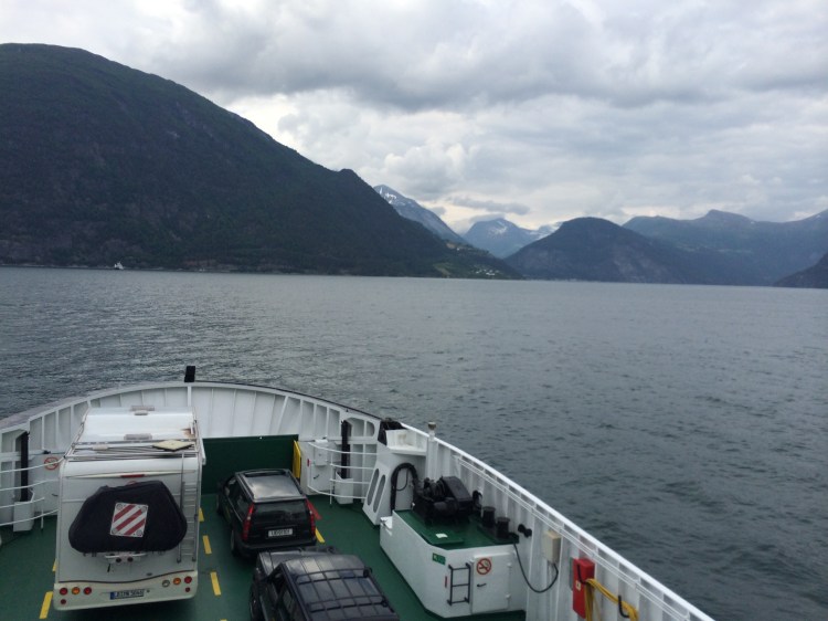
Take the ferry from Eidsdal to Linge. Continue FV63 towards Trollstigen. This is another mountain climb from the fjord and up, but at the end of the mountain, yet another spectacular view. The Trollstigen (Trolls ladder) viewpoint and road. One of the most spectacular bits of tarmac anywhere in the world winding down the mountain side with impossible twists and bends. But before you head down the road, make sure to walk and visit the platform hanging in thin air over the valley. Not for those with a fear of heights, but if you dare to walk out over the abyss, it will make for one hell of a photo opportunity.
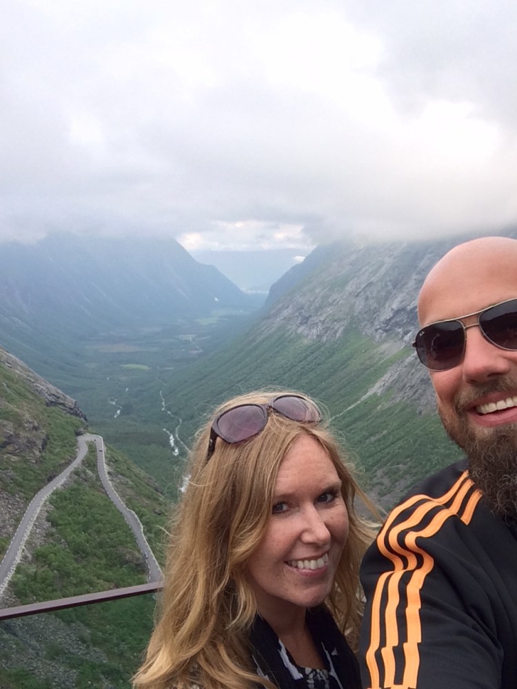
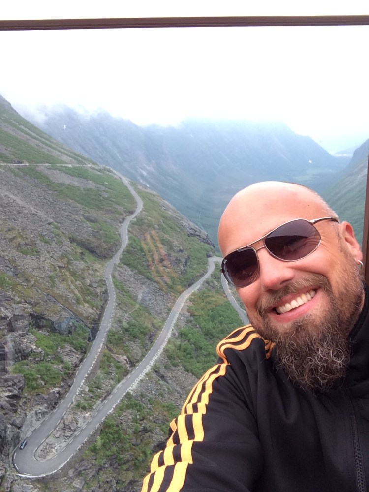
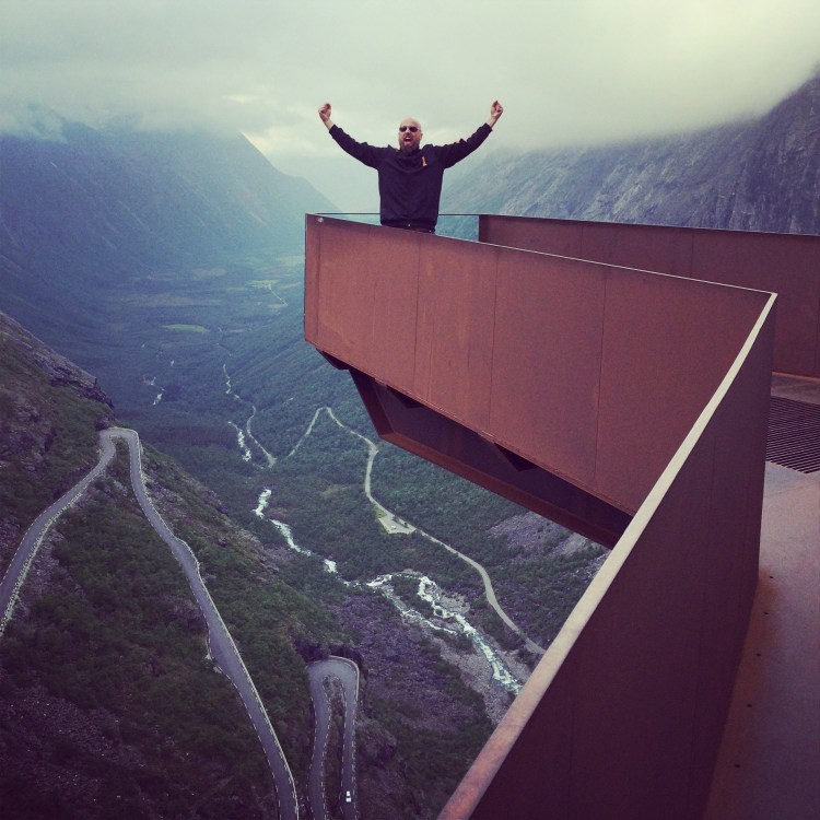
If the weather is fair, you might also see the wing suit maniacs hurling themselves down the mountain and flying along the walls of the Trollveggen massive. Trollveggen is Europe’s highest massive drop, 1700 meters, with over a 1000 metres vertical drop with a 50 meter overhang. The Trollveggen is regarded as the home of BASE jumping from mountains, in 1980 Finn Jorma Øster was the first to parachute off Trollveggen, thus giving birth to a new sport. Watch a YouTube video from the wingsuit flying at Trollstigen.
Continue down the valley, and stop for more photos on the way, it is one of the most beautiful sights in the world. When you reach the end of FV63 you continue on FV64 towards Molde, and then a short hop on another ferry across a fjord, and you are in Molde. A beautiful town, the city lies with its back to the Atlantic Ocean and the money shot is the view from town back towards those mountain massives with their snow-capped peaks. We arrived at 9pm in the evening, so we had no time for much more than some dinner and beers, before hitting the bed exhausted.
Molde-Oslo
From Molde we continued on FV64 towards Kristiansund. This road will yield the Atlantic Ocean Road (Atlanterhavsveien) also used by Top Gear and others because of its rawness and epicness hovering above the waves of the Atlantic Ocean. It makes for some awesome photos. It is not a long stretch of road but makes up for it in pure fierceness and stubbornness of being put in such an epic place.


We had to skip Kristiansund, just because of time, so no offence to the city, but we had no time for it. From Kristiansund we headed back east on E70 past Tingvoll and to Sunndalsøra. Here you will hug magnificent Tingvollfjord until you reach Sundalsøra. A typical Norwegian small town in the end of a fjord, many have or have had heavy industry history, with typical power heavy factories that use hydro power to smelt and process ore from around the world. In Sunndal they have the most modern and largest primary aluminium plant in Europe. Keep on trucking along the valley and rivers until you reach the alpine village of Oppdal famous for being one of the largest alpine skiing areas in Norway.

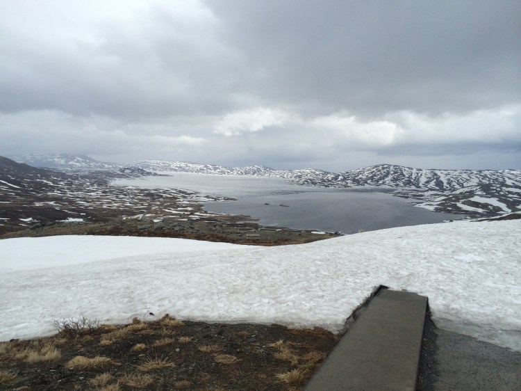
From Oppdal you will drive on the E6 south and enter the Dovrefjell area, up on this mountain plateau there are musk ox roaming, so watch out for those while driving. At Hjerkinn you can go two ways, either continue on the main road E6 south via Dombås and Otta, or like we did, take the detour via the Rondane national park. FV29 to Folldal and then the FV27 south. You will have the Rondane mountains on your right, and there are some spectacular stops along the way. The Sohlbergplassen stop offers a cool platform among the spruces to take in the vistas of the park.

Diving back into the valleys again you re-enter the E6 for a straight run down to Lillehammer home of the 1994 Olympics. From here it’s a two-hour drive back to Oslo. We arrived around 9pm in Oslo.
This was the Hyper Loop, if a hyper tour of Norway is what you need, this will take you past some of the most spectacular sights Norway has to offer. If we should recommend some amendments to this itinerary, it would be to either add an extra night in Kristiansund and explore some more of Molde and Kristiansund and the coast in that area. Or turn south in Molde and go via Ålesund and spend a night here, it is a very nice town, and has some very cool places to see and eat. And then go via even more fjords back to Oslo. Enjoy the roads of Norway, but be careful on the narrow roads, watch out for campervans, and look out for speed cameras, it is expensive to get caught for speeding in Norway. Drive safe and enjoy!

Pulpit rock (Preikestolen)
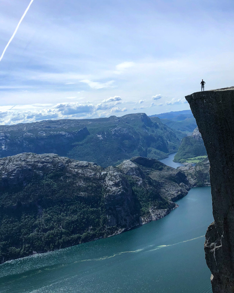
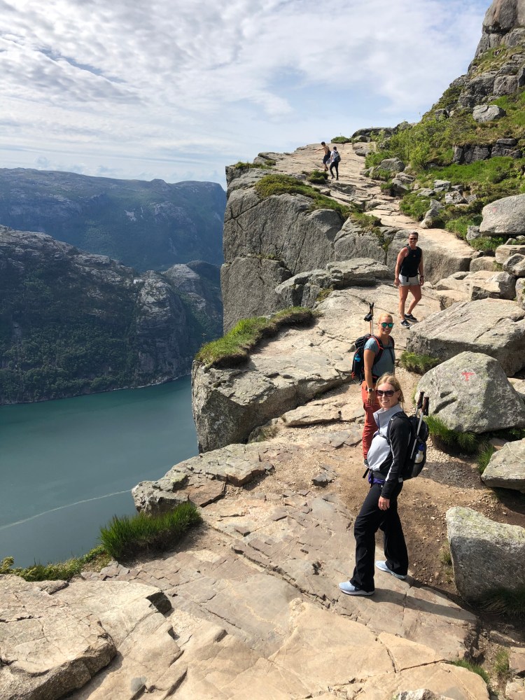
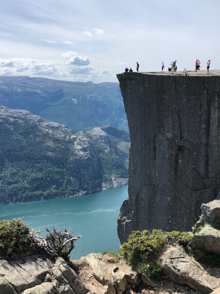
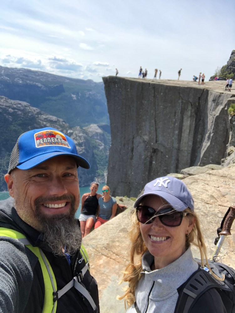
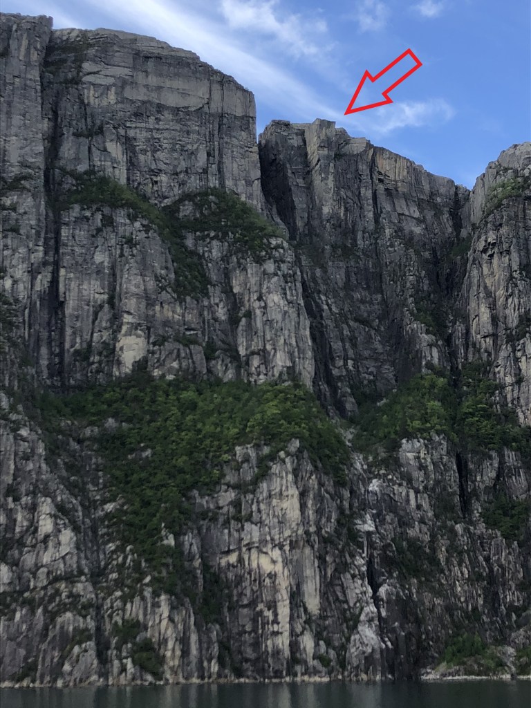
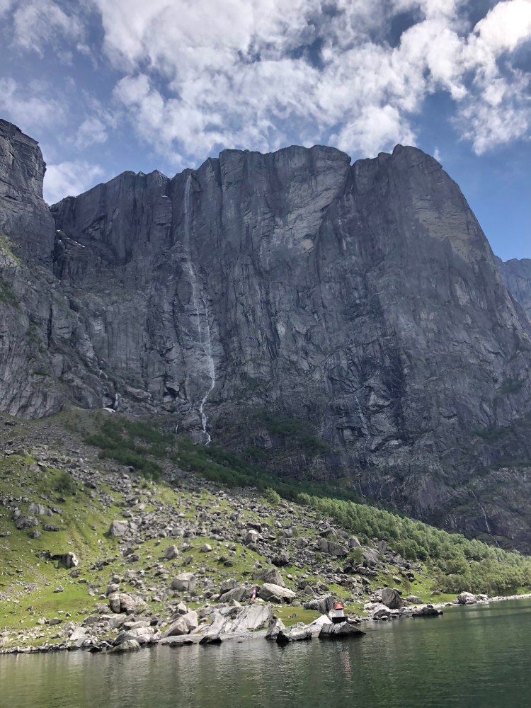
Pulpit rock is probably one of the most iconic destinations in Norway. On par with Munch’s “Scream”, Grieg’s “Morning Song”, the northern lights, Lofoten and that match winning score by Ole Gunnar Solskjær. A sheer rock face stretching 604 metres (1981 feet) from the Lysefjord and straight up towards the heavens. Seeing the rock from the fjord makes you realize why it got the name Pulpit rock, logically, it looks like a pulpit jutting out from the rock face. It is an awesome site, and it makes for some of the most spectacular SoMe photos in the world. Pulpit rock ranks as one of the world’s most jawdropping sights, and the hike to get to it is an adventure on its own.
How to get there
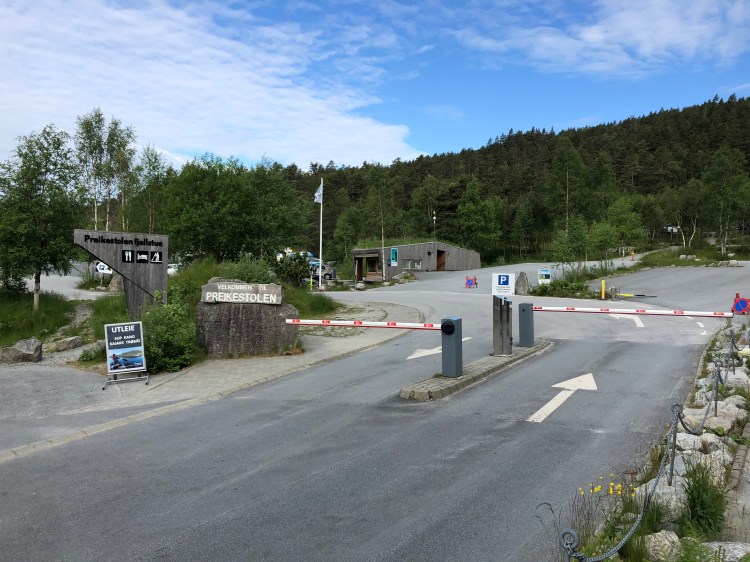
Pulpit rock is in Rogaland county, just outside Stavanger (a nice city to visit before or after your adventure). From Stavanger you drive through the brand spanking new 14.4 kilometres (9 miles) underwater tunnel from Stavanger to Tau and Jørpeland, from the tunnel exit it is signed with brown tourist/attraction signs to “Preikestolen” which is Pulpit rock in Norwegian. Past Jørpeland you take a left and begin the incline and drive to the parking on the start of the hike to Pulpit rock. The parking costs (per 2020) 250 NOK per car and has a 24 hours’ time limit. There is no free parking unless you want to walk all the way from Jørpeland (this is possible but not recommended). Preikestolen Camping is on the way between the turnoff from the main road and the parking but offers good camping facilities. At the parking area at the end of the road there is also a very nice camping option, the Preikestolen Base Camp, they have cool pods to sleep in, sauna boats and you can rent SUPs, kayaks and other stuff there to frolic in the large lake at the camp. At the parking there are also shops where you can purchase extra clothes and such if you need it for the hike. It is also the last toilet facilities you will see for a while. Visit the official website for updates on parking and weather at Preikestolen 365.


The Hike
If you think that Norwegians build their attractions with easy access for cars and campervans, you are mistaken. Norwegians pride themselves in being outdoorsy people, so driving and parking by attractions are considered cowardly. So, if you want to see Pulpit rock in all its glory, you need to put the work in. There are stories about tourists heading off in ballerina shoes and miniskirts thinking that all attractions are easy to reach. And there have been rescue operations when people have not heeded local advice and dressed appropriately.


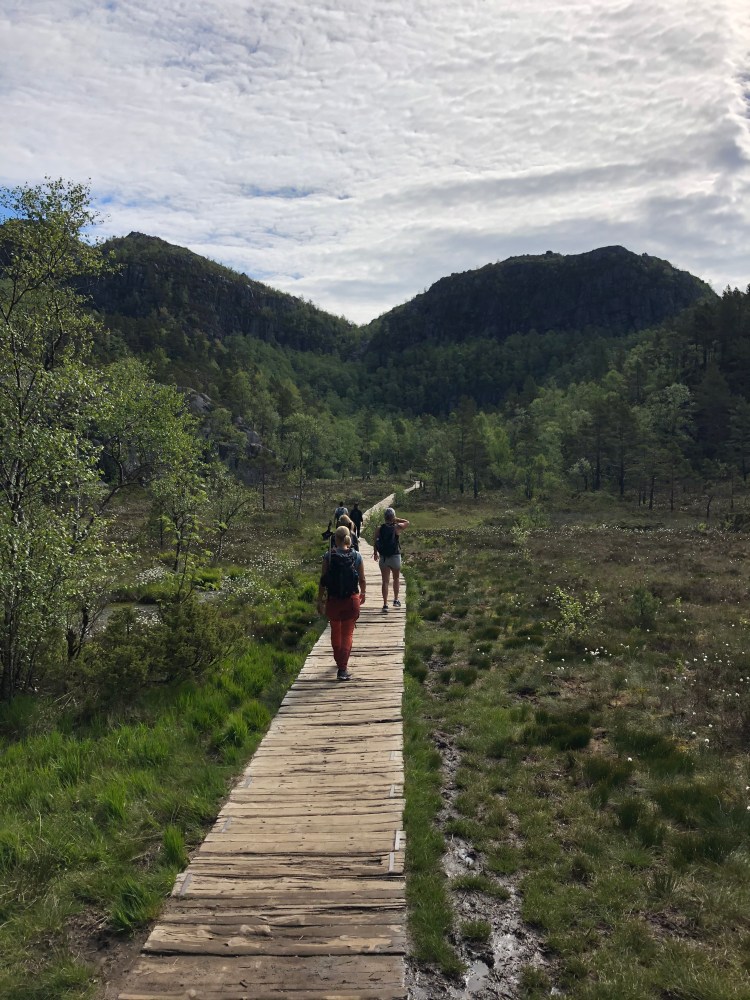
The hike itself is about 4 kilometres (2.5 miles) and has a total incline of 500 metres (1640 feet). This is a slightly tough hike and there will be sweat and need for breaks along the way. We walked in good running/walking sneakers, so either that or good mountain shoes are recommended. Bring water and snacks and/or food for lunch – you will have the possibility to eat al fresco at the most spectacular location. We would recommend starting up at between 8 and 9 am to have a nice start before the throngs of people arrive (there are about 300 000 visitors a year, and most of those will visit from May to September). Some start earlier to catch the sunrise, and this is not a bad idea, just keep in mind that sunrise is around 4am in summer. You can bring a tent and stay for the night, the right to roam act of Norway makes it legal to camp anywhere you like as long as you are not closer than 150 metres (500 feet) of buildings. Since there are no buildings around Pulpit rock, it is a possibility for the adventurous. Keep in mind it is not allowed to camp at the rock shelf itself, so the plateau before you get to the front of the mountain is the best option.


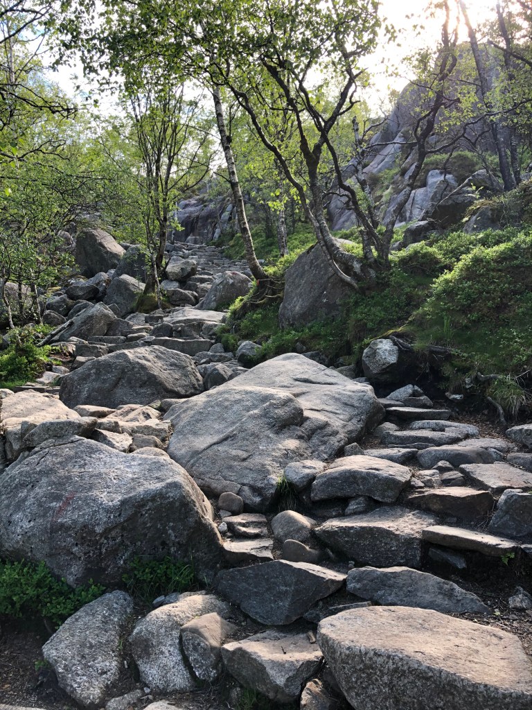
Depending on your physical fitness you will use between 1 and 2 hours for the hike up. We are average people fitness wise and we used 1 ½ hours up and a little less back again. The path itself starts off with a brutal incline, so be ready. On the pathways going to Pulpit rock Sherpas from Nepal have laid down tons of rocks to make stairs and paths. And the stairs are not what you call normal, they are natural stairs with different heights and steps all the way. So, it takes a bit of your mind as well to concentrate on the path as you walk it. Underway you will cross bogs, climb and climb some more on stairs, you will have epic views back over the fjord to Stavanger, and you will about halfway begin to see into the Lysefjord ahead. Approaching the last stretch you will walk across a plateau, where there are some nice small lakes you can swim in on the way back if you feel like it. After the plateau you walk on a wooden pathway hanging over the valley, this has just recently been installed, in the olden days you had to hug the mountain and hold on for dear life to a chain.


The last metres of the hike are on a ledge with the fjord at your left, and the rockface on your right. If you like Ørjan suffer slightly from vertigo, this is where you will start to feel the effect of being this close to the abyss.

Pulpit rock
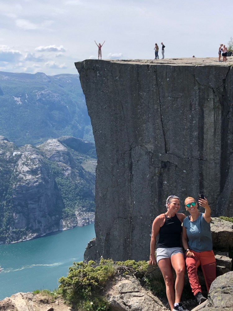
Entering the Pulpit rock itself is jaw-droppingly awesome. There is nothing else like it, and the feeling of being at an almost freestanding piece of rock 604 metres above the fjord is just mind-bending. Walking around the almost flat face, and doing what everyone is doing, taking selfies and content for SoMe, it is recommended to sit down and just take it all in. We ate our lunch a few feet from the edge, looking at other people daring the drop and dangling their feet over the edge.
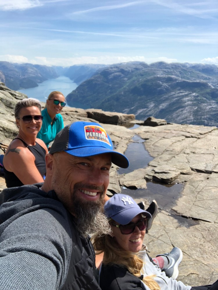
We are not daredevils, so we kind of dared to stand a few feet from the edge for photos but even then we had knots in our stomachs, and quickly retreated to the relative safety of a couple of more feet from the abyss. Just sitting there and looking into the Lysefjord towards Lysebotn and the Kjerag massive (known for BASE jumping and the Kjerag bolt) on the other side of the fjord was amazing.


The walk back down again was hard on the knees and both Tanja and Charlotte were glad they brought their Nordic walking sticks for support.


Pulpit rock stands among the giants of the natural wonders of the world. The fact that it sits in our backyard, a few hours drive from our house, makes it even more special. This was our first ever visit, and the biggest surprise was the challenge of the hike but this made it even more rewarding, the fact that you had to put in some sweat and some swearing on the way to see one of Norway’s most famous rocks, the Pulpit rock. By the way, check out Tom Cruise hanging off the rockface in this behind the scenes movie from Mission Impossible: Fallout. Irony is that the place itself was cast as somewhere in India in the movie, not Norway.
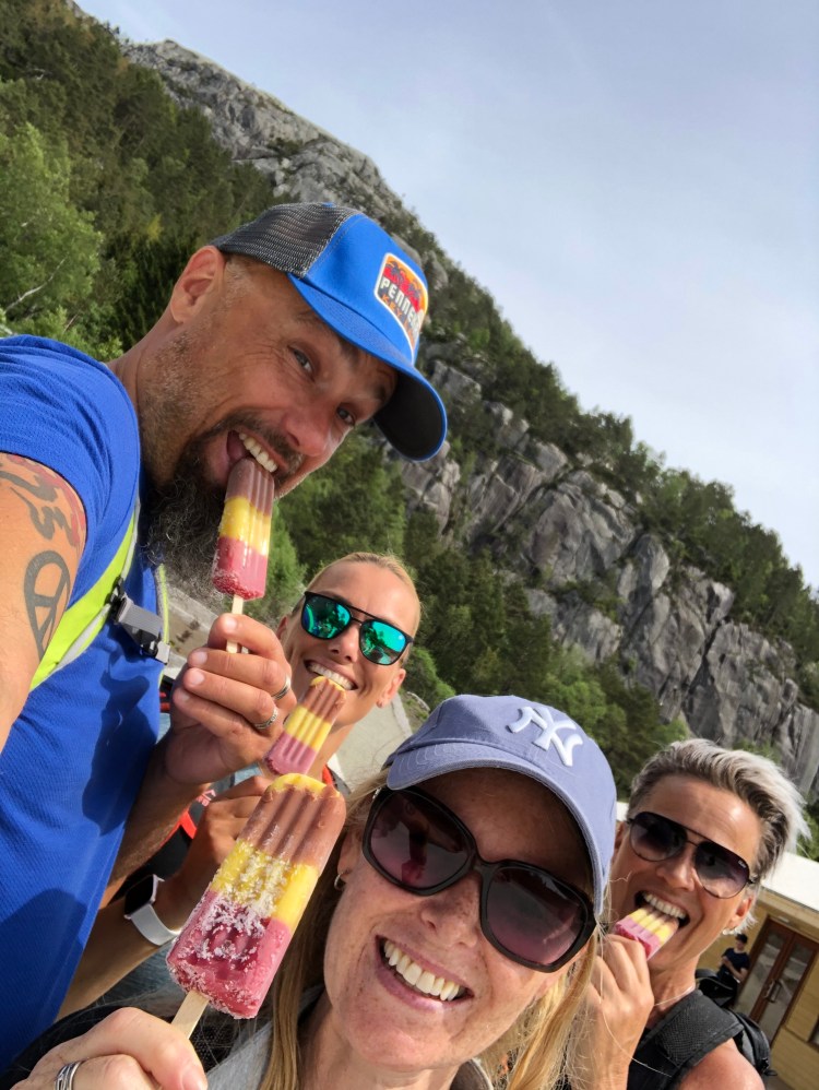
Pulpit rock should be on the bucketlist of anyone coming to Norway, and all Norwegians for that matter. And if you make it back alive, there will be icecream for everyone!
Svalbard
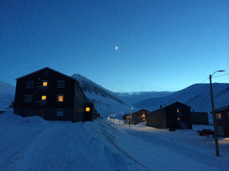
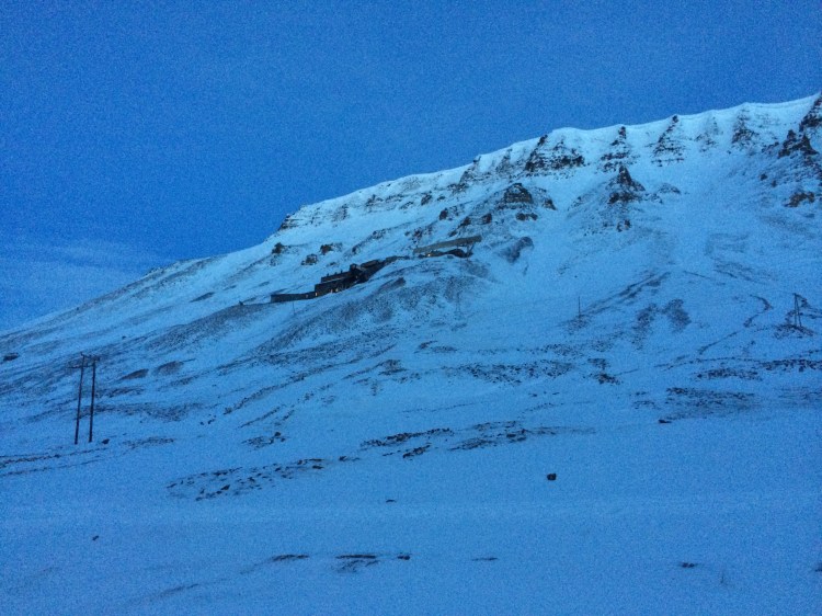
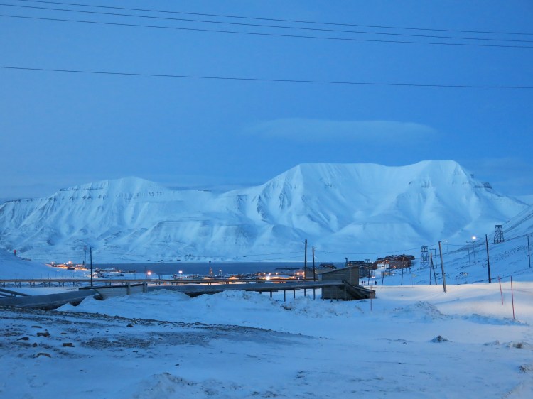
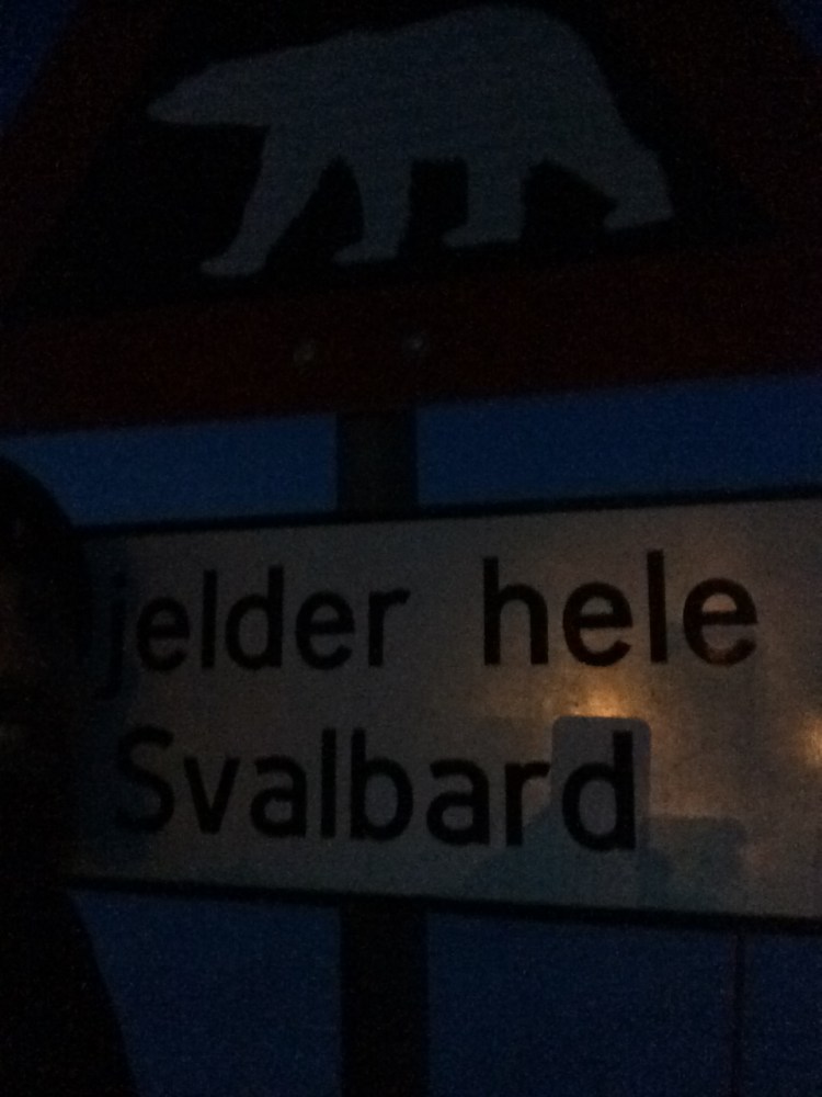
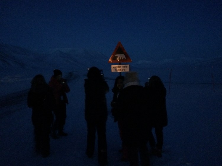
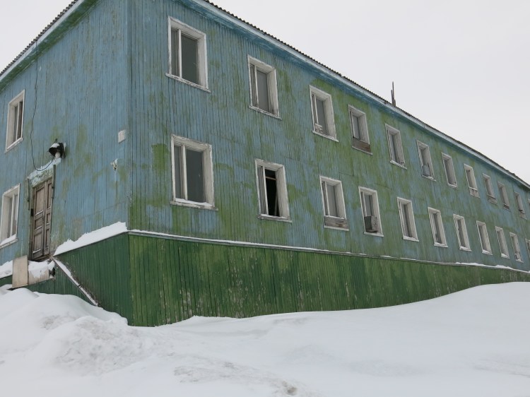
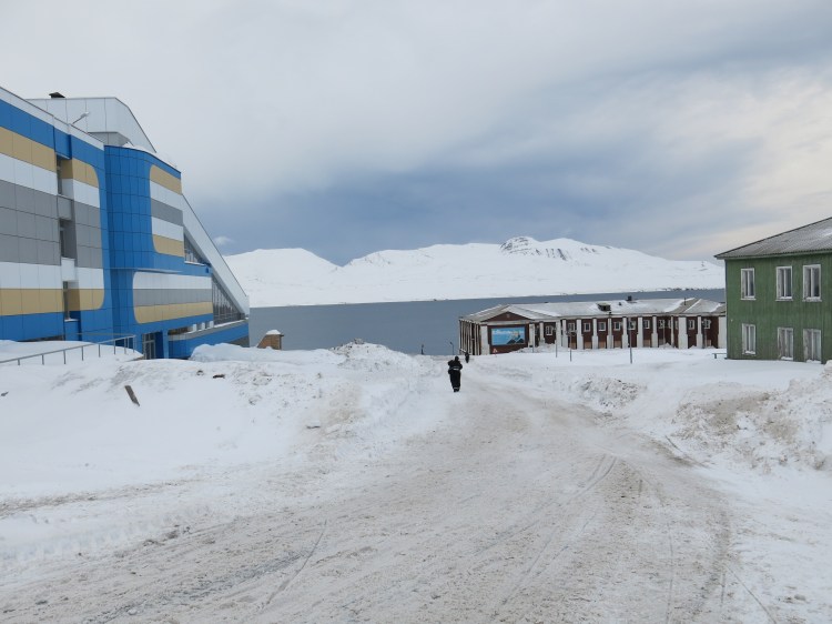
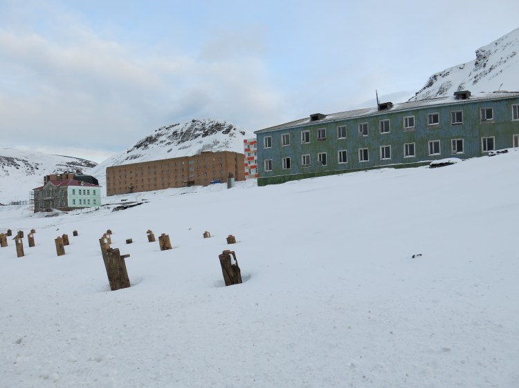
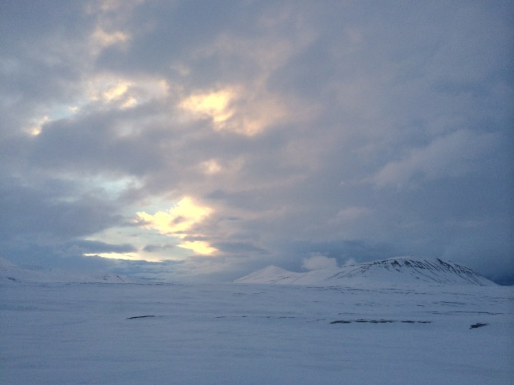
Arriving at the airport in Spitsbergen is like landing on a snow-clad planet Mars. The landscape is eerie due to lack of light in the early spring (our visit was in late February) and the crumbling mountains with their abandoned coal mines and lines of coal buckets suspended in mid-air surrounding the settlement of Longyearbyen.

The Norwegian archipelagos in the arctic is halfway between mainland Norway and the North Pole. Hence it has been used by many early expeditions to the north artic areas and the North Pole. The largest island is Spitsbergen, with Longyearbyen as its administration hub. The islands were used by whalers in the 17th and 18th century, but it was abandoned until coal was discovered in the 20th century. The coal heritage can be seen all around Longyearbyen, the old transportation system for the coal still hanging in mid-air all around. The lift system was used to haul the coal from the mines to the harbour. The Svalbard treaty of 1920 acknowledged Norwegian sovereignty over the islands, at the same time it was designated an economic free zone and a demilitarized zone. There is also Russian settlements on Spitsbergen in Barentsburg, and the ghost town of Pyramiden. Both settlements are coal related, since all nations that ratified the treaty can explore resources on Svalbard. Barentsburg is still home to around 450 Russians, while Pyramiden was abandoned and now makes for great photos of an arctic ghost town.

When to go?
There are three seasons in Svalbard: Polar Summer (mid-May to end of September) with the never ending days, the Northern Lights winter (October to February) where perpetual darkness gives high chances of seeing the Northern Lights and the Sunny Winter (March to mid-May)where the breaking point between winter and summer gives the best chances for seeing wildlife and exploring the great outdoors. The Sunny Winter is the high season for visitors since you both have light and still plenty of snow.
How to get there and where to stay
Obviously, there is only one way to get to Svalbard (unless you have a big amount of time and an inner mariner looming) and that is to fly. There are two airlines operating flight to Svalbard and those are Norwegian and SAS. Both fly from Oslo via Tromsø to Longyearbyen (LYR).
There are several hotels and guest houses in Longyearbyen. The Radisson is the biggest and is where we stayed when we visited. There are also smaller hotels like the quaint Mary-Anns Polarrigg and the boutique The Vault and Polfareren both run by Svalbard Adventures.
What to do?
There is so much to see and do in and around Svalbard islands. We have friends and family who have gone on photo safaris in summer to see the artic nesting birds and to go polar bear watching. There are polar bears all around, there are signs in Longyearbyen warning of the perils if one should roam into the city streets. And at all times do guides and people venturing outside the town have to carry a gun for self-protection. We never saw a big white fluffy killing machine on our visit, but chances are big of you go on an extended trip around the islands with Hurtigruten who have several options for cruises along the coast in summer.
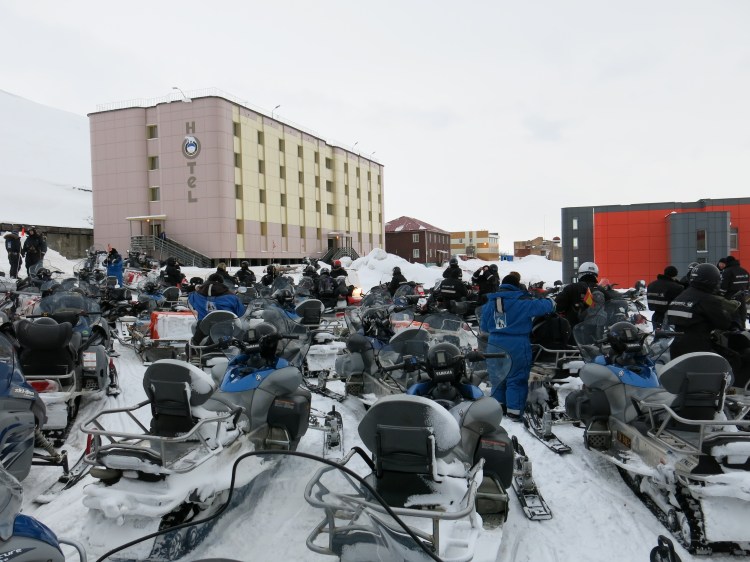
There are several companies offering tours with dogs, snowmobiles and boats around Svalbard. We chose the Hurtigruten Svalbard as our supplier of adventure. You must go on organized trips with guides, you simply do not wander off on your own in the arctic. We only visited for 2 nights, so our schedule was full. Since we visited at the end of February, it was still dark early, so we have limited daylight to explore. The first thing that hits you when you step off the plane, is the sheer brutality of the wind and the cold winter air. It makes it hard to breathe if you are used to warmer temperatures. Second you are glad that you packed 8 layers of wool and down jackets.
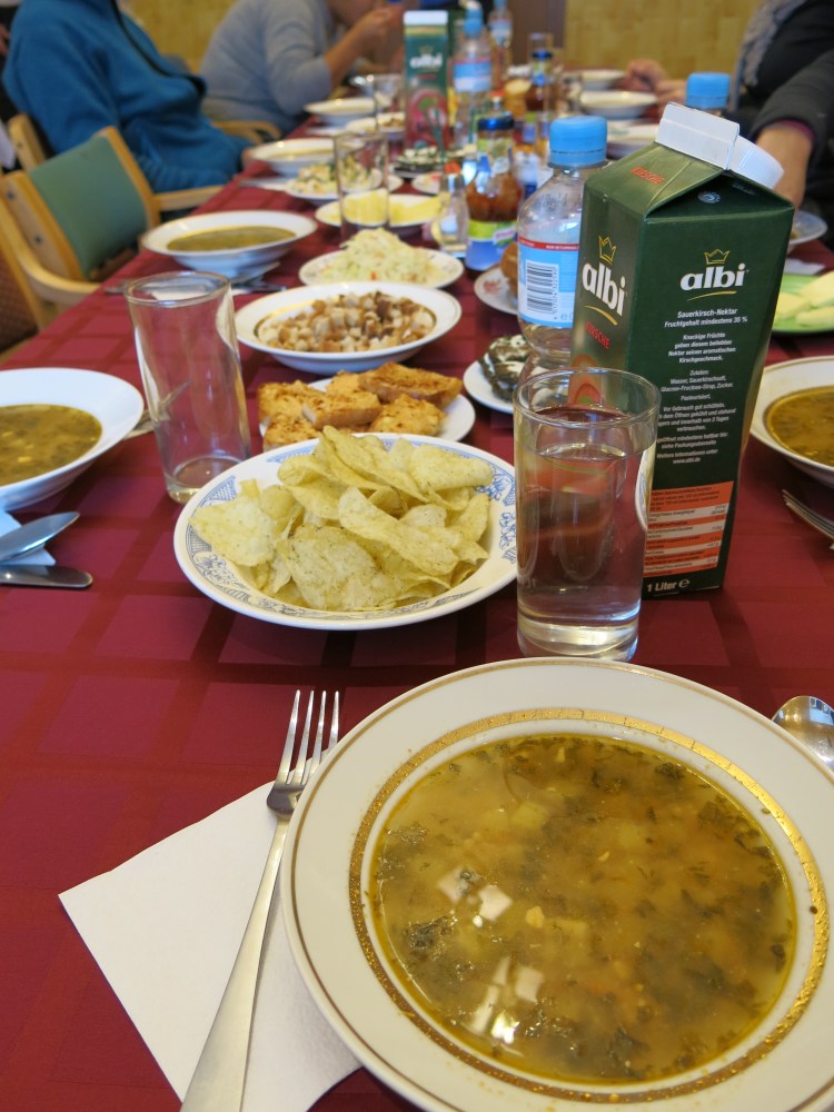
After arriving and picking up our luggage, we went straight on a dog sleigh trip to a permanent tent camp (it was almost dark so no photos) outside Longyearbyen. Since it had already gone dark, we did no see much, but the experience was something else. Probably comparable to sledding on the moon, not a tree in sight, no animals, pitch black darkness and the feeling of being very alone. At the tent camp we got a great meal made from reindeer and nice amounts of Aquavit. We were picked up after the meal by a vintage coal miners’ bus who had carried the miners to and from work for many years. The Radisson hotel had a roaring fire going in the lobby, so there was plenty of cold behinds warming up before bedtime.

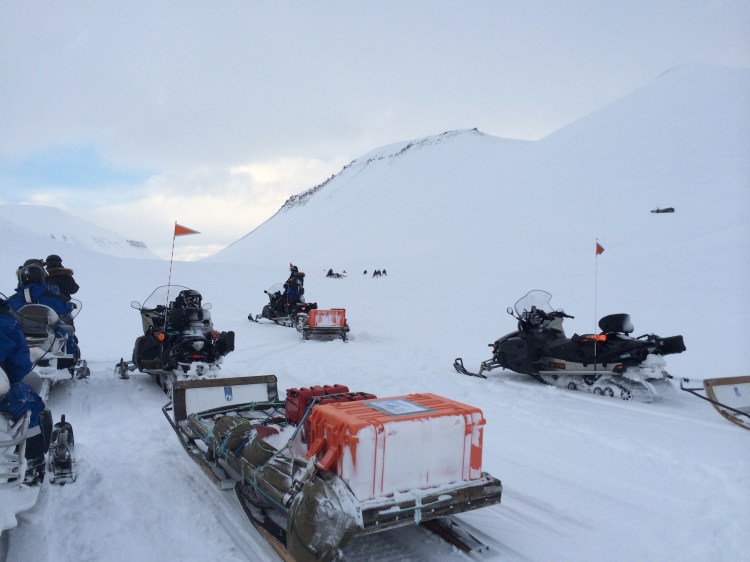
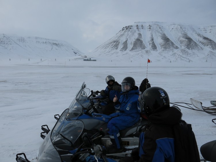
Our first full day was a snowmobile adventure from Longyearbyen to Barentsburg. We were all equipped with heavy duty romper suits, full face masks, helmets, and thick boots to survive the trip. It was freezing cold when we started early in the morning, and the temperature really did not change for the whole day. Freezing it was. Even the handles on our snowmobiles had heating elements, and we understood why during the day.


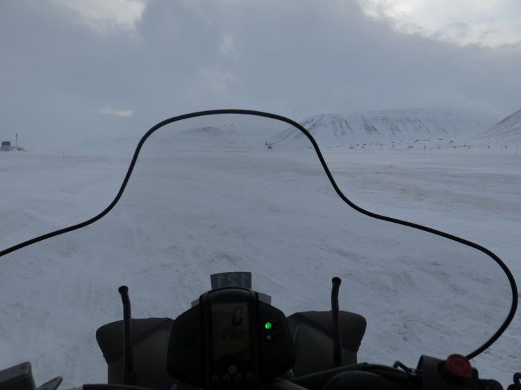
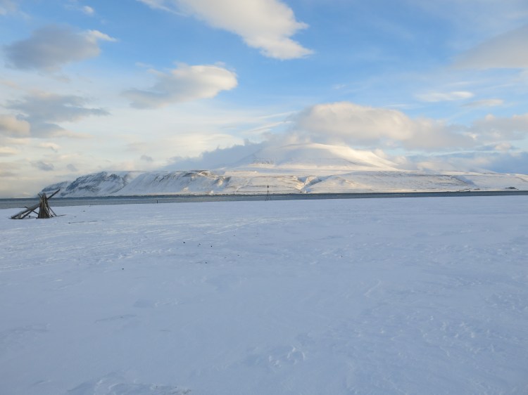
Again, it was like some other planet, fascinating nothingness, snow, and more snow. The views were epic all along our route, the snowmobiling was challenging for those who had not ridden such a machine before. Our guides were awesome and made sure that everyone kept up with the group. We had some stops along the way to spot for polar bears but at this time of year they had barely come out of hibernation, so no bears seen. We saw some reindeer, smaller and stockier because of the cold compared to their mainland counterparts.


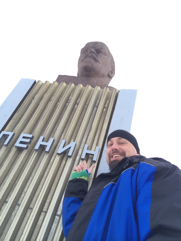
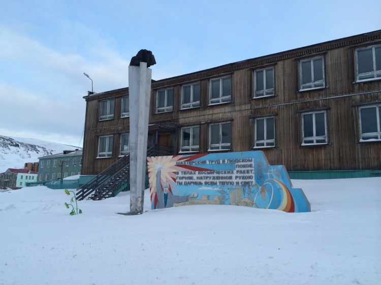
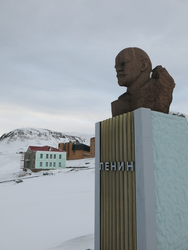
Riding into Barentsburg was peculiar, suddenly we were in Russia. Cyrillic letters on the buildings and a very eastern European look on the houses and public buildings. The main square had the customary Lenin statue and many of our travelling compadres sent postcards from the local Russian post office. We had lunch in the Russian canteen of the coalminer’s union, a typical Russian meal, lots of potatoes and meat in stews.


It warmed us up good for the 4 hours return journey to Longyearbyen. The return was hard, we all started getting tired, so mistakes were made, and snowmobiles had to be straightened right side up more than once. It was a struggle for many, so do not think that a day on a snowmobile is a piece of cake, its not.

The beers and the dinner that evening tasted like a Michelin dinner. Svalbard has some great restaurants, especially Huset is well known for being THE place to eat and drink in Longyearbyen.
Last day was spent visiting the fascinating glacier cave just outside the town. If you have ever wondered how its like inside a glacier, this is the place to explore. With headlight, crampons and helmet you wander inside and ancient glacier. A truly alien space. Our camera had frozen from yesterdays snowmobile adventure, so no pictures from this adventure. Just time for lunch and then the flight home. Our appetite for Svalbard was wetted and we need to go back and explore more. Svalbard is the place if you really want to see some of the last wildernesses of the world. The frozen wonderland of Svalbard is awesome. Check out more activities and suggestions and check Visit Svalbards website.
North Sea Road (Nordsjøvegen) RV 44 from Flekkefjord to Jæren, Scenic Byroad
This road is a gem, running through extremely dramatic mountain coastal landscape. It is designated as the North Sea Road (Nordsjøvegen) and it starts in the south at Kristiansand and ends in Haugesund in western Norway. This chapter is for the stretch of RV44 running from the town of Flekkefjord to the beaches south of Stavanger on the Jæren coastal area. We drove the road from south to north, starting in Flekkefjord via E39 that is the main road along the southern coast of Norway. The landscape changes during the whole route, from the glacier rounded mountain range north of Flekkefjord to the flat agricultural landscapes of Jæren south of Stavanger. There is plenty to see and do on the route and although it isn’t a long way in kilometres you can easily use a full day experiencing all the small stops, villages and sights along the way.

Flekkefjord
Flekkefjord is nestled at the end of the Lafjord and is a genuinely nice cool southern town with white wooden houses all around. It might seem strange that a town in Norway has a part called Hollenderbyen (Dutch town) but this well preserved part of town has many old wooden houses that were built and inhabited by Dutch merchants who exported wood, rocks and fish to Holland in the 15 and 1600s.


The rocks were used to fill in docks and such in the land expansion projects, and it is said that big parts of Amsterdam are built on oak exported from Flekkefjord. The city also boasts lots of cool murals and wall art, and you can hire dressin bikes that run on the old tracks to experience the old railway route that ran from Flekkefjord. Highly recommended are the small bakeries that have a plethora of tasty pastry and sandwiches that are good to bring along as energy boosts on stops during the day.
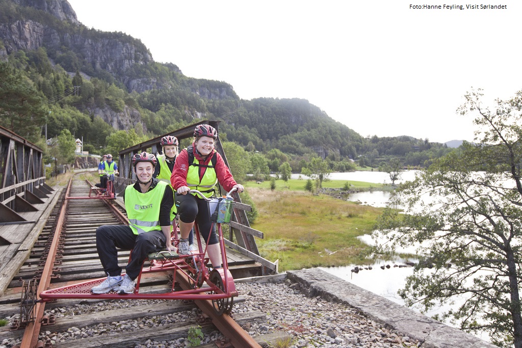
Rail biking is a perfect activity whether you`re are a family, a group of friends for a teambuilding day with your colleagues.
The bicycles are custom made and specially designed for comfortable and safe cycling on railway tracks. It`s a tandem bike, and there`s room for two people cycling, and as well as one passenger, as shown in the illustration on top. The bikes are versatile handy and flexible and can take wheelchairs and even child seats.
The trip starts at Flekkefjord station. You will experience breathtaking sceneries and seventeen tunnels on your journey. Find out more at Flekkefjordbanen.
RV 44
The RV 44 runs through Flekkefjord city centre and soon you will be on very spectacular mountainous roads with switchbacks galore and breath-taking dives into small fjords and river gorges. We would say that if you have a large RV or campervan, we would recommend not to drive this road if you are a bit unsecure on Norwegian narrow roads, the RV44 is of course driveable but with caution if you have a wide body vehicle.

On motorbike it is every bit as spectacular as it might seem, speed will be low, and corners will be many and sharp. If you venture on bicycle, we hope you have done your basic training well, this is a road for the ones with a high oxygen intake.
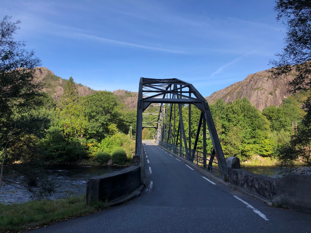
After crossing the first highland bit of road you will plunge down into the gorge of the Åna Sira river and the small hamlet of Åna Sira. Here you will also cross the county line between Agder and Rogaland. The Åna Sira river is well known for its wild salmon fishing. And a cool side trip here is to visit the Brufjell Holes, a very spectacular hike. After Åna Sira you again will ascend to the mountains.
The area you drive now is part of the Magma Geopark and it is a special area geologically. It is a UNESCO recognized geological area with major international importance. The area has one of the few sites in the world that contains anothosite (and titan ore), the other place is in Canada, and the moon gets its light parts from anothosite. When you get closer to Jøssingfjord, you will see mining activity along the way, and in Jøssingfjord there is a large harbour facility for exporting the rock mined in the area.
Jøssingfjord and Helleren

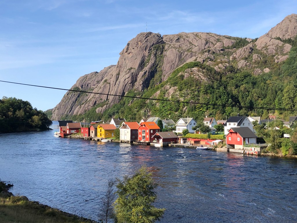
Jøssingfjorden is a narrow and deep fjord and it gained international notoriety in February 1940 during the so called “Altmark” incident. Altmark was a German auxiliary vessel and was allowed passage through Norwegian waters escorted by a Norwegian torpedo boat (at the time Norway was still neutral and not active part of WW2). The Altmark was in secret carrying 300 British prisoners of war. The Altmark was spotted by British planes and sought refuge in Jøssingfjorden. That night the British boat Cossack went in the fjord and boarded Altmark. There was a short skirmish and 8 Germans were killed and several Germans and Norwegians wounded, the British prisoners were freed, and Cossack headed for Britain. The political implications were big for Norway, the government protesting the British incursion on neutral Norwegian territory, and the German government using Norwegian failure to protect the German vessel in neutral territory as a precursor to invading Norway later in April since it was deemed that Norway could not be seen as a neutral nation.
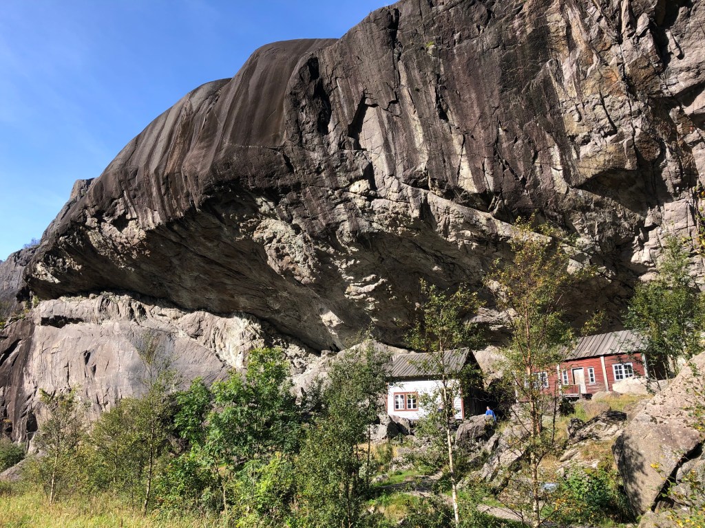


In Jøssingfjorden there is also one of the more iconic photo opportunities in Norway, the Helleren settlement. Under a 10-metre rock overhang, two small houses seem to huddle together to keep warm and protected from the Norwegian climate. The spectacular location has been settled since the 1600s and the current houses are both from the 1800s. Well protected from the rain and storms, with ample fresh water and fish just outside the window in the fjord, this is one of the more spectacular house placements in Norway. The white house is closed for visitors, but you can go into the red house and experience the low ceilings and cramped conditions of those living here a few hundred years ago. Sadly at the time of writing (2020) there is a large development just across the stream from the houses that takes away a bit of the experience but we are guessing that the area will be put back to its natural state once the building work is done.
The Wildest Road In The Country

From the Helleren site the road spectacularly soars up towards the heavens up a vertical cliff wall. This bit of engineering marvel was called “the wildest road in the country” and construction started in 1916. It is easy to see why this road is such an engineering feat when you ascend the switchbacks of the rock wall on the way up from Jøssingfjorden. You can see the old tunnel on the outside of the new one that you drive through today.

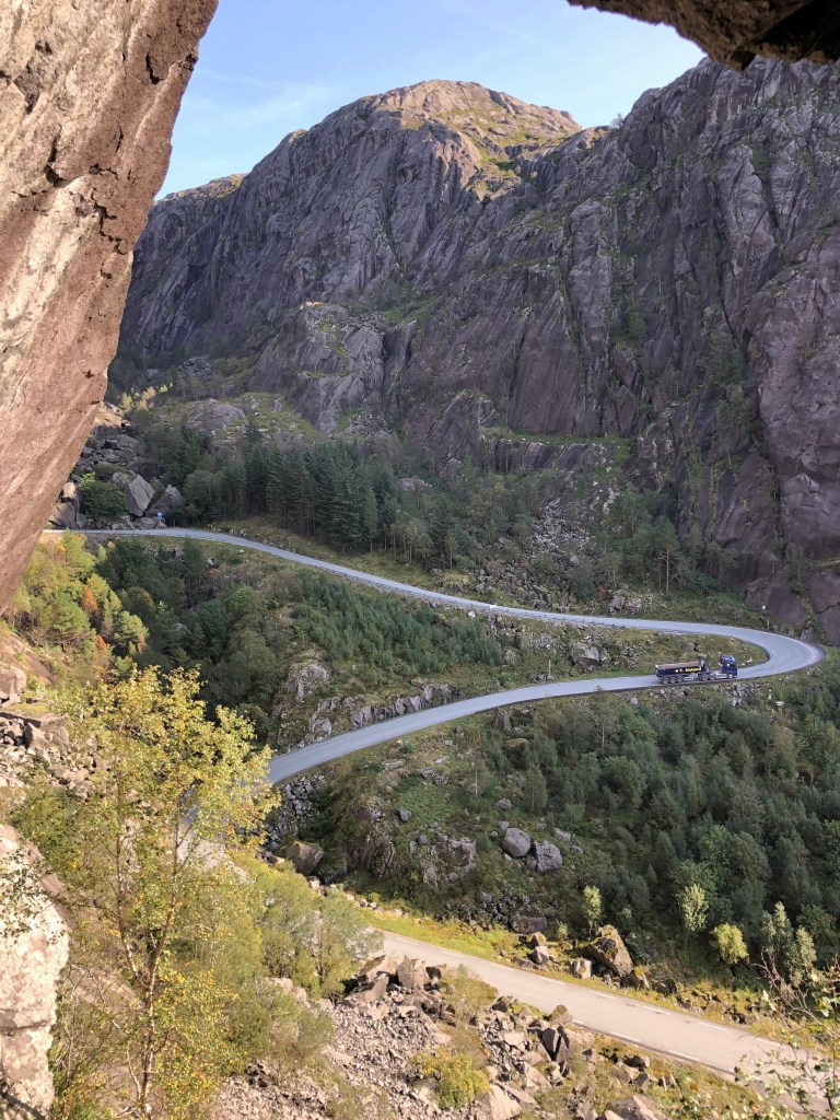


Continue up the hill and you will see a large parking area, park the car here and walk on down to the old road tunnel. The view from the various holes blasted in the rock face and down towards the fjord is epic. There is also a bench here for a special lunch, and there are even carabin hooks on the wall so that you can hang hammocks and spend the nigh if you feel particularly adventurous. At the large parking area there are placards outlining the Altmark incident and there is also a memorial commemorating 4 New Zealand airmen who lost their lives during a bombing raid on German facilities in Jøssningfjorden in 1945.

On the 14th of April 1945 a group of 20 Beaufighters from the RAF base at Dallachy in Scotland were sent to attack German vessels in Jøssingfjorden. The raid did little damage due to the difficult conditions in attacking a narrow fjord. After the attack the planes regrouped at a higher altitude, two New Zealand Beaufighters collided during this maneuvre. 4 airmen were killed. John Mostyn Brightwell, Edgar Joseph Foy, Royden Leslie Nugent and Graham George Parkin are remembered every Norwegian national day on the 17th of May with laying of wreaths at the memorial plaque. Read more about it here.
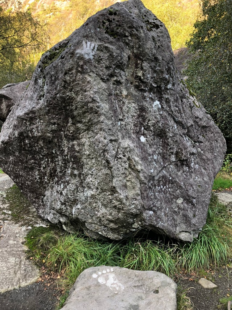
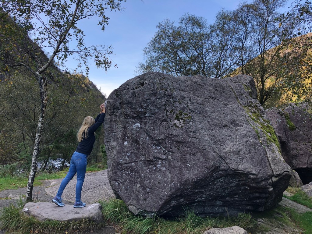
After descending into another green and lush valley, you will be close to Sokndal. Just as you start to see some houses again you will get the river on your right-hand side. There is a small cool detour here across the bridge which will be signposted to “Ruggesteinen” and “Blåfjell Gruver”. Just follow the signs on a narrow road, and the reward will be to rock a rock. A “Ruggestein” is simply put a big rock that can be rocked by one man/woman. It is said to be one of the biggest rocking stones in northern Europe, weighing in at a hefty 70-80 tonnes. In 1923 the stone was protected under the first conservation measure in Rogaland county. Just put your hand were the Uruk-Hai have been and give it a rock or two. Further on is the Blåfjell mines, a great site for hiking.


Sogndalstrand

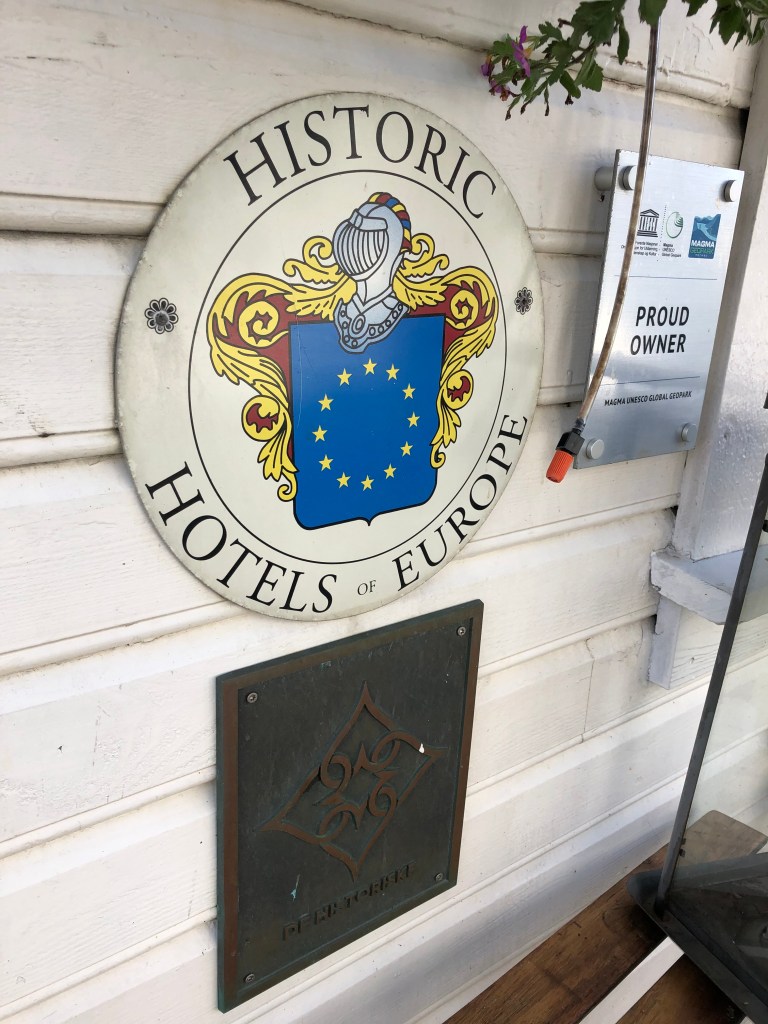
In Sokndal city centre there will be signs to Sogndalstrand, one of the best preserved wooden housed hamlets in Norway. A major tourist destination in summer, Sogndalstrand is a small but significant village in western Norway. It is the only Norwegian town where the whole town is listed. It had its heydays in the 1800s due to the salmon river and trade via the sea. When roads replaced the sea as the main transport of goods, Sogndalstrand fell into hard times. At the start of the 1990s the village was in major decline in danger of loosing its unique buildings. Local heroes and government started the work to maintain and rebuild, and the establishment of one of the coolest hotels in Norway helped Sogndalstrand to prominence for tourists from all over the world.

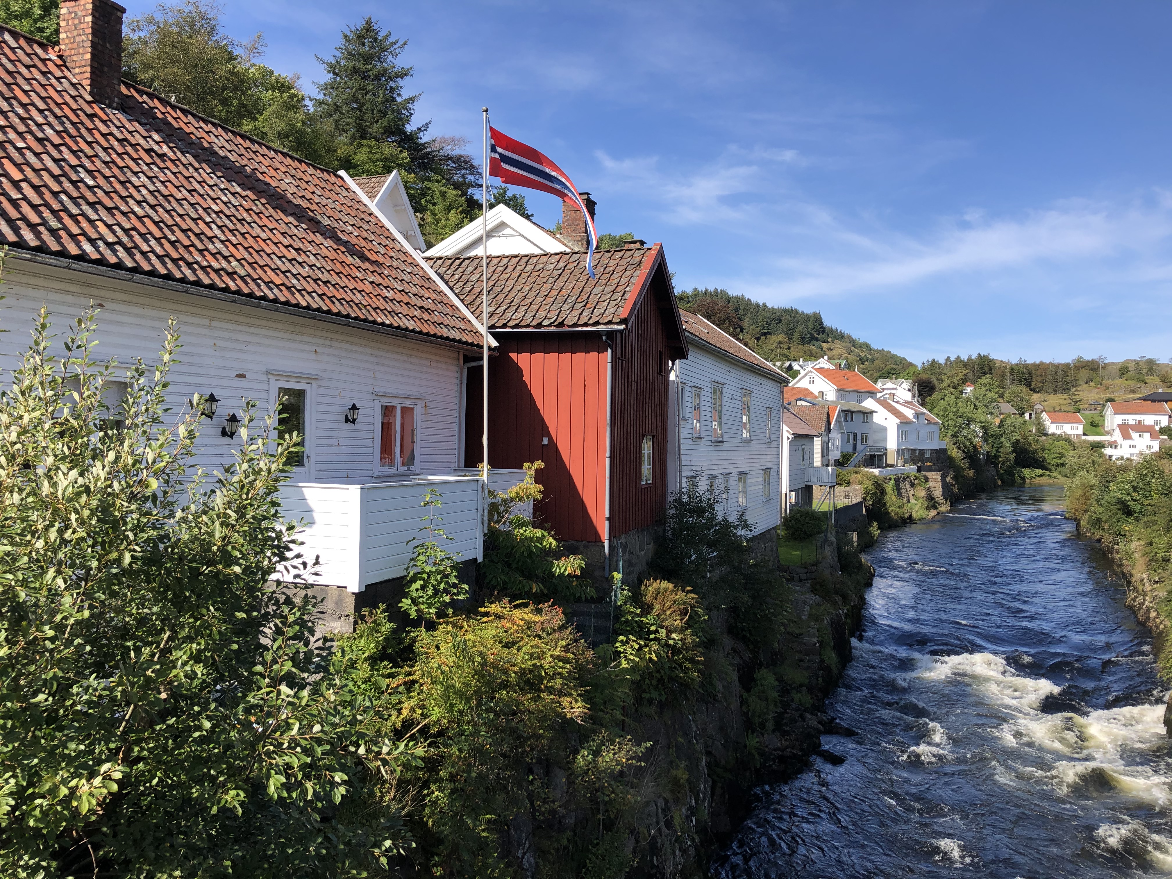


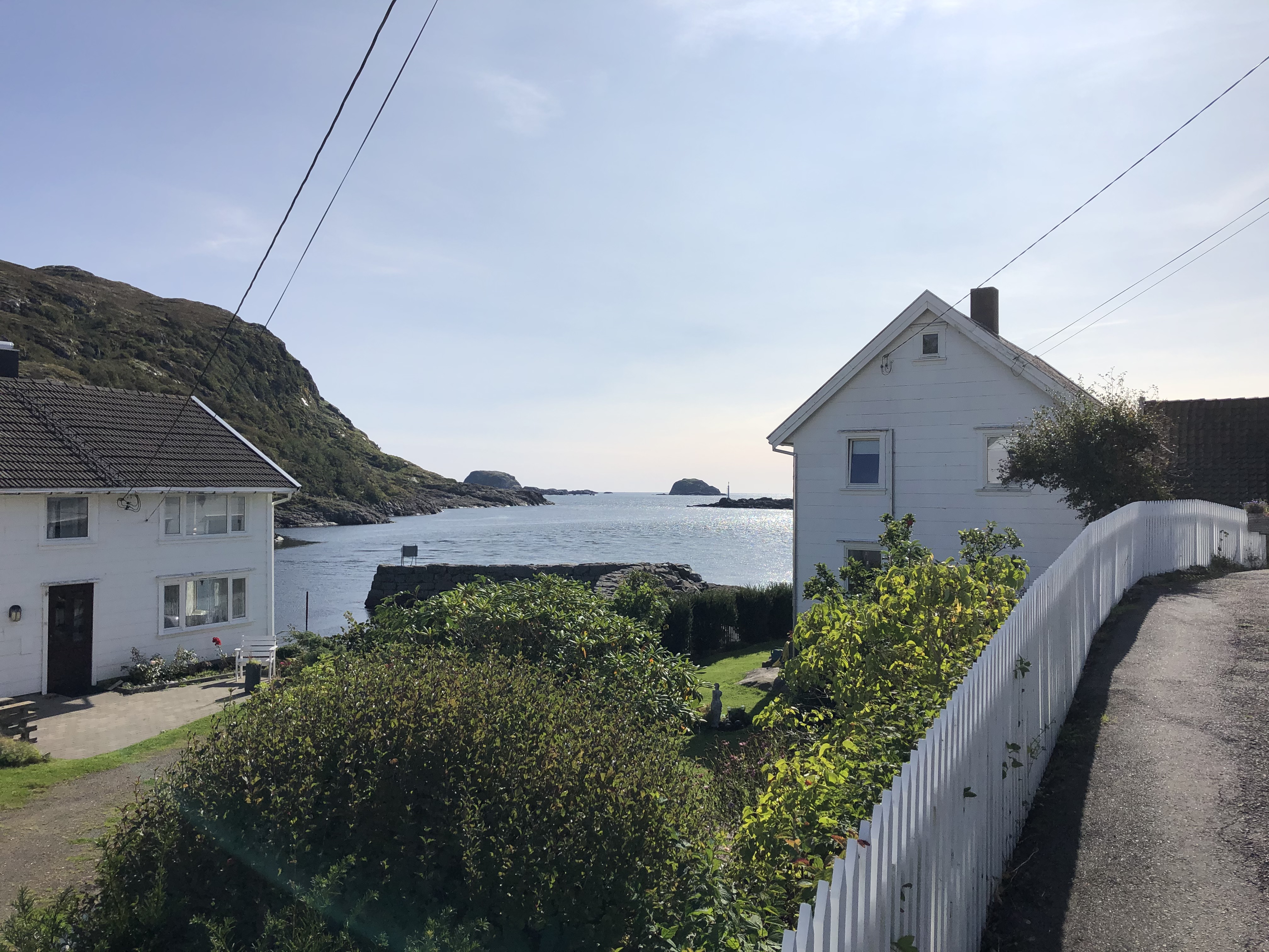
The Sogndalstrand-Kulturhotell now occupies 11 houses in the small village. If you want to spend a night or two here you never know what house or room you might end up in, every house and room is individual and unique. A true gem. Walking the streets of Sogndalstrand is like stepping back in history, you can really feel how it would be like to be a sailor or a merchant in the 1800s Norway. We came during low season, so there were not a lot of people around, since this is one of the most popular destinations in Rogaland, be prepared for more people than we encountered in high season from May to September.

After visiting Sogndalstrand (or Sokndalstrand) the road continues towards Egersund, we did not find time to stop here but this is a nice coastal town with rich maritime history with white wooden buildings.

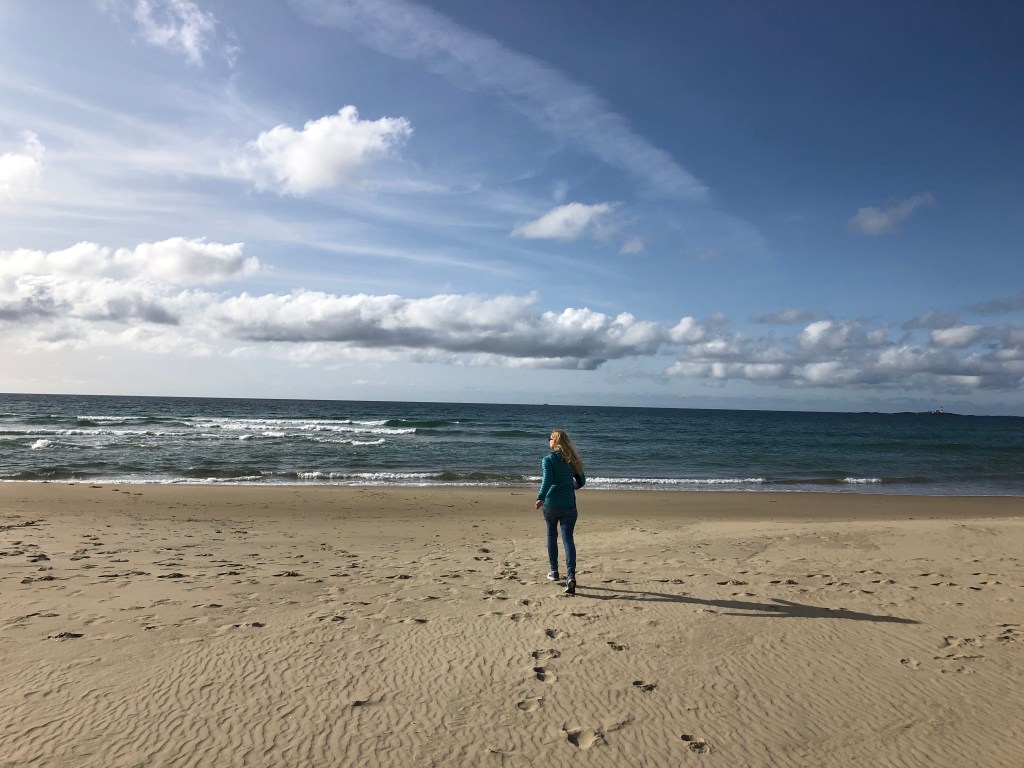
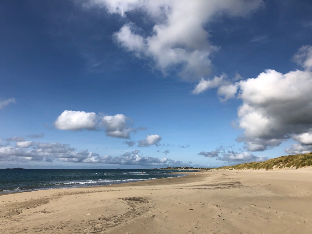
After Egersund the landscape will change dramatically, from rocks and mountains to flat pastures. This is Jæren, one of Norway’s prime agricultural areas. Expect plenty of farms, sheep and cows. You will drive with the sea at arm’s length. There are many rocky beaches, and some of Norway’s finest sandy beaches in this area. After Varhaug you need to look out for the road going left the RV507 to Orre and Jæren. Orrestranda is a genuinely nice beach but we would recommend driving a bit further and take the road to Borestranda. Here you can do something that does not immediately seem Norwegian; learn how to surf. The surf here can be epic during the winter storms, and it’s home to one of the few sites in Norway where you can rent surfboards and even take surf classes. Surf-Norge runs a cool hostel located at the beach and next to the surf school. At the beach there are excellent facilities such as showers and toilets.


A few miles north there is the Solastrand with the excellent beach hotel, just a few minutes from Sola Stavanger Airport.
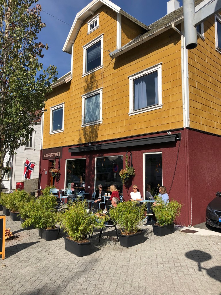
We ended our adventure with a nice coffee in Stavanger city centre.
The drive itself is not long, driving without any stops along the coast from Flekkefjord to Egersund is 1 hour 15 minutes and double that from Egersund to Stavanger, so the distances are not long at all.
And while you are in the area, why not do a day trip to Pulpit Rock?

Brokke-Suleskard-Lysebotn
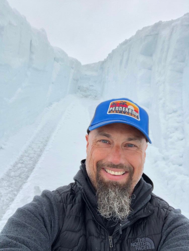
There are plenty of scenic byroads in Norway, many of which are only open during summer, the reason for this being that many of these roads are high mountain roads. Many were built to facilitate the building of hydroelectric dams in the mountains of Norway, so that the drop down to the fjord could be utilized to make power from the water. Thus, many of the byways are located on mountains near fjords, and many are surrounded by snow well into June/July with snow drifts on the side of the road making the drive spectacular, in car and on motorbike. To ride on a motorbike on dry tarmac with snow towering on each side is something else entirely. We have mentioned some of these roads earlier in our Norwegian chapter and blog posts. Find the road to Geirangerfjord and Trollstigen here.

Brokke – Suleskard
Suleskardvegen is accessed from either east in Agder or west in Rogaland and it connects the Setesdalen valley in Agder with the western parts of Rogaland county. From east you will drive RV9 either north from Kristiansand, or you will come back down from the northern mountains of south Norway and the Haukeli area. Setesdalen is an incredibly beautiful valley, full of Norwegian traditions like silversmithing and of course local food. On the way north from Kristiansand you will pass by Evje, a place with lots of mining history, and there is a mineral centre and an old abandoned mine to visit. The Mineral Park is cool for kids, and they have a campground there as well.
The old mines just outside of Evje are known for their richness in minerals, around 52 different minerals can be found here, so it is a haven for rock tourists from all over the world, and all are welcome to look for their own little treasures. Just north of Evje on RV9 is the awesome Trollaktiv park where you can climb around in the trees, great for kids. In addition, they have quite a decent rafting centre here where you can challenge your inner aquarius.

Continuing past Evje you will see the Byglandsfjord on your left, and you will also notice that the valley narrows, and the mountains keep getting higher on each side of the road. If you feel like challenging yourself a little more, one of the best via ferratas is in this area. The Helle Camping is organizing this, as well as good camping facilities. We have heard that this via ferrata is spectacular and are planning to go, but first Ørjan has to fight his vertigo demons.

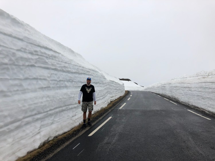
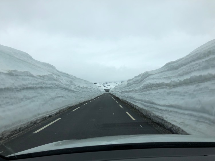

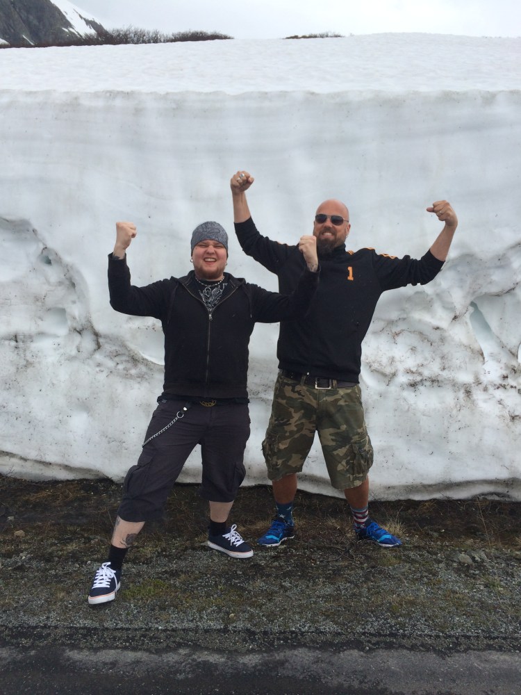
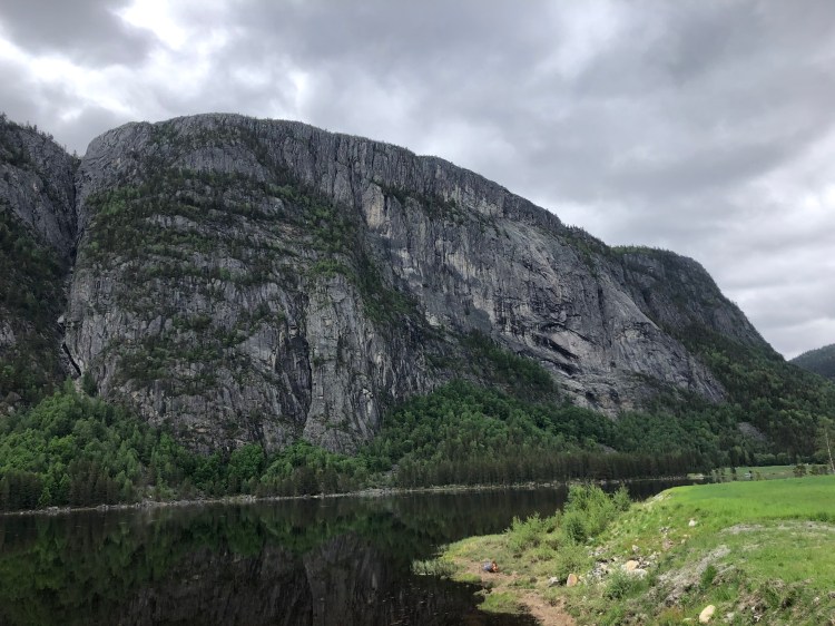
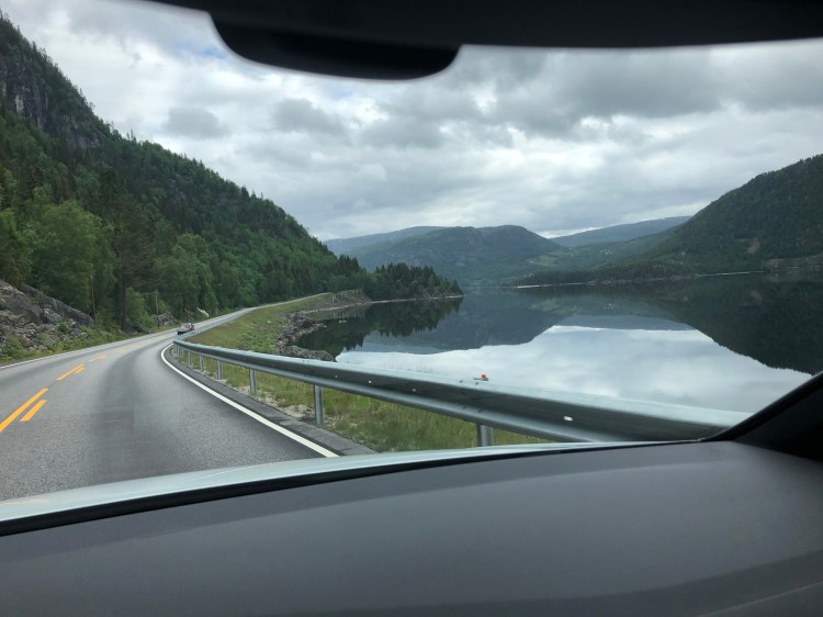
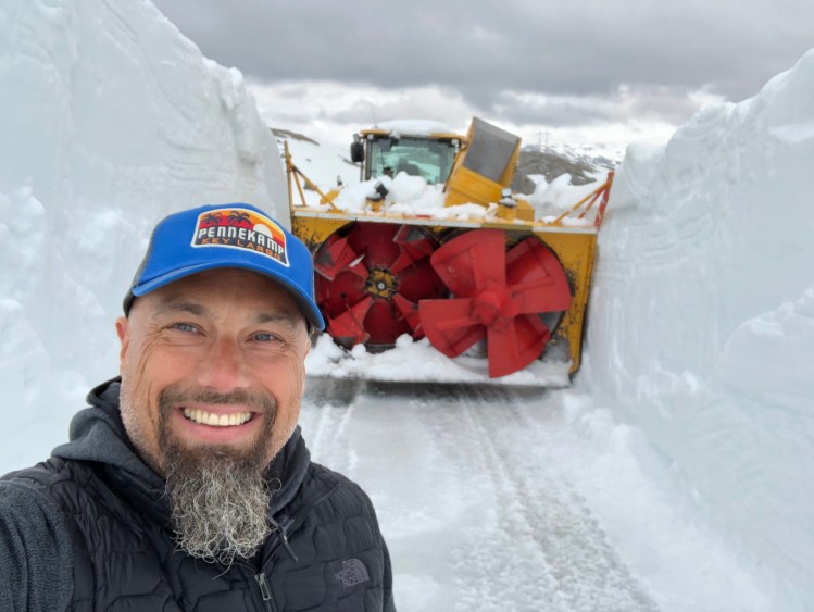
When you get to the small hamlet of Rysstad, this will the last sign of any facilities in a while, so if you need gas or snacks, this is the place to stop before entering the Suleskard road. FV337 is the official designator for the road. It is closed between November and sometime between April and June, we travelled the road on the 9th of June 2020, and the road had opened less than two weeks before. It all depends on the amount of snowfall during winter, and how long the actual clearing of the road takes. They will clear snowdrifts up to 10 metres (30 feet) so needless to say it takes a while. The road itself will reach 1050 metres above sea level (3445 feet) and it swoops and turns over the highland plateau like a tarmac serpent swimming in a sea of white powder. The road is narrow, and the traffic can be heavy with campervans in high season, so look out for those, and drive with care. There are frequent pull outs along the road, but those are not for photo stops, they are to let other cars pass. It is a thrilling ride, with metres of snowdrifts on each side of the road. The area is also a protected area for wild reindeer, so look out for those. You will also pass several lakes that are good for swimming if you visit in late summer, they were all frozen when we came by in June. Brokke to Suleskard is only about 40 kilometres (25 miles) so you will drive it in about 1 ½ hours, and then adding all the stops you like on the way. There are some great vistas, also some hydroelectric dams to see by the road, after all that is why the road was built in the first place.
Suleskard to Lysebotn
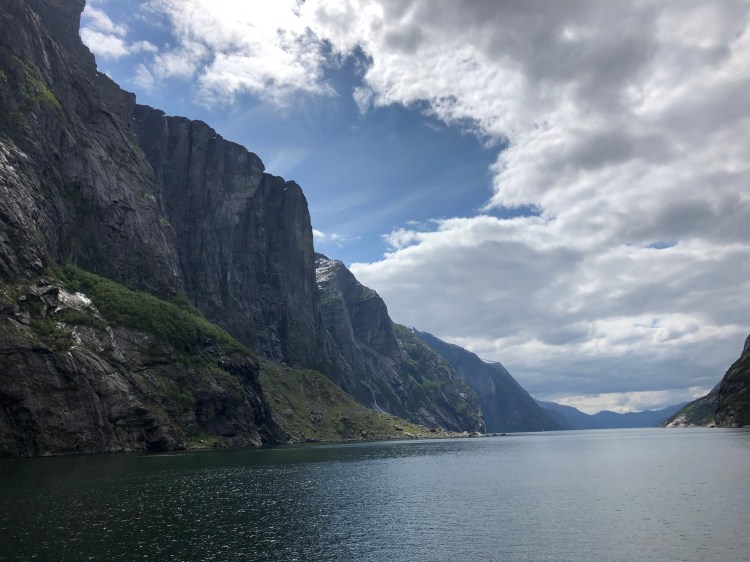
At Suleskard there is a small shop and gas if you need it. Just south of Suleskard there are two ways you can get to Stavanger, either you can go the “easy” way and drive to the RV45 to Stavanger with little fuss, there will be great vistas here as well but not as great as taking another byway to Lysebotn via the Kjerag massive. The FV986 is also a road that is closed in winter and a road built to make easy access for building hydro electric dams. And here you can really see the drop utilized for getting the water up to speed and the hydroelectric plants with the turbines themselves when you get to the bottom of the Lysefjord.


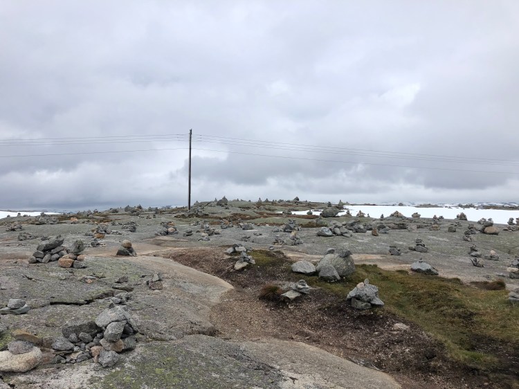

Before that you will cross another epic stretch of road, in our opinion even more spectacular than the road we just came from between Brokke and Suleskard. It has even more twists and turns, and it offers great vistas. At the peak of the route there is a field of small monoliths made by people passing by from all over the world, you will know that you are in the right spot when you see them all over, they are impossible to miss. Depending on when you cross the mountain, the amount of snow will fluctuate. When we arrived in the beginning of June, there was plenty of snow.

We did a sneaky detour, just as you start the decent there is a road to the left signed to Langavatn that will take you on a smaller road, we think we were the first to drive here for the season when we arrived, and clearing of the road was still going on when we passed. We almost got stuck at the end where there is a large parking area for hikers, summer tires and snow are a bad combo, we had a light scare but came out laughing. It was awesome to look at the dude clearing the road, it must have been a 20 foot drift he was chopping away at with what was a huge digger but it looked small compared to all the snow it was trying to remove.


The drop down into the Lysefjord is spectacular. Halfway down there is a large parking area and a café hanging out over the abyss. The parking is for those among us that thrive on jumping off mountains with parachutes. This is the spot to go on a hike to one of the most famous BASE jumping spots in the world, the Kjerag site. Of course, all people are welcome to hike there, and most do to get to the Kjerag bolt. A rock stuck in a crack 984 metres (3228 feet) above the fjord, and if you feel like doing something not everyone dares, take the small leap to stand on the bolt itself. Something we would not do in a million years.


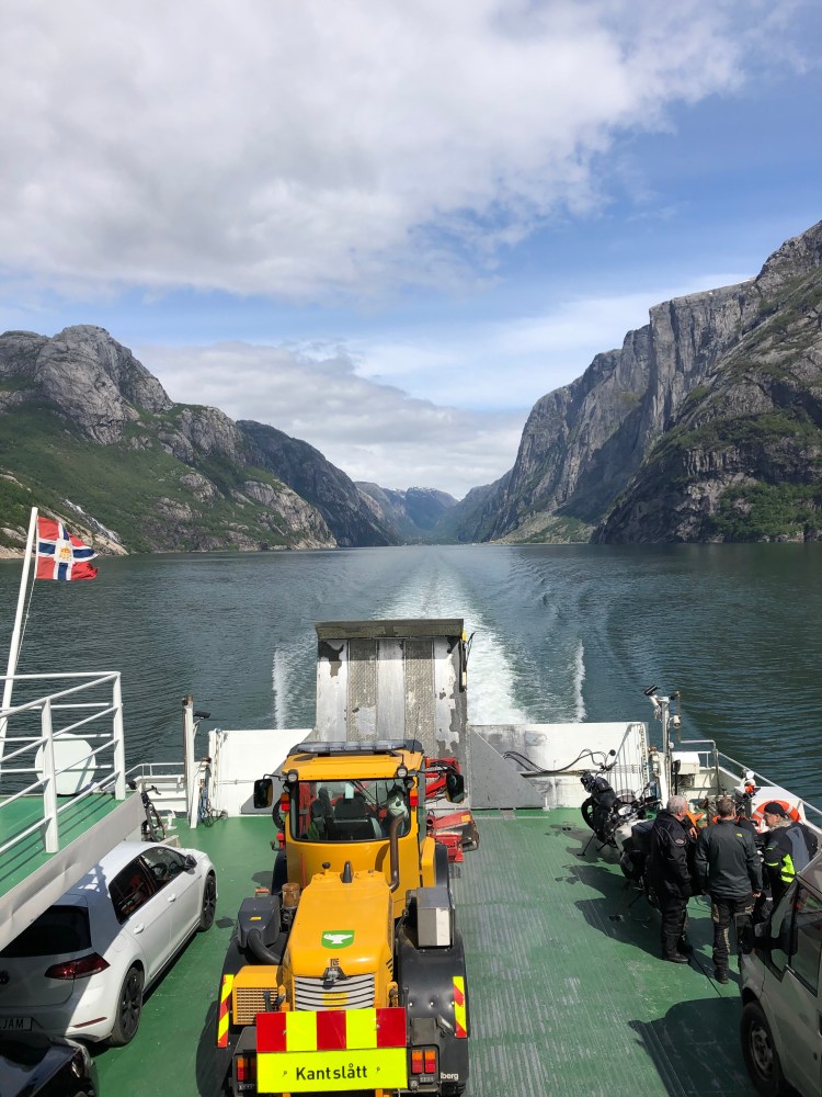
Continuing down the winding road to Lysebotn you will reach the end of the road, literally. There is no more road, you must either backtrack to RV45, or you do the scenic option and take the ferry. We took the ferry and there are 2 choices, either you take the regular ferry, or you take the tourist ferry. Easy? Well yes, if you take the regular ferry there are only a few places for cars onboard and you must book one of those early. And the ferry only runs twice a day, once early and once in the afternoon.
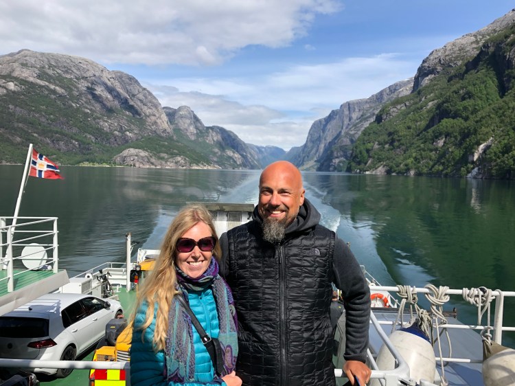
This is the site for Kolombus which runs the route, and you should choose from Lysebotn to Forsand (where you are close to Pulpit rock or the tunnel to Stavanger). If you choose the tourist boat run by Fjord Norway it also runs twice a day in each direction but is a bigger car ferry and the cost is a bit higher. Regardless of what ferry you end up on it will be one of the most epic ferry rides you have ever had. Passing the BASE jumpers point at Kjerag (they will do almost 30 second of freefall) before deploying their parachute.

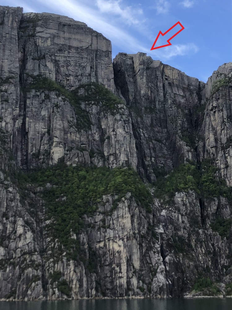
You will also pass under the Pulpit rock before disembarking at Forsand where you can either drive the tunnel back to Stavanger, or you can continue with a hike up to Pulpit rock. Read about our trek to one of the worlds most spectacular natural sights!


As scenic byways go, both these routes offer some of the best driving, best views, and some of the most spectacular experiences that Norway has to offer. If you do it in a car or on a motorbike, these roads are what dreams are made of.

The North Sea Road (Nordsjøvegen) RV44 from Flekkefjord to Jæren, a Norwegian Scenic Byroad
This road is a gem, running through extremely dramatic mountain coastal landscape. It is designated as the North Sea Road (Nordsjøvegen) and it starts in the south at Kristiansand and ends in Haugesund in western Norway. This chapter is for the stretch of RV44 running from the town of Flekkefjord to the beaches south of Stavanger on the Jæren coastal area. We drove the road from south to north, starting in Flekkefjord via E39 that is the main road along the southern coast of Norway. The landscape changes during the whole route, from the glacier rounded mountain range north of Flekkefjord to the flat agricultural landscapes of Jæren south of Stavanger. There is plenty to see and do on the route and although it isn’t a long way in kilometres you can easily use a full day experiencing all the small stops, villages and sights along the way.
Flekkefjord
Flekkefjord is nestled at the end of the Lafjord and is a genuinely nice cool southern town with white wooden houses all around. It might seem strange that a town in Norway has a part called Hollenderbyen (Dutch town) but this well preserved part of town has many old wooden houses that were built and inhabited by Dutch merchants who exported wood, rocks and fish to Holland in the 15 and 1600s.
The rocks were used to fill in docks and such in the land expansion projects, and it is said that big parts of Amsterdam are built on oak exported from Flekkefjord. The city also boasts lots of cool murals and wall art, and you can hire dressin bikes that run on the old tracks to experience the old railway route that ran from Flekkefjord. Highly recommended are the small bakeries that have a plethora of tasty pastry and sandwiches that are good to bring along as energy boosts on stops during the day.
Rail biking is a perfect activity whether you`re are a family, a group of friends for a teambuilding day with your colleagues.
The bicycles are custom made and specially designed for comfortable and safe cycling on railway tracks. It`s a tandem bike, and there`s room for two people cycling, and as well as one passenger, as shown in the illustration on top. The bikes are versatile handy and flexible and can take wheelchairs and even child seats.
The trip starts at Flekkefjord station. You will experience breathtaking sceneries and seventeen tunnels on your journey. Find out more at Flekkefjordbanen.
RV 44
The RV 44 runs through Flekkefjord city centre and soon you will be on very spectacular mountainous roads with switchbacks galore and breath-taking dives into small fjords and river gorges. We would say that if you have a large RV or campervan, we would recommend not to drive this road if you are a bit unsecure on Norwegian narrow roads, the RV44 is of course driveable but with caution if you have a wide body vehicle.
On motorbike it is every bit as spectacular as it might seem, speed will be low, and corners will be many and sharp. If you venture on bicycle, we hope you have done your basic training well, this is a road for the ones with a high oxygen intake.
After crossing the first highland bit of road you will plunge down into the gorge of the Åna Sira river and the small hamlet of Åna Sira. Here you will also cross the county line between Agder and Rogaland. The Åna Sira river is well known for its wild salmon fishing. And a cool side trip here is to visit the Brufjell Holes, a very spectacular hike. After Åna Sira you again will ascend to the mountains.
The area you drive now is part of the Magma Geopark and it is a special area geologically. It is a UNESCO recognized geological area with major international importance. The area has one of the few sites in the world that contains anothosite (and titan ore), the other place is in Canada, and the moon gets its light parts from anothosite. When you get closer to Jøssingfjord, you will see mining activity along the way, and in Jøssingfjord there is a large harbour facility for exporting the rock mined in the area.
Jøssingfjord and Helleren
Jøssingfjorden is a narrow and deep fjord and it gained international notoriety in February 1940 during the so called “Altmark” incident. Altmark was a German auxiliary vessel and was allowed passage through Norwegian waters escorted by a Norwegian torpedo boat (at the time Norway was still neutral and not active part of WW2). The Altmark was in secret carrying 300 British prisoners of war. The Altmark was spotted by British planes and sought refuge in Jøssingfjorden. That night the British boat Cossack went in the fjord and boarded Altmark. There was a short skirmish and 8 Germans were killed and several Germans and Norwegians wounded, the British prisoners were freed, and Cossack headed for Britain. The political implications were big for Norway, the government protesting the British incursion on neutral Norwegian territory, and the German government using Norwegian failure to protect the German vessel in neutral territory as a precursor to invading Norway later in April since it was deemed that Norway could not be seen as a neutral nation.
In Jøssingfjorden there is also one of the more iconic photo opportunities in Norway, the Helleren settlement. Under a 10-metre rock overhang, two small houses seem to huddle together to keep warm and protected from the Norwegian climate. The spectacular location has been settled since the 1600s and the current houses are both from the 1800s. Well protected from the rain and storms, with ample fresh water and fish just outside the window in the fjord, this is one of the more spectacular house placements in Norway. The white house is closed for visitors, but you can go into the red house and experience the low ceilings and cramped conditions of those living here a few hundred years ago. Sadly at the time of writing (2020) there is a large development just across the stream from the houses that takes away a bit of the experience but we are guessing that the area will be put back to its natural state once the building work is done.
The Wildest Road In The Country
From the Helleren site the road spectacularly soars up towards the heavens up a vertical cliff wall. This bit of engineering marvel was called “the wildest road in the country” and construction started in 1916. It is easy to see why this road is such an engineering feat when you ascend the switchbacks of the rock wall on the way up from Jøssingfjorden. You can see the old tunnel on the outside of the new one that you drive through today.
Continue up the hill and you will see a large parking area, park the car here and walk on down to the old road tunnel. The view from the various holes blasted in the rock face and down towards the fjord is epic. There is also a bench here for a special lunch, and there are even carabin hooks on the wall so that you can hang hammocks and spend the nigh if you feel particularly adventurous. At the large parking area there are placards outlining the Altmark incident and there is also a memorial commemorating 4 New Zealand airmen who lost their lives during a bombing raid on German facilities in Jøssningfjorden in 1945.
On the 14th of April 1945 a group of 20 Beaufighters from the RAF base at Dallachy in Scotland were sent to attack German vessels in Jøssingfjorden. The raid did little damage due to the difficult conditions in attacking a narrow fjord. After the attack the planes regrouped at a higher altitude, two New Zealand Beaufighters collided during this maneuvre. 4 airmen were killed. John Mostyn Brightwell, Edgar Joseph Foy, Royden Leslie Nugent and Graham George Parkin are remembered every Norwegian national day on the 17th of May with laying of wreaths at the memorial plaque. Read more about it here.
After descending into another green and lush valley, you will be close to Sokndal. Just as you start to see some houses again you will get the river on your right-hand side. There is a small cool detour here across the bridge which will be signposted to “Ruggesteinen” and “Blåfjell Gruver”. Just follow the signs on a narrow road, and the reward will be to rock a rock. A “Ruggestein” is simply put a big rock that can be rocked by one man/woman. It is said to be one of the biggest rocking stones in northern Europe, weighing in at a hefty 70-80 tonnes. In 1923 the stone was protected under the first conservation measure in Rogaland county. Just put your hand were the Uruk-Hai have been and give it a rock or two. Further on is the Blåfjell mines, a great site for hiking.
Sogndalstrand
In Sokndal city centre there will be signs to Sogndalstrand, one of the best preserved wooden housed hamlets in Norway. A major tourist destination in summer, Sogndalstrand is a small but significant village in western Norway. It is the only Norwegian town where the whole town is listed. It had its heydays in the 1800s due to the salmon river and trade via the sea. When roads replaced the sea as the main transport of goods, Sogndalstrand fell into hard times. At the start of the 1990s the village was in major decline in danger of loosing its unique buildings. Local heroes and government started the work to maintain and rebuild, and the establishment of one of the coolest hotels in Norway helped Sogndalstrand to prominence for tourists from all over the world.
The Sogndalstrand-Kulturhotell now occupies 11 houses in the small village. If you want to spend a night or two here you never know what house or room you might end up in, every house and room is individual and unique. A true gem. Walking the streets of Sogndalstrand is like stepping back in history, you can really feel how it would be like to be a sailor or a merchant in the 1800s Norway. We came during low season, so there were not a lot of people around, since this is one of the most popular destinations in Rogaland, be prepared for more people than we encountered in high season from May to September.
After visiting Sogndalstrand (or Sokndalstrand) the road continues towards Egersund, we did not find time to stop here but this is a nice coastal town with rich maritime history with white wooden buildings.
After Egersund the landscape will change dramatically, from rocks and mountains to flat pastures. This is Jæren, one of Norway’s prime agricultural areas. Expect plenty of farms, sheep and cows. You will drive with the sea at arm’s length. There are many rocky beaches, and some of Norway’s finest sandy beaches in this area. After Varhaug you need to look out for the road going left the RV507 to Orre and Jæren. Orrestranda is a genuinely nice beach but we would recommend driving a bit further and take the road to Borestranda. Here you can do something that does not immediately seem Norwegian; learn how to surf. The surf here can be epic during the winter storms, and it’s home to one of the few sites in Norway where you can rent surfboards and even take surf classes. Surf-Norge runs a cool hostel located at the beach and next to the surf school. At the beach there are excellent facilities such as showers and toilets.
A few miles north there is the Solastrand with the excellent beach hotel, just a few minutes from Sola Stavanger Airport.
We ended our adventure with a nice coffee in Stavanger city centre.
The drive itself is not long, driving without any stops along the coast from Flekkefjord to Egersund is 1 hour 15 minutes and double that from Egersund to Stavanger, so the distances are not long at all.
And while you are in the area, why not do a day trip to Pulpit Rock?

