High Desert Adventure
Denver-Great Sand Dunes-Taos Pueblo-Santa Fe-Gallup-Canyon De Chelly-Monument Valley-Arches National Park-Moab-Mesa Verde-Durango-Albuquerque-Turquoise Trail-Colorado Springs-Denver

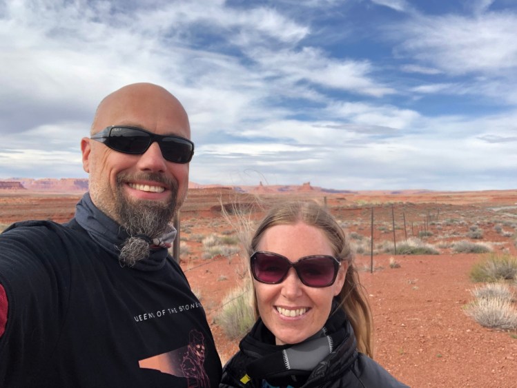
This trip we did as a combo between car and Harley Davidson. We drove the car from Denver to Albuquerque, and did a loop on motorbikes from there, and then we drove back to Denver again. The trip was in Easter, so mid-April, and we found that this is borderline early for this route. More ideal would be May-June and September-October, to get a bit warmer weather. Then again we had the roads for ourselves, not many other road warriors along the route. We also knew that it would and could be a cold trip, so we had packed accordingly with plenty of long woolly undergarments, Gore-Tex and layers of insulating clothes.
The high deserts of the US are a bit surprising, since Europeans seem to think that all deserts are warm all year around, but we have learned on previous trips that the high desert is a cold and unpredictable place. If you check the altitude of cities and places of interest in states like Arizona, Utah, New Mexico and Colorado (the states we travelled through on this adventure) they are all high in elevation. The lowest city we spent time in was Denver, at a mere 1609 meter above sea level. The highest we rode was at Mesa Verde, where we topped out at 2553 meters above sea level on a Harley! That is why this is the High Desert Adventure.


We flew into Denver with Icelandair, a convenient hop via Iceland (you could do a stopover for free in Iceland if you wanted), and the route is good, with no detour via central Europe to hop on a plane that would still have to do the flight over Iceland. Ideally we would recommend to fly into Albuquerque, but we chose Denver because of well-priced tickets for the return flight. Landing in Denver International Airport quite late in the afternoon, we headed for Avis as usual to get our pre ordered car. Being an Avis Preferred member, we got an upgrade, so we ended up with the ultimate American SUV in a monstrous Ford Explorer MAX! Plenty of room for the 4 of us (mom and dad doing this trip with us). We had already booked a motel of the south side of town, so we headed there and went straight for bed after a long flight.
Day 1: Denver, via Taos Pueblo to Santa Fe
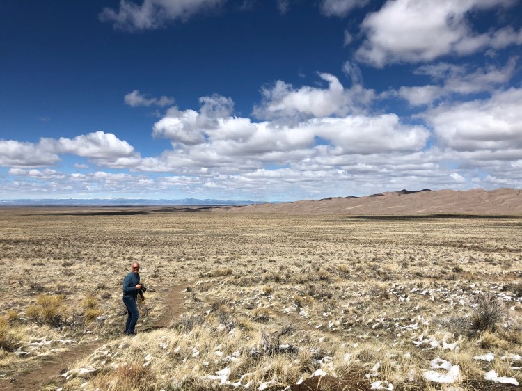
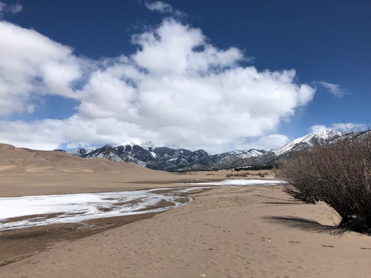
We headed out on the highway, or the Interstate south called I25, which proved to be a nice Interstate with lots of great views of the Rocky Mountains of Colorado to our left all the way. It’s about 142 miles to Exit 50 for the US 160W towards Fort Garland. This is also a nice stretch of road winding through the mountains, and we saw some cool coyotes along the road. In Fort Garland we had a choice of taking a detour to The Great Sand Dunes (the drive is around an hour round trip, plus whatever time you spend at the dunes) – we chose the detour, and it was worth the time. The dunes are truly majestic, and a weird thing they are, a Sahara-like landscape, juxtaposed with the high snowy mountains in the background.


We had lunch on the way back in Fort Garland, choosing the roadside diner with the most cars outside, as you always do in the US. Great burgers and burritos ensued.
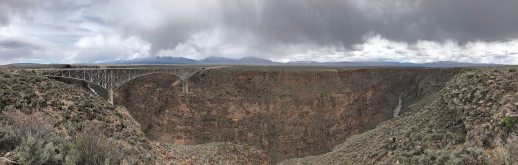
From Fort Garland it’s again epic road and views south on CO159S, when you cross the border into New Mexico it becomes the 522. Just north of Taos there is a small detour option for film buffs. US Highway 64 towards Tres Piedras will after about 15 minutes take you over the Rio Grande Gorge Bridge. A very cool place, with a nice deep gorge under the bridge. Its major claim to fame is that is was used in the movie “Natural Born Killers” where Micky and Mallory Knox pledge eternal love and drop their blood into the river from the middle of the bridge. It’s also been used in movies like Terminator Salvation, Wild Hogs, Pauls and Twins.
Returning back to the 522, that now becomes the 64 South towards Taos Pueblo.
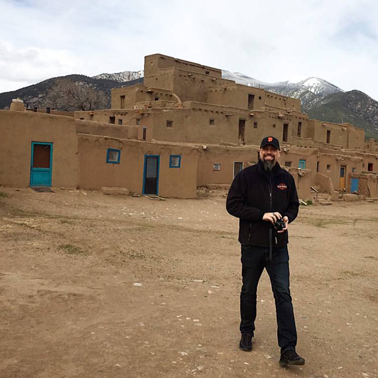
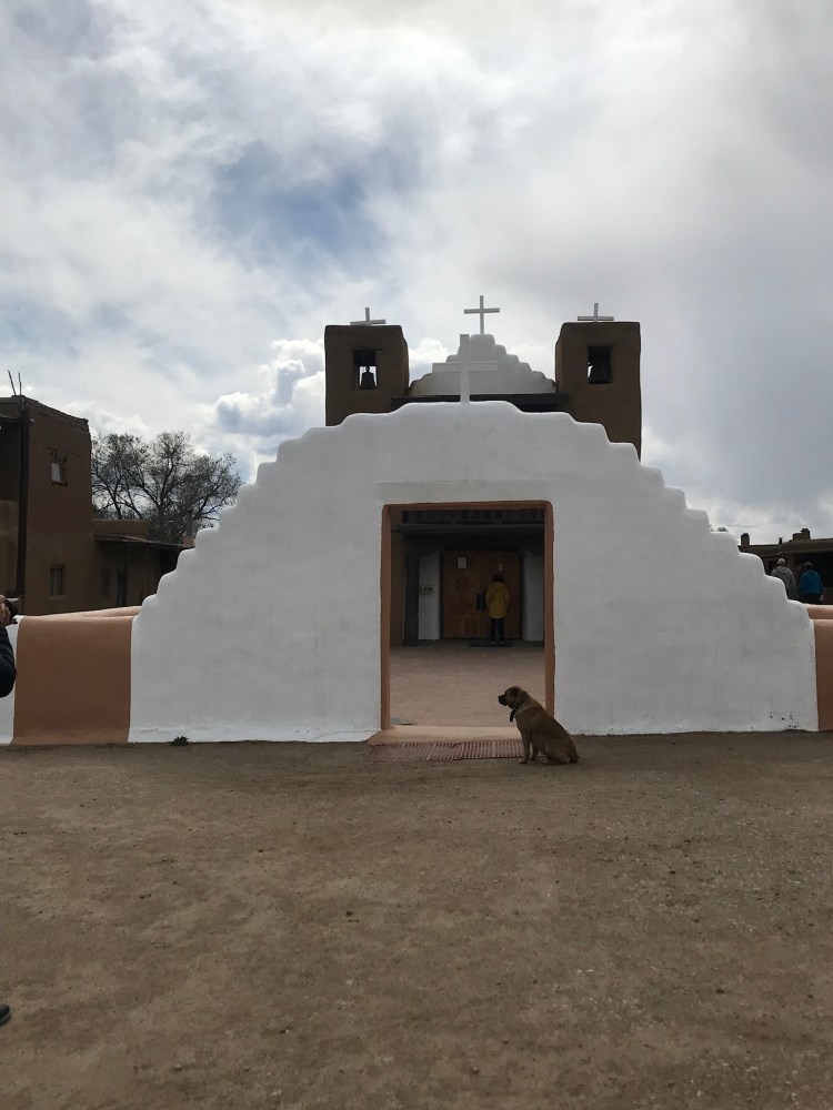
Taos Pueblo is the only living Native American community designated both a UNESCO World Heritage Site, and a National Historic Landmark. Inhabited for over a 1000 years, it is considered one of the oldest continuously inhabited communities in the United States. Inhabited by the Taos-speaking Native American tribe of Puebloan people, the community is known for being secretive and conservative, and little is still known about their religious customs to outsiders, the language has also never been written down. The most prominent feature of the Taos Pueblo is the multi-storied residential buildings made of reddish-brown adobe building material. They are very unusual and look like mini skyscrapers set to the backdrop of snow clad mountains. There are plenty of small shops offering handmade souvenirs, and since it was starting to get a bit chilly, we found a small café-like building where a lovely old lady served us tea and cookies. Since we came in the afternoon, and low season, we had much of the place to ourselves, and we could walk around and look at what a complex place this is – so full of history.

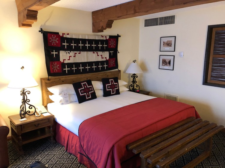
Mom and Tanja enjoying the fireplace heat 

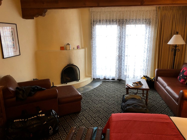
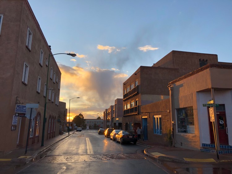
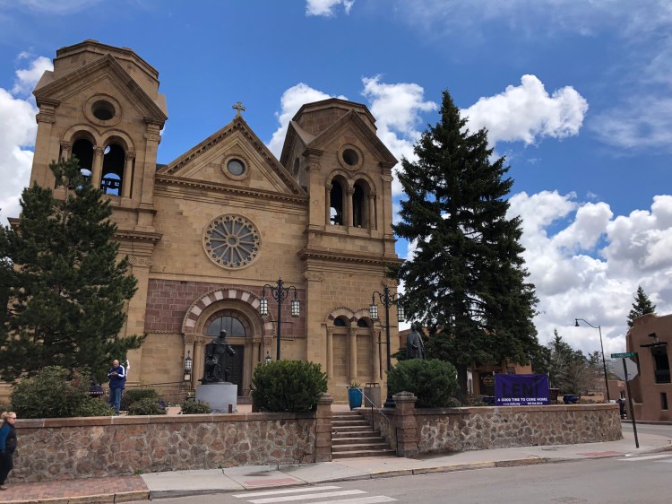
From Taos Pueblo to Santa Fe it’s about one and a half hours drive south on the NM68 to Paseo Del Pueblo, switch to Highway 285 and head for Santa Fe downtown. We had booked two nights at the Inn Of The Governors in the downtown area. We chose this hotel due to its look, location and the fact that the rooms had working fireplaces, which came in handy since it was very cool in Santa Fe during our stay. This was our first time visiting Santa Fe, and even though we only stayed for a very short while, it became one of our favourite places in the US – it had such a pleasant vibe. The adobo style buildings made it very different to most other towns in the US, and the whole downtown area was dotted with restaurants, galleries and bars. We ended up at the excellent El Callejon restaurant for dinner both nights in Santa Fe, it was that good.


Santa Fe is the oldest and highest elevated state capital in the US at 2132 metres above sea level. It is considered one of the world’s greatest art cities, due to its many galleries and art installations.
Day 2: Santa Fe
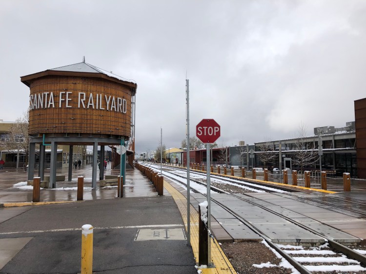
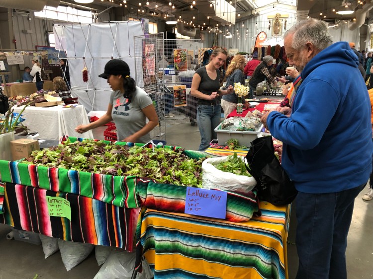
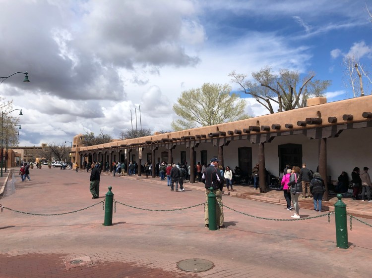
We woke up the next morning to about 3 inches of snow, blanketing the landscape, and making for an even more special day in Santa Fe. We were lucky enough to be in Santa Fe on a Saturday, so the Farmers and Artisans market was on at the Railway Yard. Regarded as one of the best farmers markets in the US, it was a feat (even though this was low season) for the eyes, and stomach. We had the best doughnut ever at the market, still something we talk about a year later. A sumptuous blueberry glazed humongous doughnut, that made us both act like Homer Simpson “mmmmmmmmm doughnut”. There were loads of other fresh produce, pickles, jams and much more, and mom even bought food to bring home to Norway. The artisan market is both indoors and outdoors with stalls of vendors selling everything from used clothes, to homemade yarn.


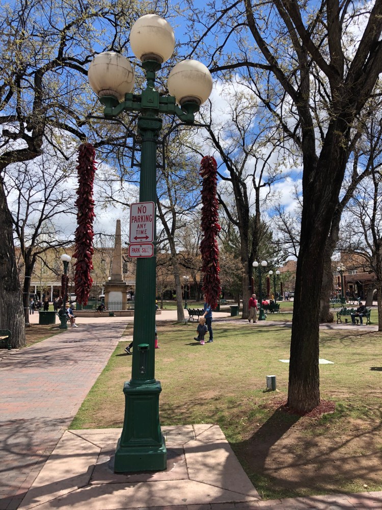
We stopped (luckily) by a stall run by Naomi and Mark Herndon, and together they run the Herndon Forge, making handmade beautiful jewellery made from local turquoise and silver. We stood talking with them for quite a while and made some purchases of some very nice bracelets and necklaces. Please check out their stuff at their homepage. After trawling the market, and having lunch, we walked to the Santa Fe Plaza, a National Historic Landmark, in the centre of town where people have gathered for hundreds of years. The Plaza if beautiful, lined with restaurants and galleries and on Saturdays there is also a great gathering of Native American artisans who sell homemade jewellery and souvenirs to tourists and passers-by. We found some nice-looking hair bands with silver and turquoise inserts for our niece. Dinner and drinks and walking around followed for the rest of that day – mom found a colourful wool blanket with native prints on it (which we still regret not buying too). We need to go back to Santa Fe and spend some more time in the town itself and the surrounding area, we really loved it.

Day 3: Santa Fe to Gallup
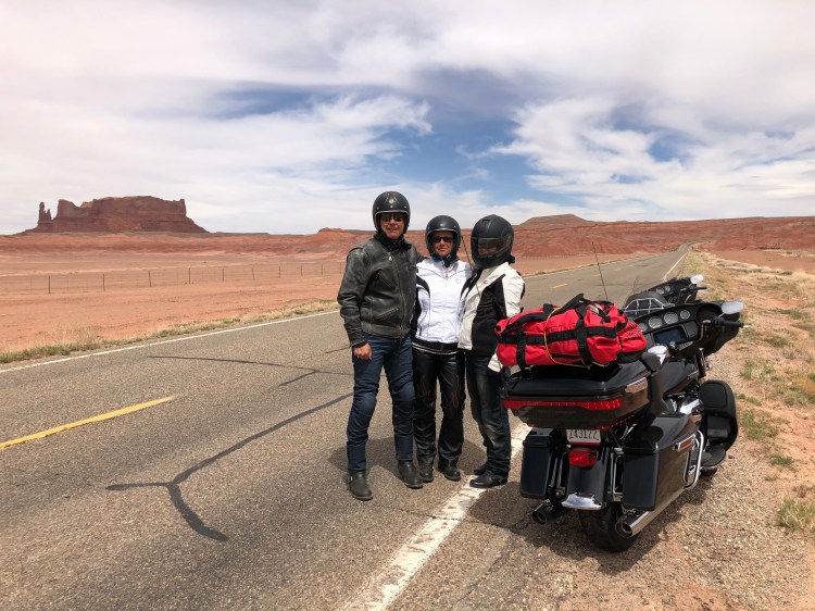
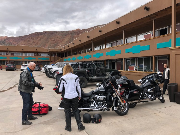
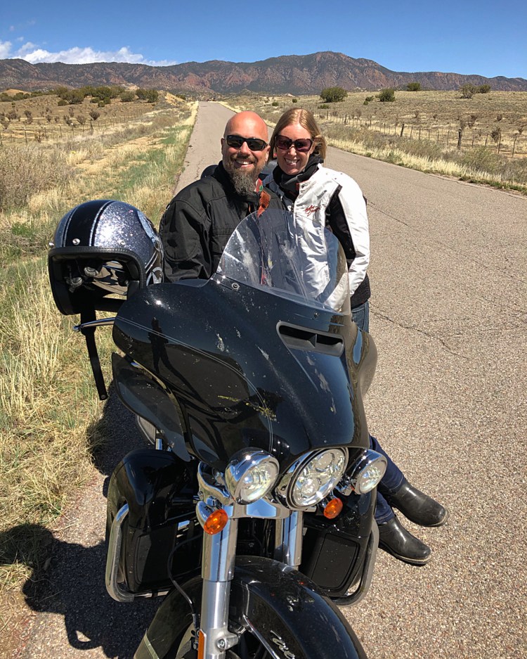
An hour’s drive south of Santa Fe is Albuquerque. We only passed by to pick up our Harley Davidsons from Eagle Rider Albuquerque to do our loop from there. We left our car in their carpark, unloaded and stored much of our luggage at their premises. As usual our bikes were ready outside, with nametags, and both had 0 miles on them. Brand spanking new Ultras for everyone! After checking out we headed out for the highway once more and started riding west towards Gallup. The I40 is not so much to write home about, but you are riding on Route 66, just before the town of Laguna you can get off I40 and continue for a bit on the old part of Route 66.
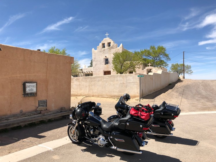
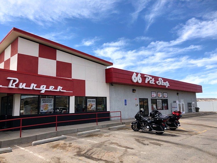
Just by the off ramp they have great burgers, if you feel like some food. Stop in Laguna by the mission on the top of the hill on your left when you drive through the small town. It’s a great photo op.

The old Routhe 66 basically follows the I40 more or less the whole way, but without all the roadtrains and traffic. Just before McCartys you need to cross over the I40, the road has a dead end further up, so make sure to do this crossing. Afer McCartys you ride through an old lava field with black lava rocks all around the road. After a short while you will drive through Grants, it has a cool main street with many old motels and neon signs.
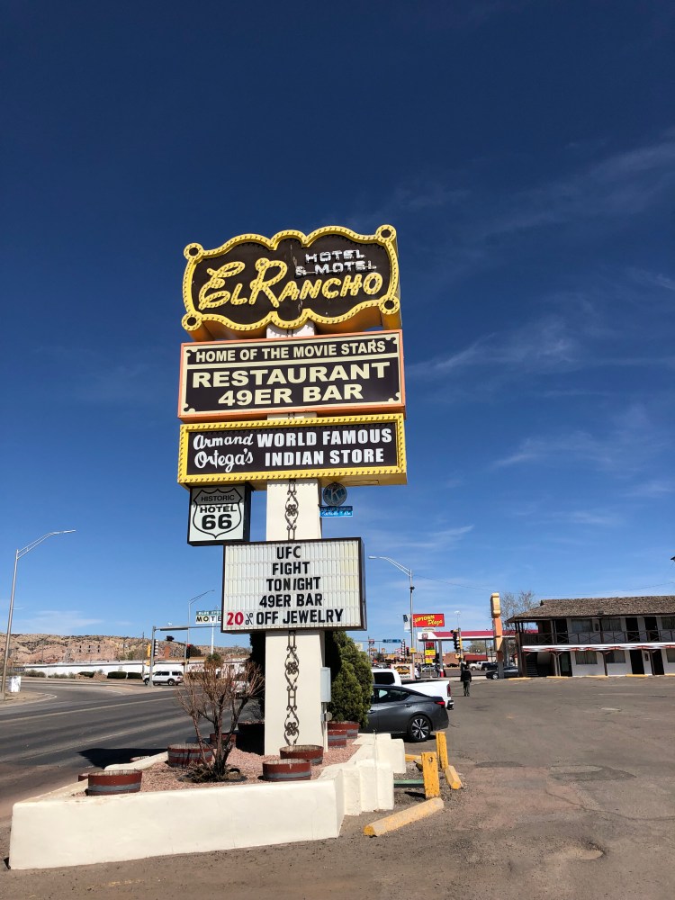


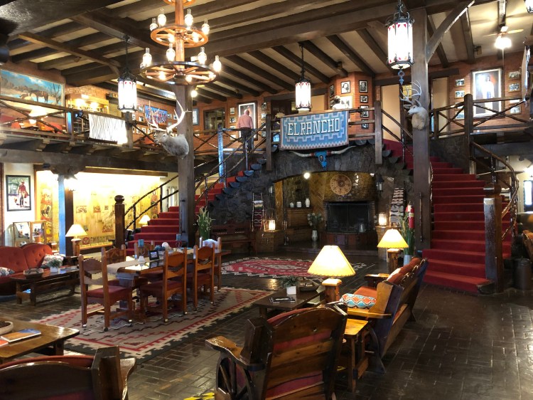


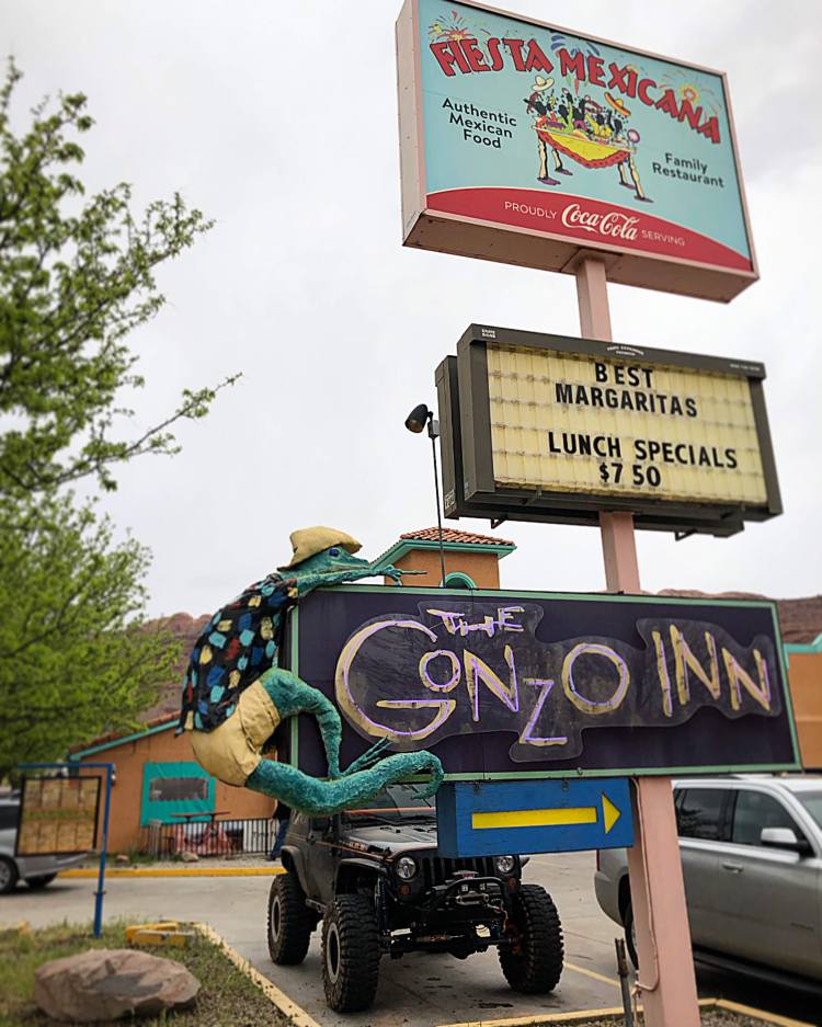
After Grants you can just join the I40 until you reach Gallup. Also an old Route 66 town, it has some interesting bits, but many shops are closed, and it has a bit of a run down feel about it. We decided to stay at the historic El Rancho Hotel with its many stories about Hollywood actors staying there in the golden era of movies. The hotel itself has lost all of its golden era, and is now not much more than a second rate dodgy motel. Stay for the cool lobby, and to see the old motel signs on the road around El Rancho.
Day 4: Gallup, Canyon De Chelly to Monument Valley

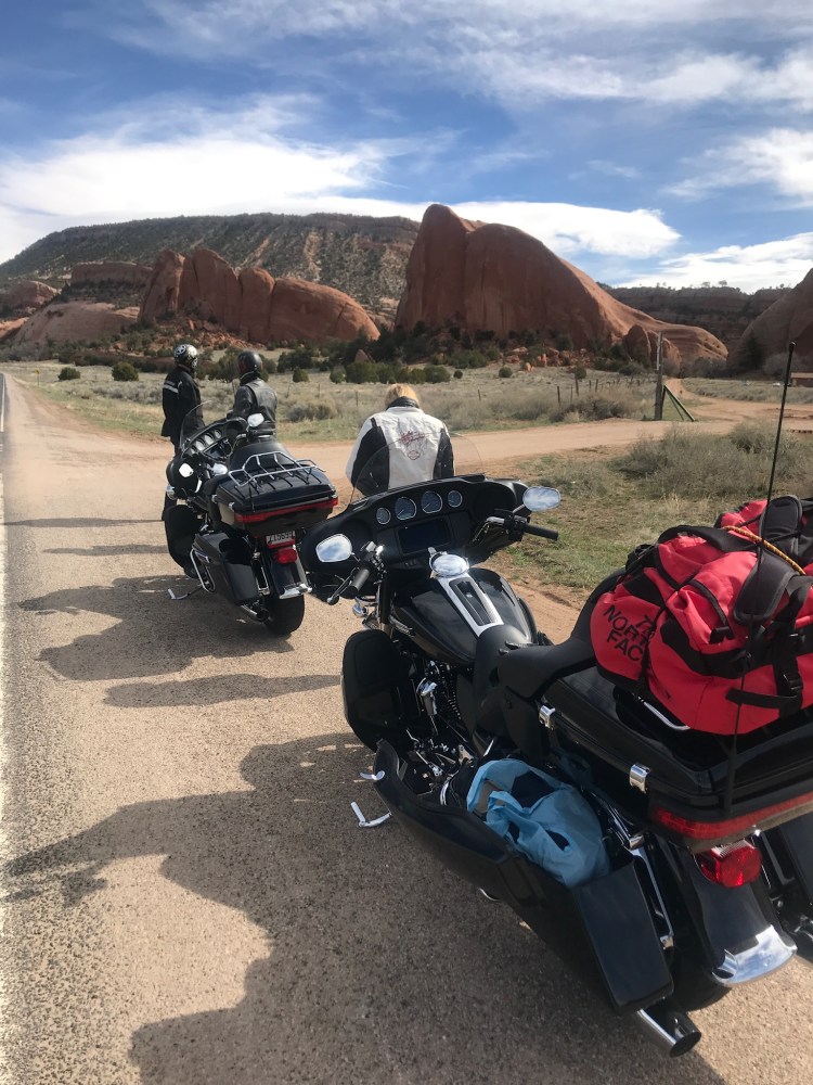
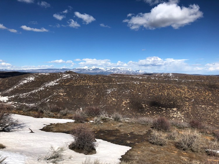
This is a long day riding, with epic roads, vistas and changing scenery. We did a lot of research to find what was the nicest way from Gallup and north via Canyon De Chelly to Monument Valley. We ended up riding out of Gallup and opting for the US491N to Yah Ta Hey, doing a left onto NM264W to Window Rock. We did not stop at Window Rock, to have more time later in the day. About 1 hours drive on Indian Route 12 north, stay right at Fort Defiance to continue at the 12 North to Navajo. Continue north to the intersection at Tsaile. This whole route from Gallup to Tsaile will take you past buttes, lakes and high alpine areas with spruce trees and bushland. It was good roads for motorbikes and a great stretch of road with plenty of scenery to take in while riding. And it seems like this route is not that often done by cars or bikes, most people opting for the more eastern route of Highway 191 from Chambers to Chinle.

From Tsaile you do a left on Indian Route 64 West. After a while you will be driving along the northern rim of Canyon De Chelly. You won’t see the canyon itself from the road, but there are 3 turnoffs that should be taken on the way. The two we stopped at and had our breath taken away at was Mummy Cave Overlook and Antelope House Overlook. When you get to the visitor centre you take a left and enter the South Rim Drive, and from here you get an even more impressive look at the canyon from the road, with several spectacular vantagepoints along the way. We wish we had more time to visit the canyon itself, but this would have taken a full day, so not this time unfortunately. It looked otherworldly. Spider Rock is especially cool, a 229-metre spire of rock in the middle of the canyon.

Canyon De Chelly is one of the longest continuously inhabited landscapes of North America, dating back around 5000 years. It is within the boundaries of the Navajo Nation, and the valley itself has ruins from both Navajo settlements and previous Ancestral Puebloans (formerly known as Anasazi). The canyon itself consists of three major canyons: de Chelly, del Muerto and Monument.

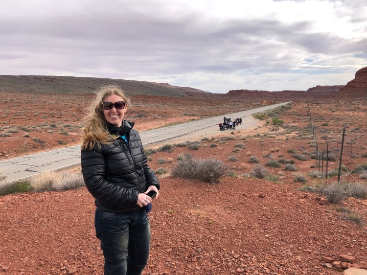

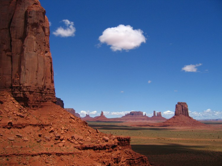
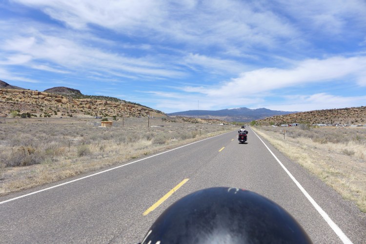
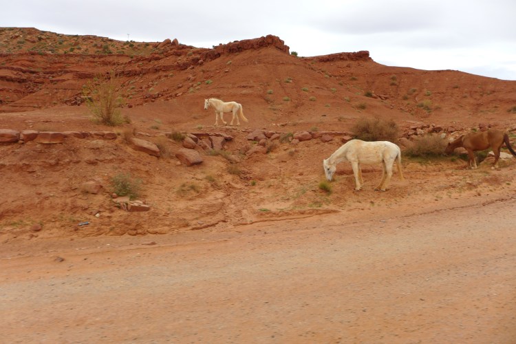
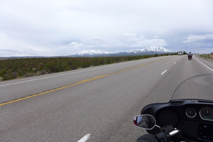
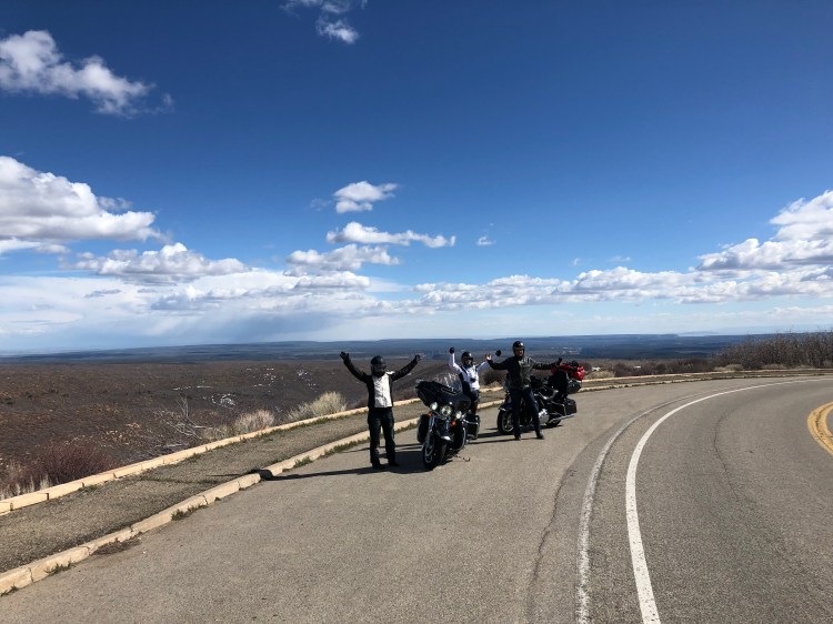
Fill up on lunch and gas in Chinle and head north on US Highway 191. Soak in the landscape on the way, for us this is what riding in the western USA is all about, desert, buttes, red sand and long straight roads that end somewhere beyond the horizon. Ørjan had a bit of a moment on this stretch of road, blasting music on the Harley to make the soundtrack to the miles going by. Pink Floyds Comfortably Numb came on, and that guitar solo, it was a tearjerker. That’s what riding the landscapes of the great highways of the USA can do, you may start crying at any moment out of sheer sensory overload. Depending on how often you stop for photographs, it will take between 1 and 2 hours north to the intersection at Mexican Water, here you will take a right turn, and there is a gas station with a diner not long after the crossroads. Just up the road, do a left and turn on to the 191 North again. The sign will say Bluff and Mexican Hat. This stretch of road is just as epic as the last one, with twisting turns along canyon floors, straight lines to the horizon, and vistas where there should have been cowboys riding the crest of that ridge to make it even more epic. Watch out for horses along the road and on the road, there are many pf them roaming the plains, they all belong to the local Native American Tribes of the area. You will get to the crossroads where you need to turn left onto Highway 163 towards Mexican Hat.

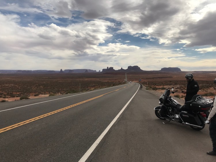
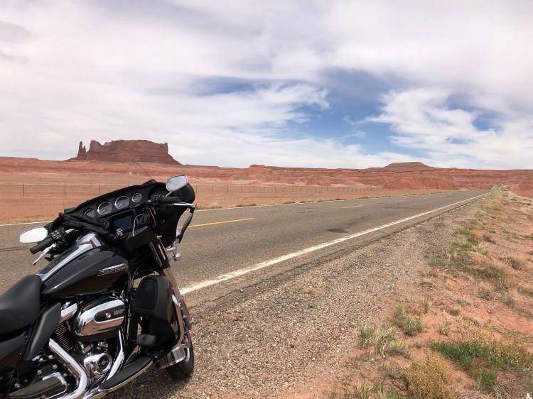
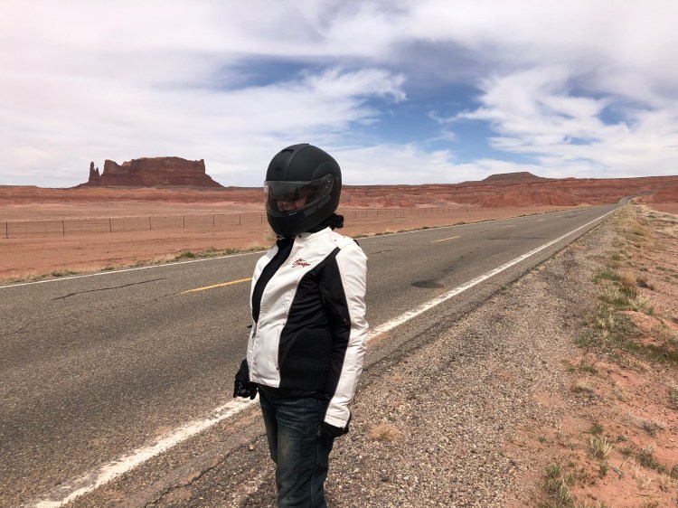
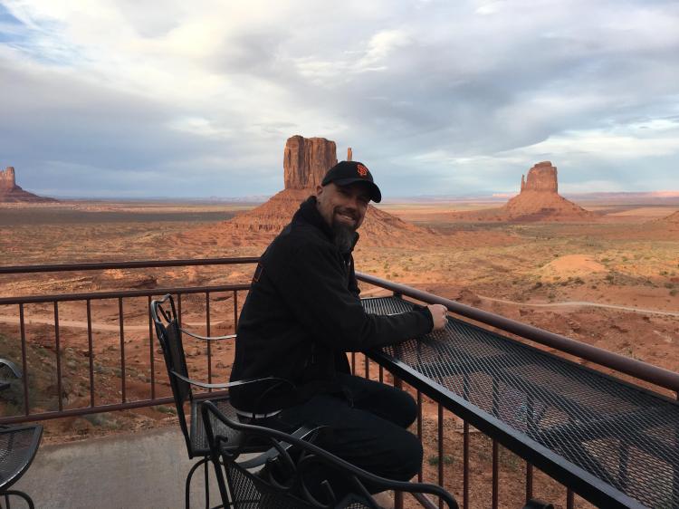
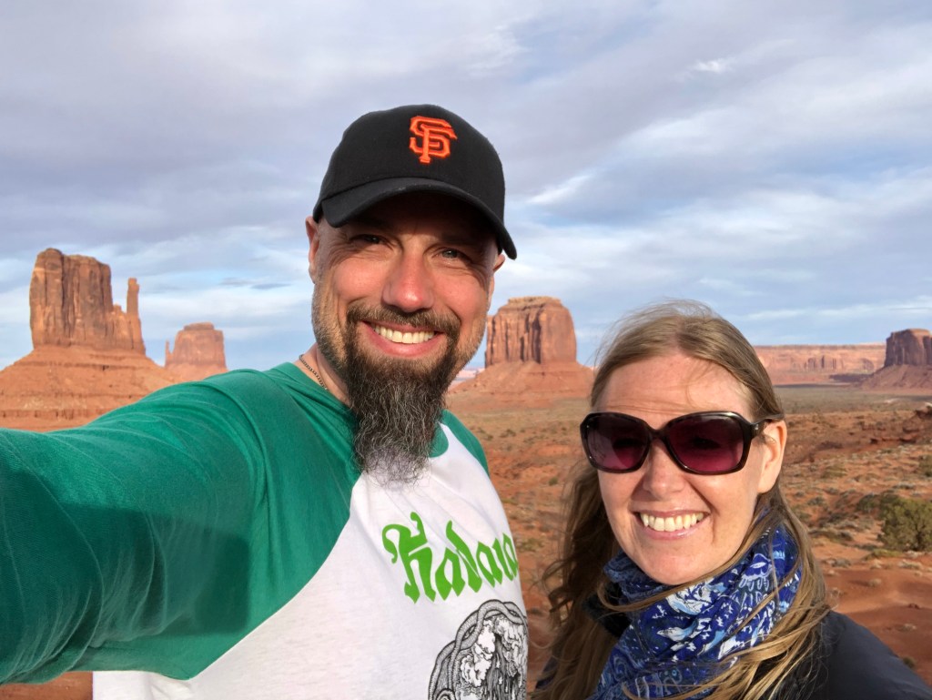
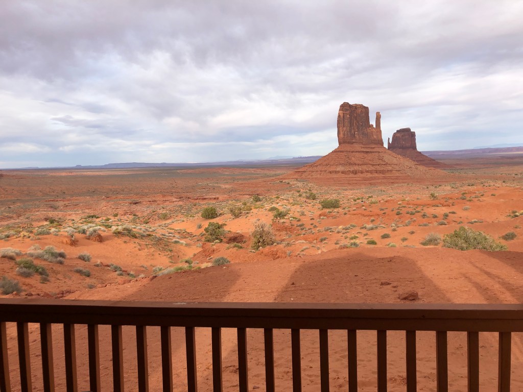
From here it’s a little more than an hour to Mexican Hat and the reason for taking that last stretch of road. You could also take a left at Mexican Water and go to Kayenta and then end up in Monument Valley. BUT by going the way we went, you will get that epic Monument Valley view from the road, after you have gone through Mexican Hat. It’s the quintessential US tourist brochure view, the road with the buttes in the background makes this the best place to enter Monument Valley Continuing from the photo madness, drive into the park itself. This park is owned by The Navajo Nation, so you pay the fee to get into the park to them, not the NPS. There is a hotel on the rim itself, there are cabins and there is a campground.

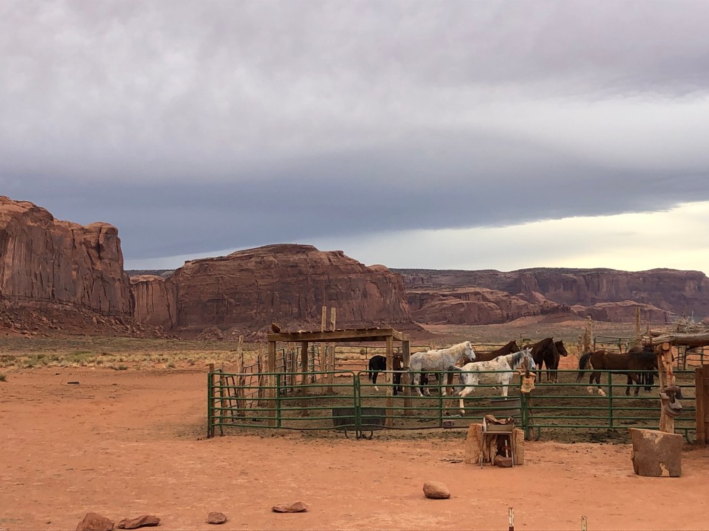
If you have a car and enter the park, you can drive into the park itself on the dirt road that starts just left of the hotel. We have done this on previous visits, and it is something you should do, so many great spots for photos and walks in the park. This time we had our Harleys, so no driving into the park. We arrived and checked in to our cabin overlooking the buttes. We made it in time to the sunset, and it was spectacular! In front of our cabin we had proper stallions roaming, the buttes in the background and the sun setting behind them. Alcohol is not permitted on Tribal lands, so no chance of a beer after a long day’s drive. We had an ok dinner at the hotel, then got back to the cabin to rest and sleep since we had a very early start the next morning.


Day 5: Monument Valley to Arches and Moab

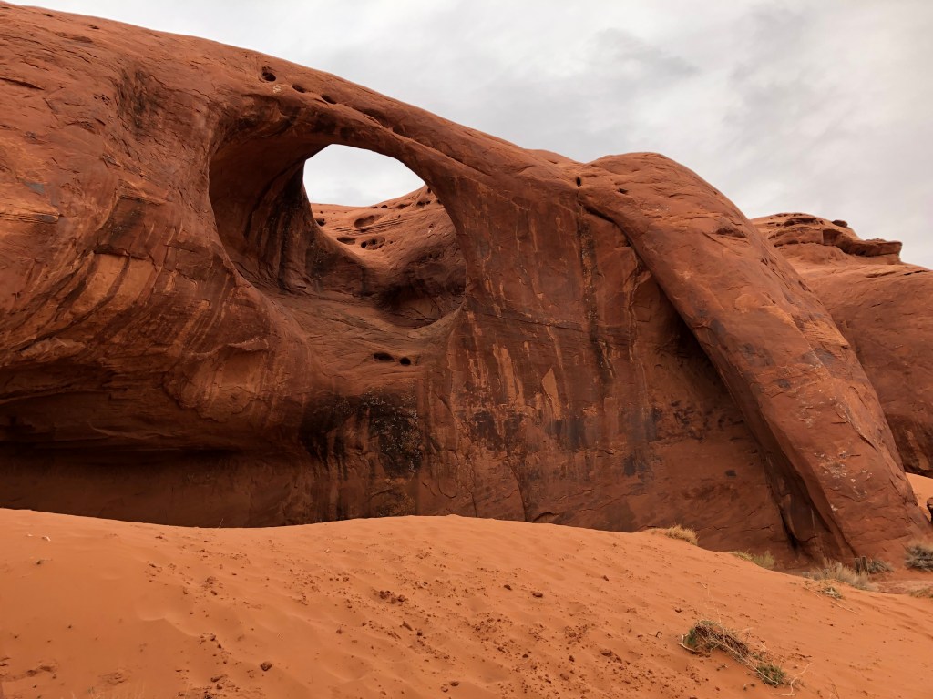
We got up before the sun, since we had booked a guided trip into the valley itself with the local Navajo tribe. Frank the Navajo was our guide. A very calm man, full of knowledge about the lands, his family still lived in the park itself. He took us beyond the road for the other visitors and showed us parts of Monument Valley not accessible to others than those few who book the tour. Of course, we got to see John Ford point, that’s a must, but we had a very special and different trip with Frank.


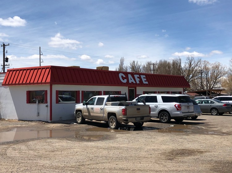
We wished we had bought some supplies for breakfast in the cabin, we only had tea and coffee. Suiting up for the ride to Moab, we knew it was going to be cold. It’s about a 4-hour drive from Monument Valley to Arches National Park. You need to backtrack to Mexican Hat and then on to Bluff on Highway 191 via Blanding and Monticello. This is high alpine area, Monticello being at 2155 metres above sea level. We were glad we had suited up with wool and layers, because we drove long parts of this stretch of road in around 0 Celsius, about 32 Fahrenheit. Luckily, we found the Peace Tree café at the north edge of Monticello for some great food and warm coffee.


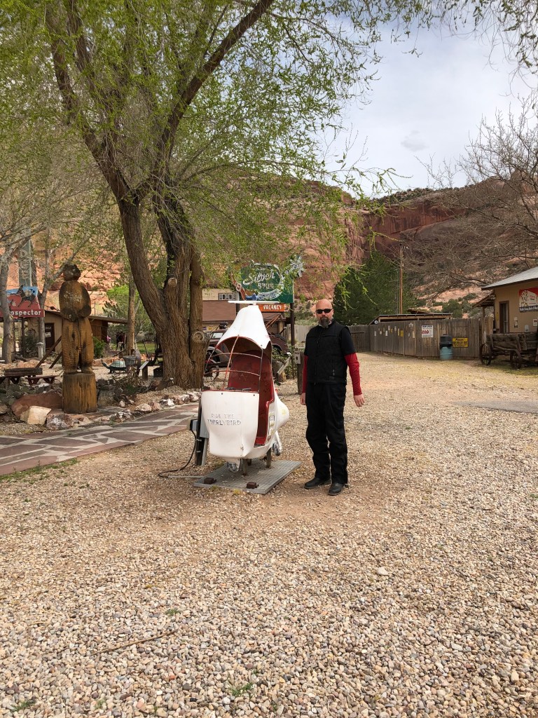
The strange thing about driving in the US is that the scenery and temperatures can change very quickly. After Monticello it was not long until that red rock and sand appeared again, and the temperatures went back to a bit more normal. You drive past Wilsons Arch, and not long after keep an eye out for the Hole `N the Rock on the right side of the road. One of those «Only in America» places that has become an attraction. Basically, it’s a house blasted into the rock by an eccentric dude called Albert Christensen. He spent 12 years blasting 50 000 cubic feet of sandstone to make a home for his family. Now there are guided tours, souvenir shops, restaurants and a small zoo at the location. It makes for a different and great place to stop on the way.


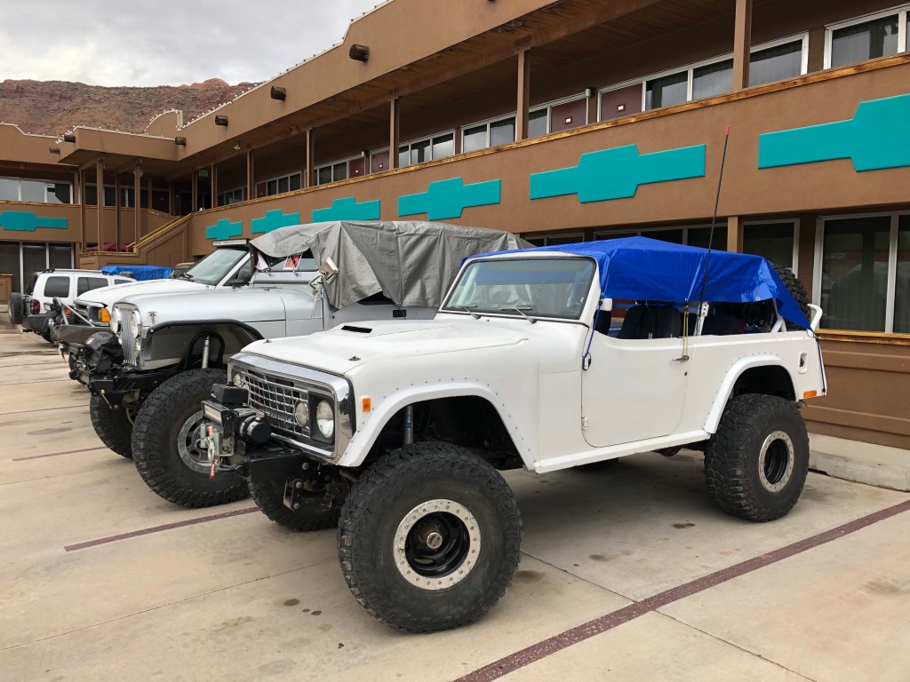
Not far up the road you will drive into Moab, somewhat of an action capital of Utah and maybe the US. Mountain biking is king here, and when we rolled into town, it was rock crawling jeeps galore. Thousands of jeeps made to crawl over the most inaccessible of terrain, we felt a bit odd coming in on Harleys. We drove through Moab and headed north of town to enter Arches National Park. The drive into the park is long, and the stops are many. The hikes are plentiful, and the stuff to see is mesmerizing. Do you research and pick your places to see and visit. If you are coming by car, make the time to do a longer trek or two. Being on motorbike you are a bit at a disadvantage to do hikes, it’s not that easy in leathers and wool. Still there are plenty of sights and smaller treks that can be done by everyone. After all, most parks in the US are made for people to drive as close to the sights as possible. Arches is one of Utah’s finest parks, and truly something else.


We spent the night in Moab. It is a very lively town, due to all action and adventure seekers who gather in town, especially at weekends. Plenty of cool bars, restaurants and breweries if you fancy a nice local beer. If you plan on staying here for a night or more, you need to book well in advance, it’s often fully booked due to its popularity with bikers, trekkers and jeepers. We had a good night, and a hearty breakfast at The Big Horn Motel.


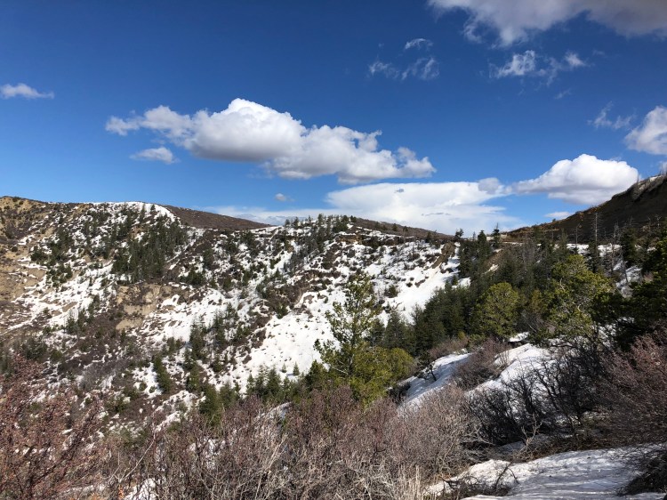
Day 6: Moab to Durango via Mesa Verde
From Moab you backtrack to Monticello, and then do a left on US491 to Cortez. Fun fact, the 491 was once called the 666, signs now taken away. But it’s still the previous Highway To Hell. You feel like you are riding down into the lowlands, the landscape now filled with green pastures with horses and cattle spread out on its emerald green carpet, but do not be fooled. The City of Cortez, where you should stop for lunch and gas, is at 1887 metres above sea level. In Cortez you need to do a left onto the US Highway 160 (hello old friend) and continue down the main street, it’s not more than about 8 miles to the entrance of Mesa Verde National Park.


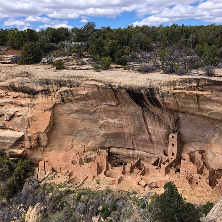
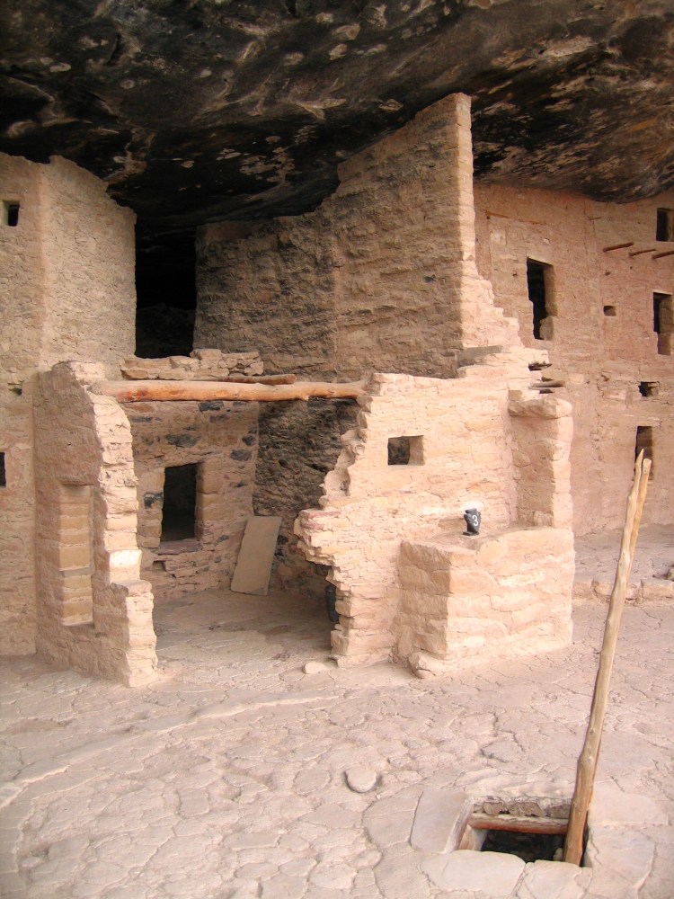
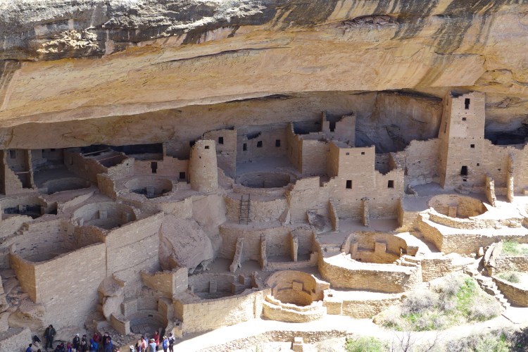
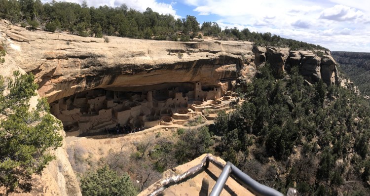
We have been twice to this park, and it’s spectacular. The park contains over 5000 archaeological sites, including 600 cliff dwellings. The cliff dwellings are what makes this park something else. Built by the Ancestral Pueblo people between 600 to 1300 AD, the villages and houses built into the cliff wall is really unlike anything we have ever seen. It’s a long drive from the entrance of the park to most of the sites, almost 20 miles, over high elevation (2500 metres above sea level, there was snow) and then onto the mesa itself. Check out the NPS site to see what places you want to see, plenty of stops along the road with views of different cliff dwellings. If you want to see them up close, you need to pre purchase tickets (well in advance) to go on a tour with a ranger. We did a guided tour on a previous visit and it was well worth the money. This time we also tried to get tickets, unfortunately they were sold out, but you still get close to the ruins around the park. There are two main road loops in the park (see park map on the NPS page). The Spruce Tree house is on the right loop and maybe the closest you can get to a cliff dwelling without a tour. If you do that loop and stop at the Square Tower house, you also get to see a lot, and you will get a good look at Cliff Palace. If you do the left loop you see less, since you are basically on top of the Cliff Palace and Balcony House.


Return to the Highway and do a right onto US160 East again and head for Durango, it’s about an hour and a half drive from the park exit.
Arriving in Durango late afternoon, most of the shops were unfortunately closed. We chose Durango as an overnight due to the location, and due to the past as a wild west town. The home of the Silverton Narrow Gauge Railroad, a good old-time steam train is running from Durango and into the mountains. Unfortunately we had no time to do the train. We did however visit some of the more famous/infamous bars and saloons of Durango and spent the night at The Best Western Plus Rio Grande Inn


Day 7: Durango to Albuquerque
Last day on our magnificent Harleys. We decided on a more direct route to Albuquerque, since we wanted to return the bikes this day before Eaglerider closed, and we needed to do some shopping before heading home. From Durango we headed south on the US Highway 550 via Aztec, Bloomfield and Nageezi to Cuba. This was mainly plains, with straight roads to the horizon and beyond. For some this might sound boring, but for hillbillies from Norway, straight roads are hard to come by, so we tend to love them and see them as something rare and exclusive. Our original plan was to take off the Highway at Cuba and ride the 126 to Jemez Springs and meet the 550 at San Ysidro. It looks like a very cool road to ride, and to stop at the springs for a soak looks very comfy.

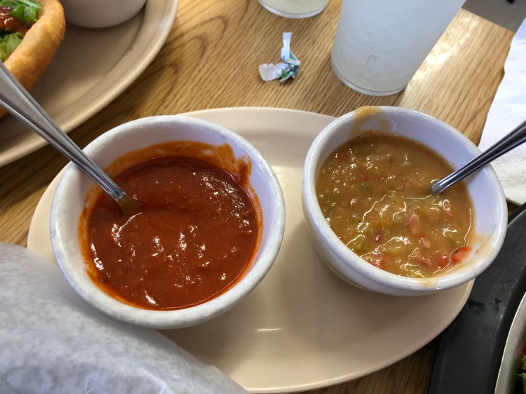
Red and green chile, a must! 
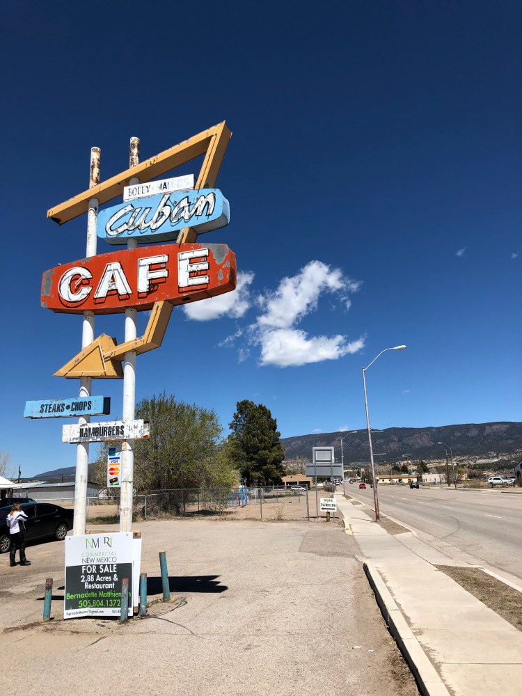
But we opted to have lunch in Cuba at the fantastic Cuban Café. You can’t miss it, there is an old neon sign by the road showing the way. Filled with locals, we had the green chile (you need to eat chile in this area) and the supernoms Navajo Frybread. One of the most local, and best food stops on our tour. From Cuba we rode towards Albuquerque, ending up at Interstate 25, driving the spaghetti 4 storey loop and joining the I40 East to get to Eaglerider. After a seamless return of our bikes, we packed our stuff into the car and drove a mile to The Sheraton Uptown Albuquerque next to the Coronado Center Mall of Albuquerque. We spent the evening shopping and eating American style at the mall.

Dad, the easy rider himself 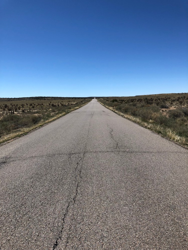


Day 8: Albuquerque to Colorado Springs
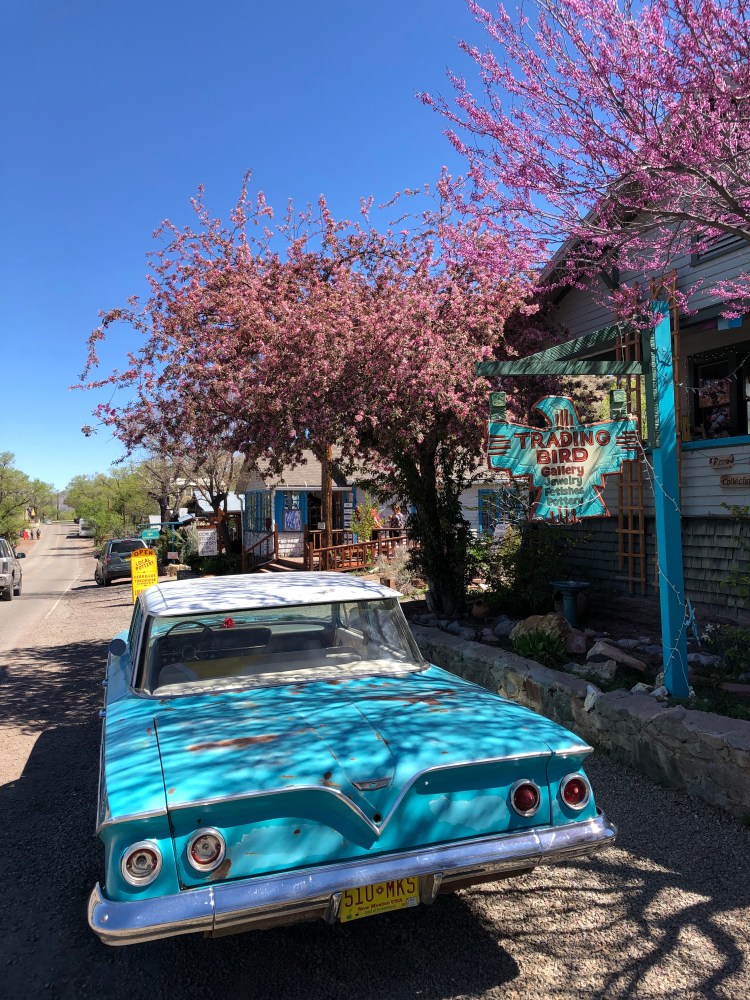
We wanted to drive the Turquoise Highway on our way back up north. Just continue east on the I40 until Exit 175 to NM 14 and Cedar Crest. This road is designated National Scenic Byway, the old road links Albuquerque to Santa Fe and is a favourite daytrip for bikers in the area. The road itself is about 50 miles, and the main stop along this road is the town of Madrid. Made famous by the road movie Wild Hogs, it has many cool artisan shops, as well as the usual tourist shops.


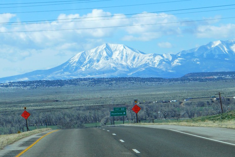
After our stop in Madrid, we did the 5 hour drive to Colorado Springs on the I25 in one go. We really wanted to drive up Pikes Peak, but we came a bit too late and the road up was closed for the day. Famous for its hill climb race, you can drive all the way to the summit at 4300 meters above sea level (14 110 feet). Someone (Ørjan) in the car was a bit disappointed.
You also have the Garden Of The Gods just on the outskirts of town, but again it was late and we wanted a beer. We stayed at the swanky Antlers with great views of Pikes Peak and the mountains. We found great beer and delish food at Phantom Canyon Brewery just up the road from the hotel.
Day 9: Heading Home
This was a transport day; we had a flight that afternoon. Stopping by the nice people at Pikes Peak Harley Davidson to pick up some pre ordered stuff for our bikes back home. Always cool to see those huge American Harley shops, they are bigger, better and more epic than any other Harley dealerships in the world. It was Easter Saturday, so the shop was filled with kids and families looking for Easter eggs, BBQing and having a great time. Back on I25 it was a little over one hour, and we were back in Denver, returning the car, and boarding our flight.

This road trip was a good one. It covered a lot of different landscapes, some of the best national parks, and gave us plenty of breath-taking roads along the way. A true High Desert Adventure!