Brokke-Suleskard-Lysebotn
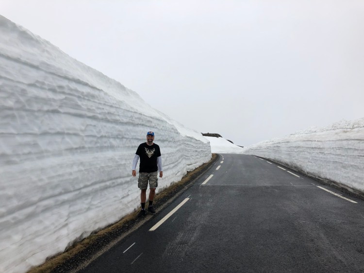
There are plenty of scenic byroads in Norway, many of which are only open during summer, the reason for this being that many of these roads are high mountain roads. Many were built to facilitate the building of hydroelectric dams in the mountains of Norway, so that the drop down to the fjord could be utilized to make power from the water. Thus, many of the byways are located on mountains near fjords, and many are surrounded by snow well into June/July with snow drifts on the side of the road making the drive spectacular, in car and on motorbike. To ride on a motorbike on dry tarmac with snow towering on each side is something else entirely. We have mentioned some of these roads earlier in our Norwegian chapter and blog posts. Find the road to Geirangerfjord and Trollstigen here.

Brokke – Suleskard
Suleskardvegen is accessed from either east in Agder or west in Rogaland and it connects the Setesdalen valley in Agder with the western parts of Rogaland county. From east you will drive RV9 either north from Kristiansand, or you will come back down from the northern mountains of south Norway and the Haukeli area. Setesdalen is an incredibly beautiful valley, full of Norwegian traditions like silversmithing and of course local food. On the way north from Kristiansand you will pass by Evje, a place with lots of mining history, and there is a mineral centre and an old abandoned mine to visit. The Mineral Park is cool for kids, and they have a campground there as well.
The old mines just outside of Evje are known for their richness in minerals, around 52 different minerals can be found here, so it is a haven for rock tourists from all over the world, and all are welcome to look for their own little treasures. Just north of Evje on RV9 is the awesome Trollaktiv park where you can climb around in the trees, great for kids. In addition, they have quite a decent rafting centre here where you can challenge your inner aquarius.
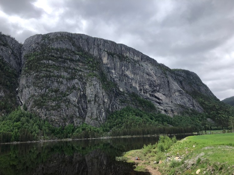

Continuing past Evje you will see the Byglandsfjord on your left, and you will also notice that the valley narrows, and the mountains keep getting higher on each side of the road. If you feel like challenging yourself a little more, one of the best via ferratas is in this area. The Helle Camping is organizing this, as well as good camping facilities. We have heard that this via ferrata is spectacular and are planning to go, but first Ørjan has to fight his vertigo demons.


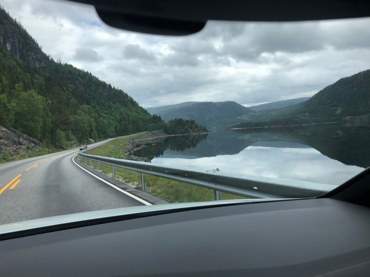
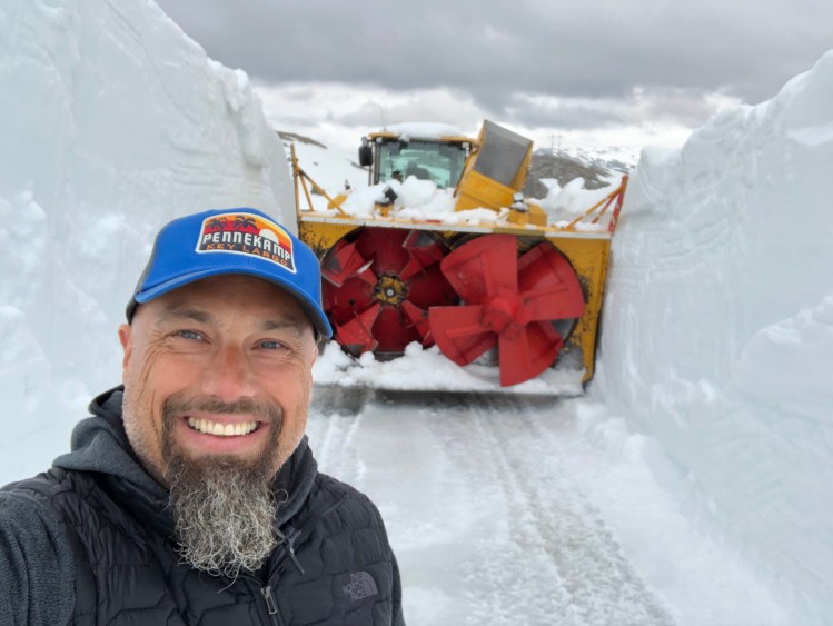
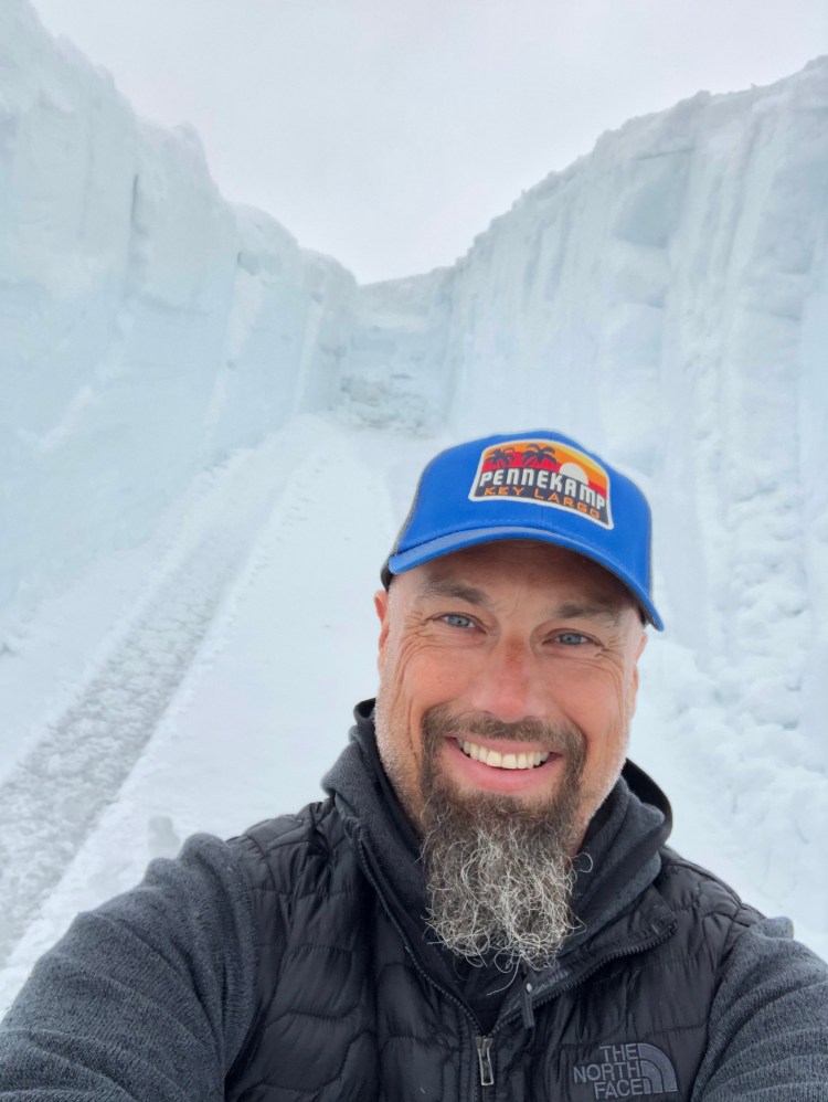
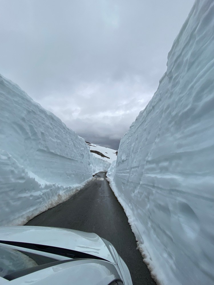
When you get to the small hamlet of Rysstad, this will the last sign of any facilities in a while, so if you need gas or snacks, this is the place to stop before entering the Suleskard road. FV337 is the official designator for the road. It is closed between November and sometime between April and June, we travelled the road on the 9th of June 2020, and the road had opened less than two weeks before. It all depends on the amount of snowfall during winter, and how long the actual clearing of the road takes. They will clear snowdrifts up to 10 metres (30 feet) so needless to say it takes a while. The road itself will reach 1050 metres above sea level (3445 feet) and it swoops and turns over the highland plateau like a tarmac serpent swimming in a sea of white powder. The road is narrow, and the traffic can be heavy with campervans in high season, so look out for those, and drive with care. There are frequent pull outs along the road, but those are not for photo stops, they are to let other cars pass. It is a thrilling ride, with metres of snowdrifts on each side of the road. The area is also a protected area for wild reindeer, so look out for those. You will also pass several lakes that are good for swimming if you visit in late summer, they were all frozen when we came by in June. Brokke to Suleskard is only about 40 kilometres (25 miles) so you will drive it in about 1 ½ hours, and then adding all the stops you like on the way. There are some great vistas, also some hydroelectric dams to see by the road, after all that is why the road was built in the first place.
Suleskard to Lysebotn
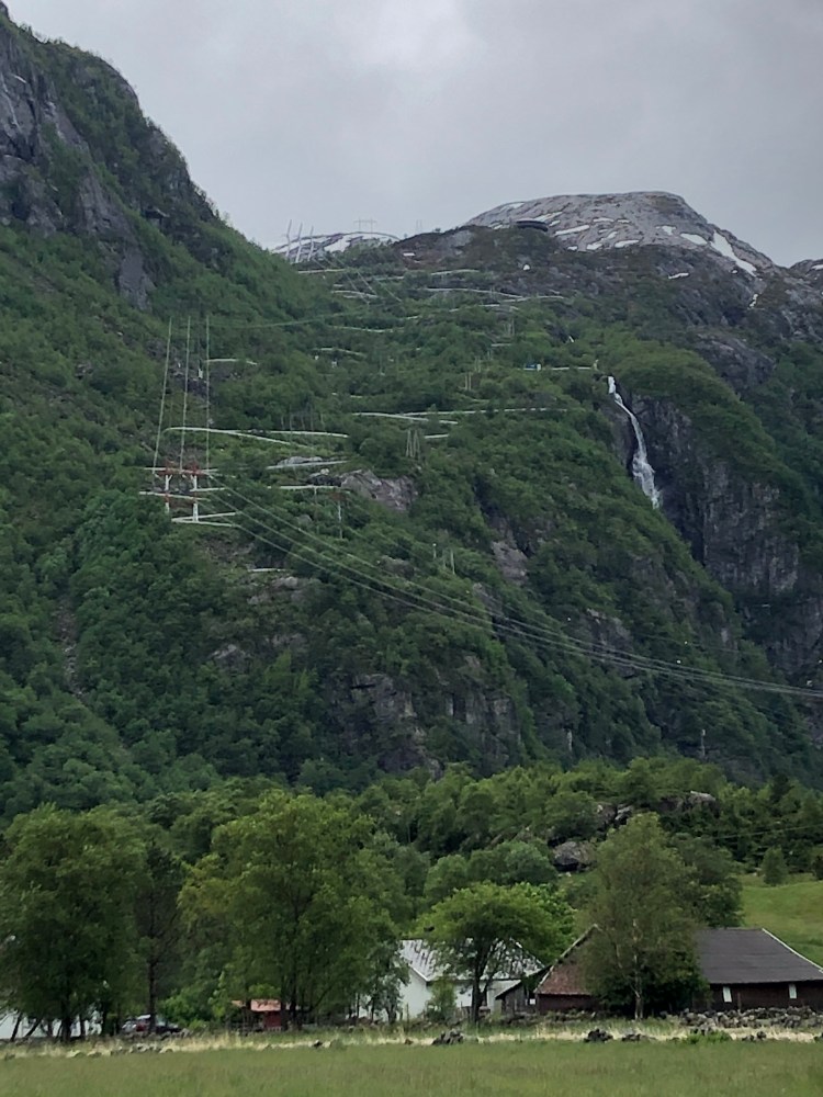
At Suleskard there is a small shop and gas if you need it. Just south of Suleskard there are two ways you can get to Stavanger, either you can go the “easy” way and drive to the RV45 to Stavanger with little fuss, there will be great vistas here as well but not as great as taking another byway to Lysebotn via the Kjerag massive. The FV986 is also a road that is closed in winter and a road built to make easy access for building hydro electric dams. And here you can really see the drop utilized for getting the water up to speed and the hydroelectric plants with the turbines themselves when you get to the bottom of the Lysefjord.


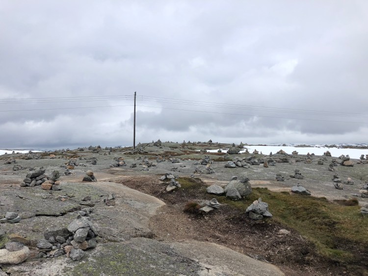

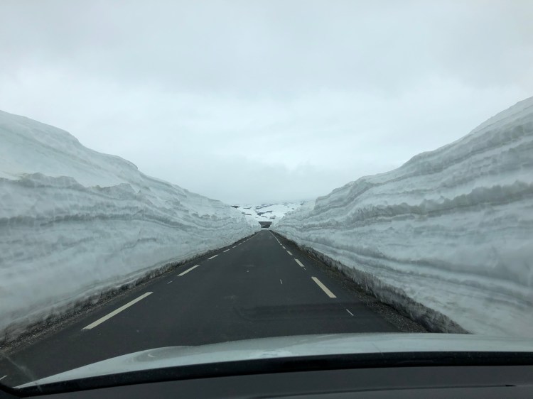
Before that you will cross another epic stretch of road, in our opinion even more spectacular than the road we just came from between Brokke and Suleskard. It has even more twists and turns, and it offers great vistas. At the peak of the route there is a field of small monoliths made by people passing by from all over the world, you will know that you are in the right spot when you see them all over, they are impossible to miss. Depending on when you cross the mountain, the amount of snow will fluctuate. When we arrived in the beginning of June, there was plenty of snow.

We did a sneaky detour, just as you start the decent there is a road to the left signed to Langavatn that will take you on a smaller road, we think we were the first to drive here for the season when we arrived, and clearing of the road was still going on when we passed. We almost got stuck at the end where there is a large parking area for hikers, summer tires and snow are a bad combo, we had a light scare but came out laughing. It was awesome to look at the dude clearing the road, it must have been a 20 foot drift he was chopping away at with what was a huge digger but it looked small compared to all the snow it was trying to remove.


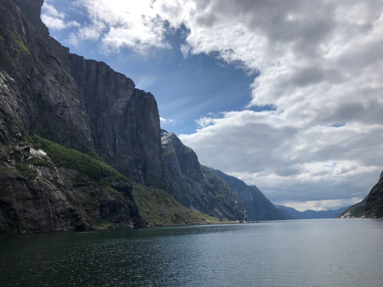
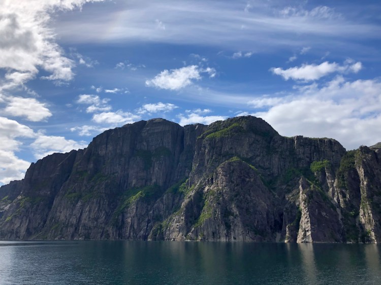
The drop down into the Lysefjord is spectacular. Halfway down there is a large parking area and a café hanging out over the abyss. The parking is for those among us that thrive on jumping off mountains with parachutes. This is the spot to go on a hike to one of the most famous BASE jumping spots in the world, the Kjerag site. Of course, all people are welcome to hike there, and most do to get to the Kjerag bolt. A rock stuck in a crack 984 metres (3228 feet) above the fjord, and if you feel like doing something not everyone dares, take the small leap to stand on the bolt itself. Something we would not do in a million years.


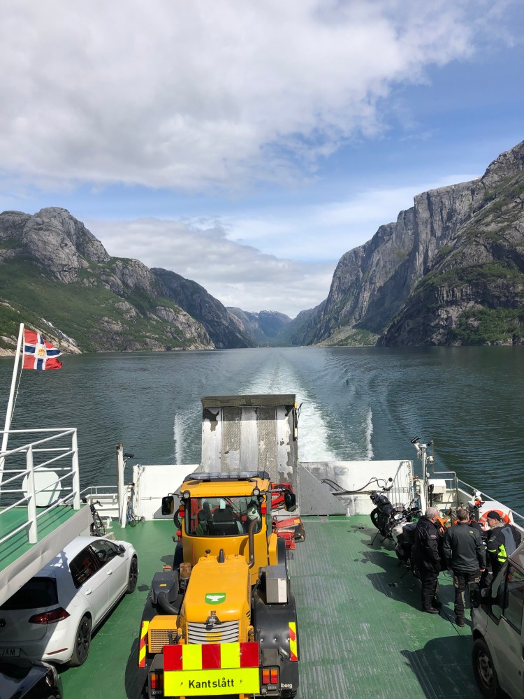
Continuing down the winding road to Lysebotn you will reach the end of the road, literally. There is no more road, you must either backtrack to RV45, or you do the scenic option and take the ferry. We took the ferry and there are 2 choices, either you take the regular ferry, or you take the tourist ferry. Easy? Well yes, if you take the regular ferry there are only a few places for cars onboard and you must book one of those early. And the ferry only runs twice a day, once early and once in the afternoon.
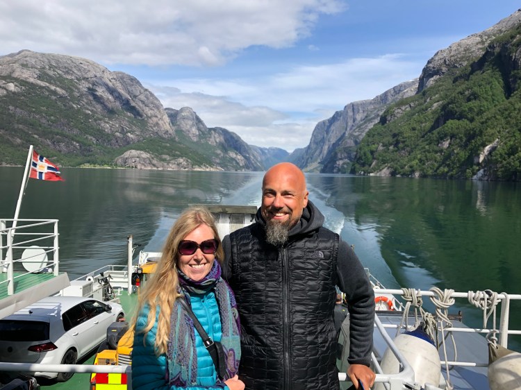
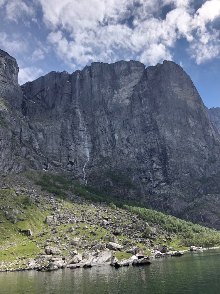
This is the site for Kolombus which runs the route, and you should choose from Lysebotn to Forsand (where you are close to Pulpit rock or the tunnel to Stavanger). If you choose the tourist boat run by Fjord Norway it also runs twice a day in each direction but is a bigger car ferry and the cost is a bit higher. Regardless of what ferry you end up on it will be one of the most epic ferry rides you have ever had. Passing the BASE jumpers point at Kjerag (they will do almost 30 second of freefall) before deploying their parachute.

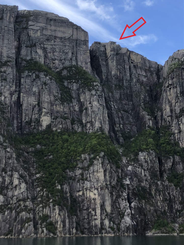
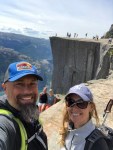
You will also pass under the Pulpit rock before disembarking at Forsand where you can either drive the tunnel back to Stavanger, or you can continue with a hike up to Pulpit rock. Read about our trek to one of the worlds most spectacular natural sights!


As scenic byways go, both these routes offer some of the best driving, best views, and some of the most spectacular experiences that Norway has to offer. If you do it in a car or on a motorbike, these roads are what dreams are made of.


Leave a comment